Mount Tzouhalem facts for kids
Quick facts for kids Mount Tzouhalem |
|
|---|---|

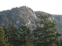
Summit of Mount Tzouhalem
|
|
| Highest point | |
| Elevation | 536 m (1,759 ft) |
| Geography | |
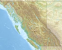
| Location | Vancouver Island, British Columbia, Canada |
| Topo map | NTS 92B/13 |
Mount Tzouhalem is a mountain on Vancouver Island, British Columbia, Canada. It is located about 4 kilometres east of Duncan, within the area of North Cowichan. The mountain sits between Quamichan Lake, Maple Bay, and Cowichan Bay.
This mountain is part of the local forest lands. A special part of it is an 18-hectare ecological reserve. Mount Tzouhalem is a favourite place for people who enjoy hiking and mountain biking. From its slopes, you can see beautiful views of Saltspring Island, the Coastal Mountains, and even Mount Baker in Washington state on a clear day.
You can also spot a large Christian cross on one of the mountain's cliffs. Local Catholic churches first placed a wooden cross here in the 1970s. Later, in the late 1980s, the Knights of Columbus replaced it with a stronger, welded metal cross.
Contents
Mountain's Name and History
The local First Nations people originally called this mountain "Shkewetsen." This name means "basking" or "warming in the sun." A legend says that during a great flood, the local people found safety on the mountain. When the water went down, they saw a frog warming itself on a big rock. This frog-shaped rock was named "Pip'oom," meaning "little swelled-up one."
The mountain was later renamed after a very important Quamichan chief named Tzouhalem. He spent his last years living on the mountain after his own people asked him to leave.
Chief Tzouhalem's Story
Chief Tzouhalem was born to a Quamichan father and a Comiaken mother. His grandmother taught him how to be a warrior. He was known for being a strong fighter and sometimes difficult to control. His fighting skills likely helped the Quamichan become the largest and richest of the Cowichan villages.
Tzouhalem led his people in battles. He helped defeat invaders near Maple Bay, even using a clever trick where warriors in canoes pretended to be women. In 1844, he also led First Nations warriors against Fort Victoria. They were upset because the fort demanded payment after some of their cattle were killed. Tzouhalem's warriors threatened the fort for two days. The fort's leader, Roderick Finlayson, then showed off the fort's large cannons. After the cannons destroyed a hut and a canoe, both sides agreed on a payment, and Tzouhalem's forces left.
Because of his many conflicts, Tzouhalem was eventually asked to leave his tribe. He moved into a cave on Mount Tzouhalem. In 1859, while trying to resolve a dispute on Penelakut Island, he was killed during a conflict.
The mountain also served as a target for the cannons of HMS Trincomalee. This Royal Navy ship used Mount Tzouhalem to signal its arrival in Cowichan Bay. Early British maps called the area "Tzohailim Hill" (1855) and "Tzohailin Hill" (1864). In 1911, it became "Tzuhalem Mountain." Finally, in 2000, the spelling was changed to "Mount Tzouhalem" to match the traditional spelling used by the Cowichan Tribes.
Mount Tzouhalem Ecological Reserve
In 1979, the Cowichan Valley Naturalists' Society found out that houses were planned for the mountain area. They worked hard to convince the local council and Mayor Graham Bruce to protect the land. In 1980, North Cowichan gave the land to BC Parks.
In 1984, BC Parks created the 18-hectare Mount Tzouhalem Ecological Reserve. This reserve protects special areas of Garry oak trees and wildflowers. Ecological Reserves in British Columbia are places chosen to protect important natural ecosystems, plants, animals, and natural features. They offer the highest level of protection for nature, while also allowing for research and educational activities.
The reserve is located on the western side of the mountain, at middle elevations (120–280 metres). It faces southwest and has a hilly landscape. The Tzouhalem area has always been a place where the Vancouver Island Coast Salish First Nations gathered plants. The reserve is a traditional site for harvesting camas flowers. Historically, these areas were sometimes burned to help more camas grow and keep the land open like a park.
How to Visit Mount Tzouhalem
The easiest way to reach Mount Tzouhalem is from a parking lot at the end of Kaspa Road. This lot has space for about 30 cars. You can also reach the mountain from Genoa Bay, but this path is much harder. The trails on the mountain are open all year round for walking and biking. However, they might close during times when there is a high risk of wildfires.
 | Bayard Rustin |
 | Jeannette Carter |
 | Jeremiah A. Brown |


