Mount Whitecap facts for kids
Quick facts for kids Mount Whitecap |
|
|---|---|
| Highest point | |
| Elevation | 13,025 ft (3,970 m) |
| Prominence | 580 ft (180 m) |
| Geography | |
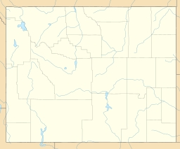
| Location | Sublette County, Wyoming, U.S. |
| Parent range | Wind River Range |
| Topo map | USGS Gannett Peak |
| Climbing | |
| First ascent | 1930 (Kenneth Henderson and Robert Underhill) |
Mount Whitecap is a tall mountain in the northern Wind River Range in Wyoming, a state in the United States. It stands at 13,025 ft (3,970 m) (about 3,970 meters) high.
This mountain is located about 2.25 mi (3.62 km) southwest of Gannett Peak, which is the highest point in Wyoming. Mount Whitecap is part of the Bridger Wilderness area, found within the Bridger-Teton National Forest.
Just east of Mount Whitecap, you can find Baby Glacier. To the southeast, about 1 mi (1.6 km) away, is Split Mountain. Mount Whitecap is also known as the 30th tallest peak in all of Wyoming.
Staying Safe in the Mountains
When exploring the Wind River Range, it is important to be aware of your surroundings. Hikers and climbers should always be prepared for different conditions.
Common Mountain Challenges
- Wildlife: You might see bears in the area. It's important to know how to act safely around them.
- Insects: Bugs can be present, especially during warmer months.
- Weather: Be ready for sudden changes in weather, including snow conditions and very cold temperatures at night.
- Wildfires: Sometimes, wildfires can happen, so always check local conditions before you go.
The mountain terrain can be challenging. Some areas have steep cliffs and loose rocks. It is important to be careful and watch your step. Always be aware of your footing to prevent slips or falls. The U.S. Forest Service encourages everyone to be prepared and safe when visiting these beautiful areas.
 | James B. Knighten |
 | Azellia White |
 | Willa Brown |


