Municipal District of Provost No facts for kids
Quick facts for kids
Municipal District of Provost No. 52
|
|
|---|---|
|
Municipal district
|
|

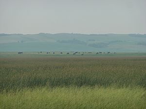
Pasture in the M.D. of Provost No. 52
|
|
| Country | |
| Province | |
| Region | Central Alberta |
| Census division | No. 7 |
| Established | 1943 |
| Incorporated | 1943 |
| Area
(2016)
|
|
| • Land | 3,628.39 km2 (1,400.93 sq mi) |
| Population
(2016)
|
|
| • Total | 2,205 |
| • Density | 0.6/km2 (2/sq mi) |
| Time zone | UTC-7 (MST) |
The Municipal District (M.D.) of Provost No. 52 is a special kind of area in east-central Alberta, Canada. It is located right on the border with Saskatchewan. The main office for this district is in the Town of Provost.
How the M.D. of Provost Started
The M.D. of Provost No. 52 was created in 1943. Before that, it was made up of two smaller areas. These were the Municipal District of Hillcrest No. 362 and the Municipal District of Sifton No. 391. They joined together to form one larger district.
Who Lives in the M.D. of Provost?
In 2016, a count of people showed that 2,205 people lived in the Municipal District of Provost No. 52. These people lived in 825 homes. This number was a little less than the 2,288 people who lived there in 2011.
The M.D. of Provost No. 52 covers a large area of land. It is about 3,628 square kilometres (1,401 square miles). This means there are not many people living in each square kilometre.
Towns and Villages Nearby
Many different communities are located within or next to the Municipal District of Provost No. 52. These include towns, villages, and smaller hamlets.
|
The following urban municipalities are surrounded by the Municipal District of Provost No. 52:
The following hamlets are located within the Municipal District of Provost No. 52:
|
The following localities are located within the Municipal District of Provost No. 52:
|


