Musbury Tor facts for kids
Quick facts for kids Musbury Tor |
|
|---|---|
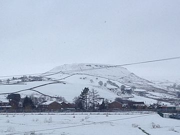
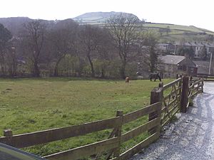
Musbury Tor in the winter of 2015
|
|
| Highest point | |
| Elevation | 340.1 m (1,116 ft) |
| Geography | |
| Location | Lancashire, England |
| OS grid | SD 7699 2068 |
| Topo map | OS Explorer 287 |
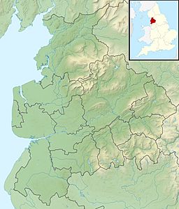
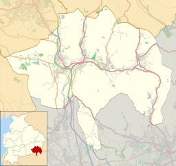
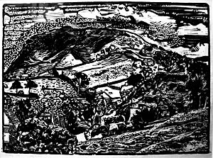
Musbury Tor, also known as Tor Hill, is a unique flat-topped hill in south-east Lancashire, England. It stands tall above the village of Helmshore. This hill acts like a natural divider, with the Alden Valley to its south and the Musbury Valley to its north.
Musbury Tor is mostly covered in farmland and pastures. Its highest point reaches about 340 meters (1,115 feet) above sea level. Locals often call it 'the Tor' because it's such a well-known landmark. You can see it from many parts of Helmshore. In fact, several houses and even a local school are named 'Tor View' after this famous hill.
Contents
What is Musbury Tor Made Of?
The ground beneath the Rossendale hills, including Musbury Tor, is mostly made of rocks from the Lower Pennsylvanian period. These rocks include layers of sandstone, shale, and mudstone.
Harder rocks, called the Millstone Grit series, sit on top of these layers. They form the caps of the hills, like a protective hat. Musbury Tor is a great example of how these harder rocks have protected the softer ones underneath. This creates the hill's distinct flat top and sharp edges.
You might also notice some bumpy areas on the hill. These are usually from old stone quarries and mining activities that happened long ago.
A Look at Musbury Tor's Past
Musbury Tor as a Deer Park
Back in the 1200s, Musbury was part of a large estate called the manor of Tottington. The de Lacy family controlled this area after the Norman conquest.
In 1296, a man named Henry de Lacy got permission to create a deer park here. Even though it was separate from the main Forest of Rossendale, it became part of it. Tor Hill was the most important feature of this park. The River Ogden and the surrounding hills formed its natural borders.
Records from 1304-05 show how much it cost to build the fence, or paling, around the park. This fence was about 7.2 kilometers (4.5 miles) long! Wood for the fence came from nearby trees, cut and shaped by carpenters. They even bought eighteen oxen to help carry the wood. Building the fence cost almost £83, which was a huge amount of money back then. It was enough to pay the park-keeper for over 36 years!
After Henry de Lacy passed away in 1311, the park was passed to his son-in-law, Thomas, 2nd Earl of Lancaster. Later, in 1323, a new "deer-leap" was added. This was a special opening that allowed deer to enter the park but stopped them from leaving.
Over time, people were allowed to graze their animals in the park. By the late 1400s, there weren't many deer left. In 1507, a survey found that the park's fence was "downe" (down). Although deer could still enter, the land was mainly used for pasture (grazing animals). The park was then divided into smaller sections and became farmland. Farms closest to the Tor were also allowed to take turf and stone from the hill.
The exact size of the old deer park is a bit unclear. However, in the 1800s, the area still known as Musbury Park was about 904 acres. Later in that century, much of Musbury became part of the Porritt Estate, owned by a mill-owning family. In the 1880s, William John Porritt started farming the land near the Tor, building barns and animal shelters. This area became known as The Exe.
Musbury's Local Government
The old area of Musbury was split into three parts: Musbury Park, Musden Head, and the Trippet of Ogden. While it was originally part of Bury's old church area, it later became part of the Hundred of Blackburn by the 1500s.
Musbury became its own local government area, called a civil parish, in 1866. Then, in 1894, it joined the town of Haslingden.
Musbury Tor During World War II
During World War II, most of the farms around Musbury Tor raised dairy cows and chickens. By early 1943, one farm, Great House, had even started using electricity to milk its cows instead of doing it by hand.
A small group of just four Home Guard members would climb to the top of the Tor every evening. They had only one old rifle and six bullets! Their job was to watch for any enemy activity from a tiny observation post. They often had to be careful not to fall into bogs or old quarry holes in the dark. Their headquarters were in Musbury School in Helmshore village. If an invasion happened, their only way to warn anyone was to run all the way down the Tor into the village!
American soldiers also used the Tor for training before D-Day. They practiced paratroop drops and field exercises with real ammunition. They even set up tents and a cookhouse near Great House on the Tor.
After the War
After the war, in 1951, the land owned by Oliver Porritt was sold to the Ministry of Agriculture. In 1952, the Great House Experimental Farm was set up by the Ministry on the flat top and southern slopes of Musbury Tor.
This 350-acre site was perfect for trying out new farming methods at higher elevations. They tested different ways to plant grains and care for animals. Scientists also studied the effects of acid rain, measured air quality, and even checked how loud noises (like sonic booms) affected livestock. The farm had offices and housing in Tor Side House and employed over 30 people.
However, Great House Experimental Farm closed in 1982. The land was then divided up and sold to private farmers and other owners.
 | Valerie Thomas |
 | Frederick McKinley Jones |
 | George Edward Alcorn Jr. |
 | Thomas Mensah |


