
National Register of Historic Places listings in Linn County, Iowa facts for kids

Welcome to Linn County, Iowa! Did you know that many buildings, places, and even whole neighborhoods here are super special? They are so important that they've been added to a list called the National Register of Historic Places. This list helps protect and celebrate amazing spots across the United States that tell us about history, art, or how people lived long ago.
In Linn County, there are over 120 of these cool historic places! Each one has a unique story. Let's explore some of them and see what makes them so special.
Contents
What is the National Register of Historic Places?
The National Register of Historic Places is like a special club for buildings, sites, and objects that are important to American history. When a place is added to this list, it means it's recognized for its historical, architectural, archaeological, engineering, or cultural value. It helps people appreciate and take care of these treasures for future generations.
Cool Historic Places in Linn County
Linn County is full of interesting historic spots, from old homes to unique buildings and even entire neighborhoods! Here are just a few examples of the many places listed on the National Register:
Historic Homes and Buildings
Many homes in Linn County have been recognized for their unique architecture or the important people who lived there.
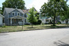
- The Robert and Esther Armstrong House in Cedar Rapids is a beautiful example of a historic home.
- The A. T. Averill House and the Glenn M. and Edith Averill House, also in Cedar Rapids, show different styles of homes from the past.
- The Joseph P. Mentzer House in Marion is another lovely old house with a story.
- The Philip A. Wolff House and Carriage House in Cedar Rapids is a grand old home that has even been turned into a bed and breakfast!
Public and Community Buildings
Some historic places are buildings where people gathered, worked, or learned.
- The Ausadie Building in Cedar Rapids is an interesting old building that was once used for businesses.
- The Best Oil and Refining Company Service Station in Cedar Rapids is a cool example of an old gas station, showing how things have changed over time.
- The Bethel African Methodist Episcopal Church in Cedar Rapids is a significant church with a rich history for its community.
- The C.S.P.S. Hall in Cedar Rapids was built in 1891 by the Czech-Slovak Protective Society, a group that helped Czech and Slovak immigrants. It was a place for meetings, performances, and community events.
- The Cedar Rapids Central Fire Station is an important building that once housed the city's main fire department.
- The Cedar Rapids Post Office and Public Building is another example of a grand building that served the community.
- The Paramount Theater Building in Cedar Rapids is a beautiful old theater where people used to watch movies and shows.
- The Mother Mosque of America in Cedar Rapids is very special because it's one of the oldest mosques in the United States! It's a significant place for religious history.
- The Lisbon Methodist Church is a historic church building in Lisbon that has served its community for many years.
- The Marion Carnegie Public Library is a lovely old library building in Marion, built with money from famous businessman Andrew Carnegie, who helped build many libraries across the country.
Historic Districts
Sometimes, it's not just one building that's historic, but a whole area! These are called historic districts.
- The Ash Park Historic District in Mount Vernon is a neighborhood with many old and interesting homes.
- The Bohemian Commercial Historic District in Cedar Rapids shows what a busy business area looked like long ago, especially for the Czech community.
- The Cornell College-Mount Vernon Historic District includes buildings on the college campus and in the surrounding town, showing how the college and town grew together.
- The Oak Hill Cemetery Historic District in Cedar Rapids is a historic cemetery, which can tell us a lot about the people who lived in the area and how they honored their loved ones.
- The Mount Vernon Commercial Historic District highlights the historic downtown area of Mount Vernon.
Unique and Interesting Sites
Linn County also has some truly unique historic listings.
- The Chain Lakes Bridge and First Avenue Bridge are examples of historic bridges that were important for transportation.
- The Highwater Rock in Cedar Rapids is a natural landmark near the Cedar River that has been important to the city's history, perhaps as a marker for river levels.
- Brucemore in Cedar Rapids is a large, beautiful mansion that tells the story of several important families who lived there. It's now a museum where you can learn about its past.
- The Grant Wood's "Fall Plowing" Rural Historic Landscape District is a special area near Viola that inspired famous artist Grant Wood's painting "Fall Plowing." It's recognized for its natural beauty and connection to art.
Current listings
| Name on the Register | Image | Date listed | Location | City or town | Description | |
|---|---|---|---|---|---|---|
| 1 | Robert and Esther Armstrong House |
 |
(#89002009) |
370 34th St., SE. 41°59′05″N 91°37′02″W / 41.984722°N 91.617222°W |
Cedar Rapids | |
| 2 | Ash Park Historic District |
 |
(#93000899) |
5th-8th Aves. N., between 6th and 8th Sts., NW. 41°55′40″N 91°25′15″W / 41.927778°N 91.420833°W |
Mount Vernon | |
| 3 | Ausadie Building |
 |
(#04001324) |
845 1st Ave., SE. 41°58′59″N 91°39′37″W / 41.983056°N 91.660278°W |
Cedar Rapids | |
| 4 | A. T. Averill House |
 |
(#78001236) |
1120 2nd Ave., SE 41°59′03″N 91°39′25″W / 41.984167°N 91.656944°W |
Cedar Rapids | |
| 5 | Glenn M. and Edith Averill House |
 |
(#15000472) |
616 4th Ave., SE 41°58′45″N 91°39′40″W / 41.979213°N 91.661222°W |
Cedar Rapids | |
| 6 | B Avenue NE Historic District |
 |
(#13000692) |
Along B Avenue, NE, from 15th to 21st Streets 41°59′35″N 91°38′54″W / 41.993181°N 91.648330°W |
Cedar Rapids | |
| 7 | Beach School |
 |
(#82002630) |
Northwest of Mount Vernon off U.S. Route 30 41°59′28″N 91°28′45″W / 41.991111°N 91.479167°W |
Mount Vernon | |
| 8 | Best Oil and Refining Company Service Station |
 |
(#14000359) |
624 12th Ave., SE 41°58′22″N 91°39′15″W / 41.972770°N 91.654117°W |
Cedar Rapids | |
| 9 | Bethel African Methodist Episcopal Church |
 |
(#13000927) |
512 6th Street, SE 41°58′39″N 91°39′37″W / 41.977628°N 91.660174°W |
Cedar Rapids | |
| 10 | Bohemian Commercial Historic District |
 |
(#02001539) |
1000 to 1300 blocks of 3rd St., SE. and the 100 and 200 blocks of 14th Ave., SE. • Boundary increase (listed March 12, 2012, refnum 12000096): Roughly bounded by 9th Ave. SE., 4th St. SE., 14th Ave. SE., 15th Ave. SW., C St. SW., 17th Ave SW. & A St. SW. 41°58′10″N 91°38′49″W / 41.969444°N 91.646944°W |
Cedar Rapids | Cedar Rapids, Iowa Multiple Property Submission |
| 11 | James W. and Ida G. Bowman House |
 |
(#02001015) |
1372 8th Ave. 42°02′03″N 91°35′40″W / 42.034167°N 91.594444°W |
Marion | |
| 12 | Braska House |
 |
(#79000911) |
889 2nd Ave. 42°01′43″N 91°36′02″W / 42.028611°N 91.600556°W |
Marion | |
| 13 | Brown Apartments |
 |
(#10000075) |
1234 4th Ave. SE 41°58′57″N 91°39′17″W / 41.982625°N 91.654806°W |
Cedar Rapids | |
| 14 | Burlington, Cedar Rapids, and Minnesota Railroad: Walker Station |
(#78001242) |
Between Rowley and Washington Sts. 42°17′03″N 91°42′52″W / 42.284167°N 91.714444°W |
Walker | ||
| 15 | C.S.P.S. Hall |
 |
(#78001237) |
1105 3rd St., SE. 41°58′15″N 91°39′31″W / 41.970833°N 91.658611°W |
Cedar Rapids | A building of the Czech-Slovak Protective Society, built in 1891. |
| 16 | Calder Houses |
 |
(#78001238) |
1214 and 1216 2nd Ave., SE. 41°59′04″N 91°39′23″W / 41.984444°N 91.656389°W |
Cedar Rapids | |
| 17 | Cedar Rapids 2nd Avenue SE. Automobile Row Historic District |
 |
(#15000749) |
Roughly 2nd to 3rd Aves., SE., from 6th to 8th Sts., SE. 41°58′49″N 91°39′45″W / 41.9803°N 91.6624°W |
Cedar Rapids | |
| 18 | Cedar Rapids Central Business District Commercial Historic District |
 |
(#15000757) |
Roughly bounded by 1st & 5th Aves., SE. & 5th & 2nd Sts., SE. 41°58′39″N 91°39′56″W / 41.9775°N 91.6655°W |
Cedar Rapids | |
| 19 | Cedar Rapids Central Fire Station |
 |
(#14000175) |
427 1st St., SE 41°58′29″N 91°40′00″W / 41.974747°N 91.666746°W |
Cedar Rapids | |
| 20 | Cedar Rapids Post Office and Public Building |
 |
(#82000413) |
305 2nd Ave., SE. 41°58′42″N 91°39′58″W / 41.978333°N 91.666111°W |
Cedar Rapids | |
| 21 | Cedar Rapids Pump Company Factory and Warehouse |
 |
(#12000907) |
605 G Avenue NW 41°58′48″N 91°40′53″W / 41.97993°N 91.68138°W |
Cedar Rapids | |
| 22 | Central City Commercial Historic District |
 |
(#02001027) |
300 and 400 blocks of E. Main St., N. 4th St. to Commercial 42°12′15″N 91°31′28″W / 42.204167°N 91.524444°W |
Central City | |
| 23 | Chain Lakes Bridge |
(#98000529) |
Pedestrian trail over the Cedar River 42°02′59″N 91°46′32″W / 42.049722°N 91.775556°W |
Hiawatha | ||
| 24 | Coggon Public School |
(#16000605) |
408 E. Linn St. 42°16′51″N 91°31′40″W / 42.280850°N 91.527688°W |
Coggon | ||
| 25 | Consistory Building No. 2 |
|
(#98001327) |
616 A Ave., NE. 41°58′58″N 91°39′52″W / 41.982778°N 91.664444°W |
Cedar Rapids | Also known as Scottish Rite Temple |
| 26 | Cornell College-Mount Vernon Historic District |
 |
(#80001456) |
Roughly bounded by railroad tracks, College Boulevard, N. 10th, N. 8th, and S. 3rd Aves., and N. 2nd and S. 4th Sts. 41°55′34″N 91°25′29″W / 41.926111°N 91.424722°W |
Mount Vernon | |
| 27 | William and Sue Damour House |
 |
(#96001586) |
1844 2nd Ave., SE. 41°59′30″N 91°38′38″W / 41.991667°N 91.643889°W |
Cedar Rapids | |
| 28 | Dewitt-Harman Archeological Site |
(#00001077) |
Address Restricted |
Cedar Rapids | ||
| 29 | George B. Douglas House |
 |
(#82002628) |
800 2nd Ave., SE. 41°58′56″N 91°39′39″W / 41.982222°N 91.660833°W |
Cedar Rapids | |
| 30 | Dows Street Historic District |
 |
(#02001026) |
Dows St. between State and Main Sts. 41°52′23″N 91°35′10″W / 41.873122°N 91.586117°W |
Ely | |
| 31 | William and Phebe C. Dunn House |
 |
(#13000663) |
524 10th St. 42°01′54″N 91°35′58″W / 42.031747°N 91.599326°W |
Marion | |
| 32 | Ely School House |
 |
(#06000859) |
1570 Rowley St. 41°52′17″N 91°35′05″W / 41.871389°N 91.584722°W |
Ely | |
| 33 | Evans Manufacturing Company Building |
 |
(#99000450) |
301 6th Ave., SE. 41°58′32″N 91°39′46″W / 41.975556°N 91.662778°W |
Cedar Rapids | |
| 34 | First Avenue Bridge |
 |
(#98000530) |
U.S. Route 151 over the Cedar River 41°58′36″N 91°40′20″W / 41.976667°N 91.672222°W |
Cedar Rapids | |
| 35 | First Presbyterian Church of Marion, Iowa |
 |
(#92000924) |
802 12th St. 42°02′04″N 91°35′50″W / 42.03441111°N 91.59709444°W |
Marion | |
| 36 | First Universalist Church of Cedar Rapids |
 |
(#78001239) |
600 3rd Ave., SE. 41°58′48″N 91°39′44″W / 41.98°N 91.662222°W |
Cedar Rapids | Demolished in 2011. |
| 37 | Granger House |
 |
(#76000781) |
970 10th St. 42°02′09″N 91°35′59″W / 42.03596389°N 91.59966389°W |
Marion | |
| 38 | Grant Vocational High School |
|
(#15000728) |
346 2nd Ave., SW. 41°58′27″N 91°40′38″W / 41.9742°N 91.6772°W |
Cedar Rapids | |
| 39 | Grant Wood's "Fall Plowing" Rural Historic Landscape District |
 |
(#03000476) |
0.5 miles (0.80 km) north of the junction of Matsell Ln. and Stone City Rd. 42°06′55″N 91°23′20″W / 42.115278°N 91.388889°W |
Viola | |
| 40 | Douglas and Charlotte Grant House |
_NW_View.jpg) |
(#88002145) |
3400 Adel St., SE. 42°00′42″N 91°37′20″W / 42.011667°N 91.622222°W |
Marion | |
| 41 | Hamilton Brothers Building |
 |
(#94001098) |
401 1st St., SE. 41°58′30″N 91°40′02″W / 41.975°N 91.667222°W |
Cedar Rapids | |
| 42 | Harper and McIntire Company Warehouse |
 |
(#15000758) |
411 6th Ave., SE. 41°58′34″N 91°39′42″W / 41.9760°N 91.6617°W |
Cedar Rapids | |
| 43 | Highwater Rock |
 |
(#77000535) |
Cedar River near 1st Ave. and 1st St., NE. 41°58′43″N 91°40′19″W / 41.978611°N 91.671944°W |
Cedar Rapids | |
| 44 | Hotel Roosevelt |
 |
(#91000534) |
200 1st Ave., NE. 41°58′45″N 91°40′06″W / 41.979167°N 91.668333°W |
Cedar Rapids | |
| 45 | IANR Railroad Underpass |
|
(#98000528) |
Ely Rd. 41°56′40″N 91°38′12″W / 41.944444°N 91.636667°W |
Cedar Rapids | |
| 46 | Indian Creek Bridge |
 |
(#98000514) |
Artesian Rd. over Indian Creek 41°58′02″N 91°34′52″W / 41.967222°N 91.581111°W |
Cedar Rapids | |
| 47 | Iowa Building |
 |
(#83000385) |
221 4th Ave., SE. 41°58′36″N 91°39′53″W / 41.976667°N 91.664722°W |
Cedar Rapids | |
| 48 | Iowa State Highway Commission, District 6 Building |
(#100000486) |
430 16th Ave., SW. Coordinates missing |
Cedar Rapids | ||
| 49 | Iowa Wind Mill and Pump Company Office and Warehouse |
 |
(#12000890) |
42 7th Ave., SW. 41°58′19″N 91°40′03″W / 41.972062°N 91.667608°W |
Cedar Rapids | |
| 50 | Jan F. and Antonie Janko Farmstead District |
 |
(#00001079) |
4021 Vista Rd. 41°52′25″N 91°36′18″W / 41.873611°N 91.605°W |
Ely | |
| 51 | King Memorial Chapel |
 |
(#76000782) |
Cornell College campus 41°55′30″N 91°25′25″W / 41.925°N 91.423611°W |
Mount Vernon | |
| 52 | Samuel M. Lane House |
 |
(#02001014) |
1776 8th Ave. 42°02′03″N 91°35′31″W / 42.034167°N 91.591944°W |
Marion | |
| 53 | Lattner Auditorium Building |
 |
(#83000386) |
217 4th Ave., SE. 41°58′35″N 91°39′55″W / 41.976389°N 91.665278°W |
Cedar Rapids | |
| 54 | Lesinger Block |
 |
(#97001544) |
1317 3rd St., SE. 41°57′46″N 91°39′34″W / 41.962778°N 91.659444°W |
Cedar Rapids | |
| 55 | Lisbon Methodist Church |
 |
(#15000952) |
200 E. Market St. 41°55′21″N 91°23′00″W / 41.922540°N 91.383472°W |
Lisbon | |
| 56 | Lustron Home No. 02102 |
|
(#04000898) |
2009 Williams Boulevard, SW. 41°58′15″N 91°42′03″W / 41.970833°N 91.700833°W |
Cedar Rapids | |
| 57 | Marion Carnegie Public Library |
 |
(#94000260) |
1298 7th Ave. 42°02′01″N 91°35′45″W / 42.03355°N 91.59597222°W |
Marion | |
| 58 | Marion Commercial Historic District |
 |
(#09000930) |
560-748 10th St., 958-1298 7th Ave., 760-96 11th St., 766-76 13th St., 1108 8th Ave., and 969 6th Ave. 42°02′00″N 91°35′58″W / 42.033358°N 91.599314°W |
Marion | |
| 59 | Matsell Bridge |
 |
(#98000534) |
Natsell Park Rd. over the Wapsipinicon River 42°07′49″N 91°23′01″W / 42.130278°N 91.383611°W |
Springville | |
| 60 | May's Island Historic District |
 |
(#78001240) |
Between 1st and 5th Aves. on May Island 41°58′54″N 91°40′10″W / 41.981667°N 91.669444°W |
Cedar Rapids | |
| 61 | Joseph P. Mentzer House |
 |
(#82002629) |
2233 3rd Ave. 42°01′49″N 91°35′26″W / 42.030278°N 91.590556°W |
Marion | |
| 62 | Josias L. and Elizabeth A. Minor Farmstead District |
 |
(#00001080) |
7500 Ely Rd. 41°54′19″N 91°36′51″W / 41.905278°N 91.614167°W |
Ely | |
| 63 | Monroe Elementary School Historic District |
 |
(#15000751) |
3200 Pioneer Ave., SE. 41°58′11″N 91°37′12″W / 41.9697°N 91.6199°W |
Cedar Rapids | |
| 64 | Joseph and Clara Amanda H. Moorhead House |
 |
(#00001081) |
88 Palisades Access Rd. 41°51′59″N 91°32′08″W / 41.866389°N 91.535556°W |
Ely | |
| 65 | Moslem Temple |
 |
(#96000516) |
1335 9th St., NW. 41°59′11″N 91°41′02″W / 41.986389°N 91.683889°W |
Cedar Rapids | |
| 66 | Mount Vernon Commercial Historic District |
 |
(#93000898) |
1st St. between 2nd and 1st Aves., N. 41°55′20″N 91°25′01″W / 41.922222°N 91.416944°W |
Mount Vernon | |
| 67 | Notbohm Mill Archaeological District |
(#99001383) |
Address Restricted |
Alburnett | ||
| 68 | Oak Hill Cemetery Historic District |
 |
(#13000243) |
Roughly bounded by Mt. Vernon Rd., SE., 15th St., SE., S.& E. lot lines 41°58′33″N 91°38′45″W / 41.975908°N 91.645767°W |
Cedar Rapids | |
| 69 | Odd Fellows Hall |
(#85003008) |
Troy Mills Rd. 42°17′20″N 91°40′57″W / 42.288889°N 91.6825°W |
Troy Mills | ||
| 70 | Our Mother of Sorrows Grotto Historic District |
 |
(#14000213) |
1330 Elmhurst Dr., NE. (on the Mount Mercy University campus) 42°00′10″N 91°39′12″W / 42.0028°N 91.6534°W |
Cedar Rapids | |
| 71 | Paramount Theater Building |
 |
(#76000778) |
121-127 3rd Ave., SE. 41°58′36″N 91°40′00″W / 41.976667°N 91.666667°W |
Cedar Rapids | |
| 72 | People's Savings Bank |
 |
(#78001241) |
101 3rd Ave., SW. 41°58′28″N 91°40′18″W / 41.974444°N 91.671667°W |
Cedar Rapids | |
| 73 | Charles W. and Nellie Perkins House |
 |
(#02000456) |
1228 3rd Ave., SE. 41°59′02″N 91°39′18″W / 41.983889°N 91.655°W |
Cedar Rapids | |
| 74 | Podhajsky-Jansa Farmstead District |
(#00001082) |
Hoosier Creek Rd. 41°51′41″N 91°36′30″W / 41.861389°N 91.608333°W |
Ely | ||
| 75 | Pucker Street Historic District |
 |
(#02001013) |
Bounded by 13th St., 9th Ave., 20th St., and 8th Ave. 42°02′03″N 91°35′34″W / 42.034167°N 91.592778°W |
Marion | |
| 76 | Glenn O. and Lucy O. Pyle House |
 |
(#02001016) |
1540 8th Ave. 42°02′03″N 91°35′35″W / 42.034167°N 91.593056°W |
Marion | |
| 77 | Redmond Park-Grande Avenue Historic District |
(#01000994) |
Roughly bounded by U.S. Route 151, 19th St., and Washington Ave. 41°59′16″N 91°38′42″W / 41.987778°N 91.645°W |
Cedar Rapids | ||
| 78 | St. James United Methodist Church |
 |
(#15000894) |
1430 Ellis Blvd., NW 41°59′15″N 91°40′57″W / 41.987453°N 91.682555°W |
Cedar Rapids | |
| 79 | St. Paul Methodist Episcopal Church |
 |
(#85001376) |
1340 3rd Ave., SE 41°59′08″N 91°39′10″W / 41.985556°N 91.652778°W |
Cedar Rapids | |
| 80 | Second and Third Avenue Historic District |
 |
(#00000926) |
1400 to 1800 blocks of 2nd Ave., SE. and 3rd Ave., SE. 41°59′14″N 91°38′12″W / 41.987222°N 91.636667°W |
Cedar Rapids | |
| 81 | Security Building |
.jpg) |
(#77000536) |
2nd Ave. and 2nd St., SE 41°58′40″N 91°40′03″W / 41.977778°N 91.6675°W |
Cedar Rapids | |
| 82 | Seminole Valley Farmstead |
(#76000780) |
West of Cedar Rapids 42°00′13″N 91°43′38″W / 42.003611°N 91.727222°W |
Cedar Rapids | ||
| 83 | Sinclair Building-Smulekoffs Furniture Store |
.jpg) |
(#16000214) |
97 3rd Ave., SE 41°58′34″N 91°40′05″W / 41.976134°N 91.668179°W |
Cedar Rapids | |
| 84 | T.M. Sinclair Mansion |
 |
(#76000781) |
2160 Linden Dr., SE 41°59′31″N 91°38′19″W / 41.991944°N 91.638611°W |
Cedar Rapids | |
| 85 | Sokol Gymnasium |
 |
(#13000274) |
417 3rd St., SE 41°58′34″N 91°39′53″W / 41.976164°N 91.664609°W |
Cedar Rapids | |
| 86 | Harrison Stuckslager House |
 |
(#79000910) |
207 N. Jackson St. 41°55′25″N 91°23′05″W / 41.923611°N 91.384722°W |
Lisbon | |
| 87 | Sumner School |
 |
(#13000242) |
877 W. Mount Vernon Rd. 41°56′32″N 91°27′05″W / 41.942145°N 91.451327°W |
Mount Vernon vicinity | |
| 88 | Taylor-Van Note |
 |
(#85003009) |
4600 Blairs Ferry Rd. 42°02′31″N 91°43′42″W / 42.041944°N 91.728333°W |
Cedar Rapids | |
| 89 | Terrace Park Historic District |
 |
(#06000953) |
Roughly bounded by 10th Ave., 9th Ave., 11th St., and the eastern side of 12th St. 42°02′15″N 91°35′50″W / 42.0375°N 91.597222°W |
Marion | |
| 90 | Torrance House |
(#83000387) |
South of Lisbon 41°53′44″N 91°23′48″W / 41.895556°N 91.396667°W |
Lisbon | ||
| 91 | Upper Paris Bridge |
 |
(#98000532) |
Sutton Rd. over the Wapsipinicon River 42°14′40″N 91°35′04″W / 42.244444°N 91.584444°W |
Coggon | |
| 92 | Wesley West House |
 |
(#85001380) |
Palisades Rd. 41°55′04″N 91°25′43″W / 41.917778°N 91.428611°W |
Mount Vernon | |
| 93 | West Side Third Avenue SW Commercial Historic District |
|
(#14000323) |
3rd Avenue SW, between 1st and 3rd streets SW 41°58′27″N 91°40′24″W / 41.974201°N 91.673201°W |
Cedar Rapids | |
| 94 | Whittier Friends Meeting House |
 |
(#93000653) |
Junction of County Roads E34 and X20 42°05′35″N 91°27′50″W / 42.093056°N 91.463889°W |
Whittier | |
| 95 | Witwer Grocery Company Building |
 |
(#98000386) |
905 3rd St., SE. 41°58′21″N 91°39′38″W / 41.9725°N 91.660556°W |
Cedar Rapids | |
| 96 | Philip A. Wolff House and Carriage House |
.jpg) |
(#82000414) |
1420 Seminole Ave., NW. 41°58′43″N 91°41′30″W / 41.978611°N 91.691667°W |
Cedar Rapids | Restored property now Belmont Hill Victorian Bed & Breakfast |
Former listings
Sometimes, places are removed from the National Register, often because they were damaged or changed too much. Here are a few places that were once on the list in Linn County:
| Name on the Register | Image | Date listed | Date removed | Location | City or town | Summary | |
|---|---|---|---|---|---|---|---|
| 1 | Bertram Bridge |
 |
(#98000531) |
|
Ely St. over Big Creek 41°57′23″N 91°31′36″W / 41.956389°N 91.526667°W |
Bertram | |
| 2 | Luther A. and Elinore T. Brewer House |
 |
(#98000383) |
|
847 4th Ave., SE. 41°58′51″N 91°39′27″W / 41.980833°N 91.6575°W |
Cedar Rapids | |
| 3 | Henek and Mary Horecky Log Cabin |
(#00001078) |
|
Address Restricted |
Mount Vernon vicinity | ||
| 4 | Indian Creek Bridge II |
(#98000515) |
|
Artesian Rd. over Indian Creek |
Cedar Rapids | ||
| 5 | Mittvatsky House |
(#75000695) |
|
1035 2nd St., SE |
Cedar Rapids |
