National Register of Historic Places listings in Mille Lacs County, Minnesota facts for kids
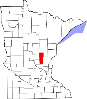
Have you ever wondered about really old buildings or special places that tell a story about the past? In Mille Lacs County, Minnesota, there are 12 such places listed on the National Register of Historic Places. This is a special list in the United States that helps protect important historical sites. Think of it like a hall of fame for buildings, bridges, and even ancient villages!
One of these places is so important it's called a National Historic Landmark. This means it's super special to the history of the whole country. Let's explore some of these amazing spots in Mille Lacs County!
Cool Places in Mille Lacs County
| Name on the Register | Image | Date listed | Location | City or town | Description | |
|---|---|---|---|---|---|---|
| 1 | Bridge No. 3355-Kathio Township |
(#98000685) |
U.S. Route 169 over Whitefish Creek 46°12′55″N 93°47′34″W / 46.215298°N 93.792869°W |
Kathio Township | This bridge was built in 1921. Later, in 1939, a group called the Civilian Conservation Corps (CCC) added beautiful stone decorations to it. The CCC was a program during the Great Depression that helped people find jobs and build useful things. | |
| 2 | Cooper Site |
(#70000299) |
Elbow of Ogechie Lake within Mille Lacs Kathio State Park 46°08′43″N 93°46′31″W / 46.145278°N 93.775222°W |
Onamia vicinity | The Cooper Site is an ancient place where people lived long before Christopher Columbus came to America. It also includes a village site of the Mdewakanton Dakota people from more recent history. | |
| 3 | Robert C. Dunn House |
(#85001922) |
708 S. 4th St. 45°33′58″N 93°35′04″W / 45.56606°N 93.584395°W |
Princeton | This house was built in 1902 for Robert C. Dunn. He was a newspaper publisher and also worked to improve roads. The house is built of brick and has a style called Colonial Revival. | |
| 4 | Ephraim C. Gile House |
(#85001907) |
311 8th Ave., S. 45°33′57″N 93°35′06″W / 45.565936°N 93.585063°W |
Princeton | The Ephraim C. Gile House was built around 1872. It's a brick house designed in the Gothic Revival style, which often features pointed arches and fancy details. | |
| 5 | Great Northern Depot |
(#77000757) |
101 S 10th St. 45°34′09″N 93°35′17″W / 45.569222°N 93.587994°W |
Princeton | This old train station, called a depot, was built in 1902. It's made of brick with special sandstone decorations. Its style is a mix of Queen Anne and Jacobean designs. | |
| 6 | Kathio Site |
(#66000403) |
Within Mille Lacs Kathio State Park 46°07′45″N 93°45′15″W / 46.129174°N 93.754063°W |
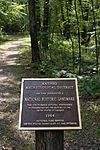
Vineland vicinity | The Kathio Site is a very important place with 19 different archaeological sites. These sites show how people lived from about 3000 BCE (that's 5,000 years ago!) all the way up to 1750 CE. Today, this area is part of a state park where you can visit and learn about its history. | |
| 7 | Milaca Municipal Hall |
(#85002201) |
145 Central Ave, S. 45°45′15″N 93°39′03″W / 45.754213°N 93.650883°W |
Milaca | This town hall was built in 1936 using fieldstone. It has cool murals inside! It was built by the Works Progress Administration (WPA), another program that helped people find jobs during the Great Depression. Now, it's a museum about local history. | |
| 8 | Mille Lacs County Courthouse |
(#77000756) |
635 2nd St., SE. 45°45′15″N 93°38′35″W / 45.754297°N 93.643092°W |
Milaca | The Mille Lacs County Courthouse was built in 1923. It's a grand building made of Indiana Limestone and designed in the Renaissance and Classical Revival styles, which look back to ancient Greek and Roman designs. | |
| 9 | Onamia Municipal Hall |
(#85002333) |
621 Main St. 46°04′13″N 93°40′08″W / 46.070415°N 93.668857°W |
Onamia | Similar to the Milaca hall, this town hall in Onamia was also built in 1936 by the Works Progress Administration. It's made of fieldstone and has design elements from the Arts and Crafts movement. | |
| 10 | Petaga Point |
(#70000300) |
Southern end of Ogechie Lake at the source of the Rum River 46°07′50″N 93°46′50″W / 46.130556°N 93.780556°W |
Onamia vicinity | Petaga Point is an ancient living site that dates back to 3000–1000 BCE. It's the oldest part of the larger Kathio Site district, showing how long people have lived in this area. | |
| 11 | Saw Mill Site |
(#70000301) |
Mille Lacs Kathio State Park Coordinates missing |
Onamia vicinity | The Saw Mill Site is another ancient village site within Mille Lacs Kathio State Park. People lived here between 400 and 1600 CE. | |
| 12 | Vineland Bay Site |
(#70000302) |
Shore of Vineland Bay immediately north of the Rum River 46°09′45″N 93°45′22″W / 46.162556°N 93.756111°W |
Vineland vicinity | The Vineland Bay Site was a village that existed around 800–1100 CE. It's located right on the shore of Vineland Bay. |
Places No Longer Listed
Sometimes, a place might be removed from the National Register if it changes too much or is moved.
| Name on the Register | Image | Date listed | Date removed | Location | City or town | Summary | |
|---|---|---|---|---|---|---|---|
| 1 | Ellen Ruth (launch) |
(#85001923) |
|
Main St. between Lake Shore Boulevard and Fifth St. (original address) Current coordinates are 46°07′05″N 93°31′15″W / 46.118129°N 93.520713°W |
Wahkon | The Ellen Ruth was a fishing boat that came to the lake in 1933. It was used at an early lake resort. It was removed from the list because it was moved in 1989. |

All content from Kiddle encyclopedia articles (including the article images and facts) can be freely used under Attribution-ShareAlike license, unless stated otherwise. Cite this article:
National Register of Historic Places listings in Mille Lacs County, Minnesota Facts for Kids. Kiddle Encyclopedia.


