
National Register of Historic Places listings in St. Louis County, Minnesota facts for kids

Welcome to Saint Louis County, Minnesota! This area is full of amazing places that are super important to history. These special spots are on something called the National Register of Historic Places. Think of it like a Hall of Fame for buildings, bridges, and even old mines!
Saint Louis County has 130 of these historic places. Three of them are even more special, called National Historic Landmarks. Many of these places are in Duluth, a big city on the Great Lakes. Duluth is a major port, like a busy highway for ships! The county is also famous for its iron ore mines, especially in places like Chisholm, Hibbing, Virginia, and Ely. Iron ore is a rock used to make steel. Some of these mines, like the Hull–Rust–Mahoning Open Pit Iron Mine and the Soudan Iron Mine, are also National Historic Landmarks.
Let's explore some of these cool historic spots!
Contents
Cool Historic Places in Saint Louis County
Amazing Bridges
Saint Louis County has some really neat bridges!
Aerial Lift Bridge

The Aerial Lift Bridge in Duluth is super famous! It was built in 1905 as a rare type of bridge called a "transporter bridge." Imagine a platform that would carry cars across the water! Later, in 1929–30, it was changed into a "vertical-lift bridge." This means the middle part lifts straight up to let tall ships pass. It's like a giant elevator for boats! This bridge is a symbol of Duluth and a gateway to the Great Lakes.
Old Stone Bridges

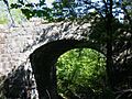
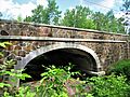
You can find some beautiful old stone bridges here too. Bridge No. 5757 in Duluth was built in 1937. It's an arch bridge with cool Gothic Revival details. Imagine knights and castles, but on a bridge!
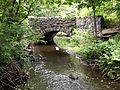
Another one is Bridge No. L-6007, built around 1925. It crosses Stewart Creek in Duluth and is known for its beautiful design and setting in a city park. It looks very natural and blends in with the scenery.
Bridge No. L6113 and Bridge No. L8515 are also in Duluth, crossing Tischer Creek. These bridges were built in the 1920s and show off a cool "rustic" style. They use local rock called gabbro to look like they're part of nature.
Lester River Bridge

The Lester River Bridge was built in 1924–25. It's a big concrete arch bridge with a long span. It helped open up the scenic highway along the North Shore of Lake Superior. It's a great example of how bridges helped people travel and see more of the beautiful area.
Historic Buildings and Homes
Many buildings in the county tell stories about how people lived and worked long ago.
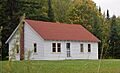
Alango School

The Alango School near Cook was built in 1927. It's a large, well-preserved example of a rural school in northern Minnesota. Because it was so far away from towns, it even had living quarters for the teachers! Imagine your teachers living at school!
B'nai Abraham Synagogue

The B'nai Abraham Synagogue in Virginia was built in 1909. It shows how many different groups of people came to the Iron Range. It also shows how important religious centers were for these immigrant communities to stay connected.
W. Bailey House

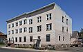
The W. Bailey House in Eveleth was built in 1905. It's a great example of the Queen Anne style of architecture, which often features towers, turrets, and decorative details.
Buhl Public Library

The Buhl Public Library was built in 1917. It was paid for by money from local mining. It helped provide education and culture for the many different people living in this "company town," where the mining company often owned everything.
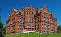
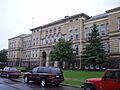
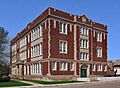
Duluth Central High School

The Duluth Central High School building, built in 1892, is a major landmark in Duluth. It has a tall clock tower and is a beautiful example of Richardsonian Romanesque architecture. It's one of the best examples of this style in Minnesota!
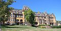
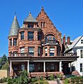
Glensheen Historic Estate

Glensheen Historic Estate in Duluth is a magnificent mansion and its grounds. It was built between 1905 and 1920 for the wealthy Congdon family. It's designed in a style called Jacobethan, which looks like old English country homes. Today, it's a museum where you can learn about life in the early 1900s.
Hibbing High School

Hibbing High School was built between 1919 and 1924. It's known for its fancy Jacobethan architecture. This school shows how much both companies and people wanted better education as mining became more modern.
Kitchi Gammi Club

The Kitchi Gammi Club in Duluth, built in 1912, is a beautiful building. It has a mix of Georgian and Gothic Revival styles and is known for its amazing craftsmanship.
Sons of Italy Hall

The Sons of Italy Hall in Hibbing was built in 1930. It was a meeting place for an Italian American group. It shows how diverse the Iron Range was, with many different immigrant groups. In Hibbing, Italian communities often gathered in clubs rather than churches.
YWCA of Duluth

The YWCA of Duluth headquarters was built in 1908. The YWCA is an organization that helps women and girls. This building is important because it shows how the YWCA helped the community in Duluth through its social welfare programs.
Mines and Industry
The history of Saint Louis County is deeply tied to mining and industry.
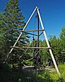
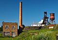
Bruce Mine Headframe

The Bruce Mine Headframe near Chisholm was built in 1925–26. It's the very last headframe left on the Mesabi Range! A headframe is a tall structure over a mine shaft. Back then, underground mining was common, not just open-pit mining. This headframe reminds us of that time.
Hull–Rust–Mahoning Open Pit Iron Mine

The Hull–Rust–Mahoning Open Pit Iron Mine in Hibbing is the world's largest iron mine! It started in 1895 and helped make Minnesota the biggest producer of iron ore in the country. This, in turn, made the United States the biggest steel maker. It's a National Historic Landmark!
Mountain Iron Mine

The Mountain Iron Mine was the very first mine opened on the Mesabi Range in 1892. The Mesabi Range has the world's largest known iron ore deposits! This mine also helped make Minnesota a huge iron producer and the U.S. a leader in steel. It's another National Historic Landmark.
Soudan Iron Mine

The Soudan Iron Mine is Minnesota's oldest and deepest iron mine. It was active from 1884 to 1962. It played a big role in starting Minnesota's iron ore production. Today, it's a state park where you can go underground and see what mining was like! It's also a National Historic Landmark.
E.J. Longyear First Diamond Drill Site

The E.J. Longyear First Diamond Drill Site near Hoyt Lakes is where the very first diamond drilling for exploration happened on the Mesabi Range in 1890. This was the start of the huge mining industry that changed Minnesota and the United States. Now, it's a park with replica equipment.
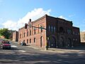
Fitger Brewing Company

The Fitger Brewing Company in Duluth is a complex of buildings that was Duluth's oldest continuously running brewery, from 1859 to 1974. The buildings, built between 1886 and 1920, show what industrial architecture looked like back then.
Cool Ships and Shipwrecks
The Great Lakes are home to many interesting ships and even some shipwrecks!
Bull-of-the-Woods Logging Scow
.jpg)
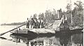
The wreck of the Bull-of-the-Woods Logging Scow is found in Burntside Lake. This scow, built around 1893, was used for timber rafting. It's the only known example of this type of boat, which was very important for the logging industry in northern Minnesota.
Robert Wallace Shipwreck
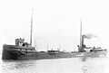
The wreck of the Robert Wallace (bulk carrier) is about 7 miles south of Knife River in Lake Superior. This iron-reinforced wooden steam barge sank in 1902. It's largely untouched, which means it can teach us a lot about how these early "lake freighters" were designed and what life was like on board.
Thomas Wilson Shipwreck

The wreck of the Thomas Wilson (Whaleback Freighter) is near the Duluth Harbor entrance. This freight steamer sank in 1902. It's one of the best examples of a "whaleback" ship design still existing. Whalebacks were unique ships that looked a bit like submarines on the surface!
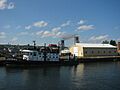
William A. Irvin (freighter)

The William A. Irvin was a flagship for U.S. Steel, serving from 1938 to 1978. It's important for its role in Great Lakes shipping and its new design features. Now, it's a museum ship in Duluth Harbor, where you can explore it!
USS Essex Shipwreck Site
.jpg)
The remains of the USS Essex Shipwreck Site are in Lake Superior. This was a U.S. Navy steam sloop that was active from 1876 to 1903. It was scrapped and burned in 1931. What's left are the only surviving parts of a ship built by the famous shipbuilder Donald McKay.
Parks and Natural Sites
Historic places aren't just buildings; they can be natural areas too!
Height of Land Portage

The Height of Land Portage is a 4.6-mile route over the Laurentian Divide. This area was very important during the fur trade from the 1630s to the 1870s. It's a place where people would carry their canoes and goods between different waterways.
Kettle Falls Historic District

The Kettle Falls Historic District is in Voyageurs National Park. It includes a dam, log buildings, and a hotel built around 1910–1914. This spot was a key crossing point on the Canada–United States border and a hub for industry and tourism deep in the wilderness. The Kettle Falls Hotel itself, built in 1913, provided lodging for fishermen, lumberjacks, and tourists.
Listening Point

Listening Point near Ely was the lake retreat of Sigurd F. Olson (1899–1982). He was a nationally famous advocate for wilderness conservation. The site includes his cabin, a sauna, and other buildings. It's a peaceful place that reflects his love for nature. His one-room writing studio, the Sigurd F. Olson Writing Shack, is also preserved as a museum.
Olcott Park Electric Fountain and Rock Garden

The Olcott Park Electric Fountain and Rock Garden in Virginia was built in 1937. It's a unique and popular feature created by the Works Progress Administration (WPA), a government program during the Great Depression. It's known for its cool colored light display from General Electric!
Orr Roadside Parking Area

The Orr Roadside Parking Area was developed between 1935 and 1938. It's a great example of an early roadside rest stop. It was built by the Minnesota Department of Highways with help from New Deal agencies, showing a rustic design that blends with nature.
Other Interesting Sites
Civilian Conservation Corps Camp S-52

The Civilian Conservation Corps Camp S-52 near Cusson has four workshops built around 1933. These are the only surviving buildings in the area built for the Civilian Conservation Corps (CCC). The CCC was a program during the Great Depression that put young men to work on conservation projects.
Kabetogama Ranger Station District

The Kabetogama Ranger Station District in Voyageurs National Park was built between 1933 and 1941. It was built by the Civilian Conservation Corps for the Minnesota Division of Forestry. It's another example of federal work projects during the Great Depression and shows a rustic architectural style.
St. Louis County 4-H Club Camp

The St. Louis County 4-H Club Camp in Biwabik Township was built in 1934. It's known for its excellent log construction and its unique story. It was built with prize money from a national competition for the county with the best 4-H program! Today, it's called Camp Esquagama.
US Fisheries Station, Duluth

The US Fisheries Station, Duluth (also known as the Lester River Fish Hatchery) is a four-building complex built in the 1880s. It's a great example of Shingle and Stick style architecture. It was a fish hatchery and later became a research station for the University of Minnesota Duluth.
Valon Tuote Raittiusseura

The Valon Tuote Raittiusseura in Virginia was built around 1906. It was a long-serving meeting hall for various Finnish American groups. It was originally built by a temperance society, which promoted avoiding alcohol.
Images for kids
-
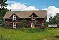
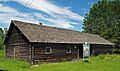
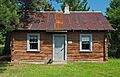
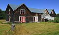
Elias and Lisi Aho Historic Farmstead
-
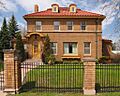
Andrew G. Anderson House
-

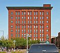
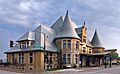
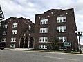
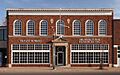
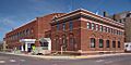
Androy Hotel
-

Archaeological Site No. 21SL82
-
Archeological Site 21SL35
-
Archeological Site 21SL55
-
Archeological Site 21SL141
-
Archeological Site No. 21SL73
-
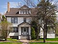
W.T. Bailey House
-
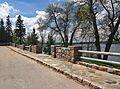
Bridge No. L-6007
-
Bridge No. L6113
-
Bridge No. L8515
-

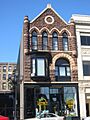
Buhl Village Hall
-
Bull-of-the-Woods Logging Scow
-
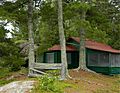
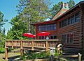
Burntside Lodge Historic District
-
Emmett Butler House
-
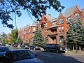
Chester Terrace
-
Chisholm Commercial Historic District
-
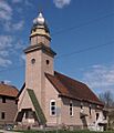
Church of St. John the Baptist (Catholic)
-
Church of St. Joseph (Catholic)
-
Church of the Holy Family (Catholic)
-
Civilian Conservation Corps Camp S-52
-

Coates House
-
Delvic Building
-
DeWitt-Seitz Building
-
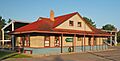
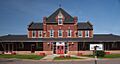
Duluth and Iron Range Railroad Company Passenger Station
-
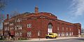
Duluth Armory
-
Duluth Civic Center Historic District
-
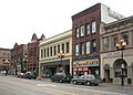
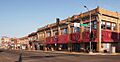
Duluth Commercial Historic District
-
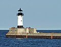
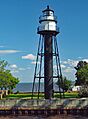
Duluth Harbor North Pier Light
-
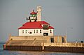
Duluth Harbor South Breakwater Outer Light
-
Duluth Masonic Temple
-
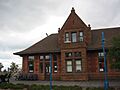
Duluth Missabe and Iron Range Depot (Endion)
-
Duluth Public Library
-
Duluth South Breakwater Inner (Duluth Range Rear) Lighthouse
-
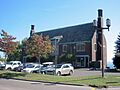
Duluth State Normal School Historic District
-
Duluth Union Depot
-
Duluth, Winnipeg, and Pacific Depot
-
East Howard Street Commercial Historic District
-
Ely Community Center
-
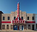
Ely State Theater
-
Endion School
-
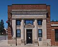
Engine House No. 1
-
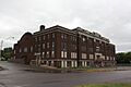
Eveleth Manual Training School
-
Eveleth Recreation Building
-
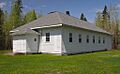
Finnish Sauna
-
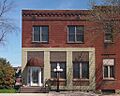
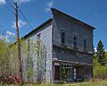
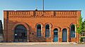
First National Bank of Gilbert
-
Flint Creek Farm Historic District
-
Jun Fujita Cabin
-
Gregorius and Mary Hanka Historic Farmstead
-
Hartley Building
-
Hibbing City Hall
-
Hibbing Disposal Plant
-
Hotel Glode
-
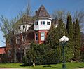
William Ingersoll Estate
-
Irving School
-
Jukola Boardinghouse
-
Kabetogama Ranger Station District
-
Kettle Falls Historic District
-
Kettle Falls Hotel
-
LaSalle Apartments
-
LeMoine Building
-
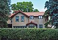
Charles Lenont House
-
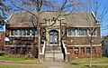
Lincoln Branch Library
-
Lincoln School Building
-
E.J. Longyear First Diamond Drill Site
-
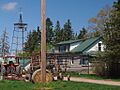
Monson's Hoist Bay Resort
-
Munger Terrace
-
Erick and Kristina Nelimark Sauna
-
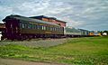
Northland (railcar)
-
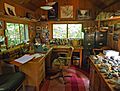
Sigurd F. Olson Writing Shack
-
Orr Roadside Parking Area
-
Pioneer Mine Buildings and "A" Headframe
-
Anna and Mikko Pyhala Farm
-
Robert Wallace (bulk carrier) shipwreck site
-
Sacred Heart Cathedral, Sacred Heart School and Christian Brothers Home
-
St. Louis County 4-H Club Camp
-
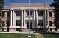
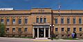
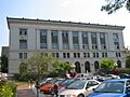
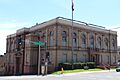
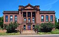
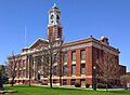
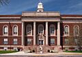
St. Louis County District Courthouse
-
St. Mark's African Methodist Episcopal Church
-
Saints Peter and Paul Church-Ukrainian Catholic
-
Alex Seitaniemi Housebarn
-
Sons of Italy Hall
-
I.W. Stevens Lakeside Cottage
-
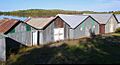
Stuntz Bay Boathouse Historic District
-

Tanner's Hospital
-
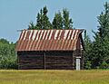
Waino Tanttari Field Hay Barn
-
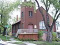
Tower Fire Hall
-
Oliver G. Traphagen House
-
United States Army Corps of Engineers Duluth Vessel Yard
-

Virginia Brewery
-
Virginia City Hall
-
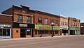
Virginia Commercial Historic District
-
Virginia–Rainy Lake Lumber Company Manager's Residence
-
Virginia–Rainy Lake Lumber Company Office
-
Virginia Recreation Building
-
Western Bohemian Fraternal Union Hall
-
Wirth Building


.jpg)
.jpg)


.jpg)


.jpg)


