
National Register of Historic Places listings in Valdez–Cordova Census Area, Alaska facts for kids

This is a list of the National Register of Historic Places listings in Valdez–Cordova Census Area, Alaska.
This is intended to be a complete list of the properties and districts on the National Register of Historic Places in Valdez-Cordova Census Area, Alaska, United States. The locations of National Register properties and districts for which the latitude and longitude coordinates are included below, may be seen in a Google map.
There are 28 properties and districts listed on the National Register in the census area, including 3 National Historic Landmarks. Another two properties were once listed but have been removed.
Current listings
| Name on the Register | Image | Date listed | Location | City or town | Description | |
|---|---|---|---|---|---|---|
| 1 | Bering Expedition Landing Site |
 |
(#77001542) |
South of Katalla on Kayak Island 59°53′40″N 144°29′08″W / 59.894444°N 144.485556°W |
Katalla | |
| 2 | Bremner Historic Mining District |
 |
(#00000659) |
Wrangell-St. Elias National Park and Preserve 61°01′28″N 143°26′24″W / 61.024444°N 143.44°W |
Chitina | part of the Mineral Development in Wrangell-St. Elias National Park and Preserve, Alaska MPS |
| 3 | Cape Hinchinbrook Light Station |
 |
(#05000728) |
Southwestern corner of Hinchinbrook Island on the eastern side of the Hinchinbrook Entrance of Prince William Sound 60°14′16″N 146°38′48″W / 60.23783°N 146.64657°W |
Cordova | part of the Light Stations of the United States MPS |
| 4 | Cape St. Elias Lighthouse |
 |
(#75002157) |
South of Katalla on Kayak Island 59°48′27″N 144°36′40″W / 59.8075°N 144.611111°W |
Katalla | |
| 5 | Chilkat Oil Company Refinery Site |
(#74002320) |
Katalla Rd. 60°11′19″N 144°27′00″W / 60.188611°N 144.45°W |
Katalla | ||
| 6 | Chisana Historic Mining Landscape |
 |
(#85002999) |
Extending west 0.25 miles (0.40 km) from the southeastern end of Chisana Airstrip and parallel to Johnson Creek 62°03′57″N 142°02′34″W / 62.065833°N 142.042778°W |
Chisana | Expanded and renamed in 1998 |
| 7 | Chistochina Trading Post |
(#97000553) |
Junction of the Glenn Highway and the Tok Cutoff 62°34′07″N 144°40′59″W / 62.568611°N 144.683056°W |
Gakona | ||
| 8 | Chitina Tin Shop |
 |
(#79003763) |
Main St. 61°31′03″N 144°26′23″W / 61.5175°N 144.439722°W |
Chitina | |
| 9 | Copper River and Northwestern Railway |
 |
(#73002275) |
Beginning at Chitina and following the Copper River to the Tasnuna River 61°17′34″N 144°42′48″W / 61.292778°N 144.713333°W |
Chitina | |
| 10 | Copper River and Northwestern Railway Bunkhouse and Messhouse |
(#02001460) |
3rd St. 61°30′58″N 144°26′02″W / 61.516111°N 144.433889°W |
Chitina | ||
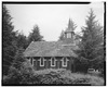
| 11 | Cordova Post Office and Courthouse |
.jpg) |
(#77001571) |
2nd St. 60°32′42″N 145°45′18″W / 60.545°N 145.755°W |
Cordova | |
| 12 | Dakah De'nin's Village Site |
(#79003764) |
Address Restricted |
Chitina | ||
| 13 | Gakona Historic District |
 |
(#01000024) |
Mile 2 on the Tok Cutoff-Glenn Highway 62°18′10″N 145°18′12″W / 62.302778°N 145.303333°W |
Gakona | |
| 14 | Gakona Roadhouse |
 |
(#77001579) |
Mile 205 on the Glenn Highway 62°18′10″N 145°18′16″W / 62.302778°N 145.304444°W |
Gakona | The c. 1904 roadhouse, not the present c. 1920s roadhouse. |
| 15 | Kansky's |
(#97000432) |
Mile 42 on Skookum Rd., approximately 2 miles (3.2 km) north of the Nabesna Mine 62°22′46″N 142°59′33″W / 62.379444°N 142.9925°W |
Slana | ||
| 16 | Kennecott Mines |
 |
(#78003420) |
Southeast of the Kennecott Glacier on the northern bank of National Creek 61°30′36″N 142°52′05″W / 61.51°N 142.868056°W |
Kennecott | |
| 17 | McCarthy General Store |
 |
(#78003421) |
Kennecott and Sholai Sts. 61°26′03″N 142°55′16″W / 61.434167°N 142.921111°W |
McCarthy | |
| 18 | McCarthy Power Plant |
(#79003752) |
At McCarthy Creek 61°25′57″N 142°55′30″W / 61.4325°N 142.925°W |
McCarthy | ||
| 19 | Million Dollar Bridge |
 |
(#00000293) |
Mile 48 on the Copper River Highway 60°40′24″N 144°44′36″W / 60.673333°N 144.743333°W |
Cordova | |
| 20 | Nabesna Gold Mine Historic District |
(#79003755) |
Base of White Mountain 62°22′28″N 142°59′52″W / 62.374444°N 142.997778°W |
Nabesna | ||
| 21 | Palugvik Archeological District |
(#66000957) |
Address Restricted |
Cordova | ||
| 22 | Pioneer Igloo Hall Number 19 |
(#12000492) |
621 1st St. 60°32′38″N 145°45′32″W / 60.543865°N 145.758776°W |
Cordova | ||
| 23 | Reception Building |
(#80004566) |
2nd and B Sts. 60°33′10″N 145°45′02″W / 60.552778°N 145.750556°W |
Cordova | ||
| 24 | Red Dragon Historic District |
 |
(#82004899) |
Lake St. 60°32′31″N 145°45′21″W / 60.541944°N 145.755833°W |
Cordova | St. George's Church and the Red Dragon Reading Room |
| 25 | St. Michael the Archangel Church |
 |
(#80004578) |
In Cordova 60°32′33″N 145°44′16″W / 60.5425°N 145.737778°W |
Cordova | part of the Russian Orthodox Church Buildings and Sites TR |
| 26 | Slana Roadhouse |
 |
(#04001569) |
Mile 1 on Nebesna Rd. 62°42′19″N 143°57′39″W / 62.705278°N 143.960833°W |
Slana | |
| 27 | Tangle Lakes Archeological District |
(#71001091) |
Address Restricted |
Paxson | ||
| 28 | Valdez Trail-Copper Bluff Segment |
(#98000077) |
Milepost 106.5 on the Richardson Highway 62°01′16″N 145°21′52″W / 62.021111°N 145.364444°W |
Copper City | part of the Valdez Trail MPS |
Former listing
| Name on the Register | Image | Date listed | Date removed | Location | City or town | Summary | |
|---|---|---|---|---|---|---|---|
| 1 | Sourdough Lodge |
.jpg) |
(#74002264) |
|
Mile 147.5, Richardson Highway 62°31′52″N 145°31′07″W / 62.5312°N 145.5187°W |
Gakona | Historic roadhouse; destroyed by fire in 1992. |

All content from Kiddle encyclopedia articles (including the article images and facts) can be freely used under Attribution-ShareAlike license, unless stated otherwise. Cite this article:
National Register of Historic Places listings in Valdez–Cordova Census Area, Alaska Facts for Kids. Kiddle Encyclopedia.