
National Register of Historic Places listings in Volusia County, Florida facts for kids

This article is about the amazing historic places in Volusia County, Florida. These special spots are listed on the National Register of Historic Places. This is a list kept by the United States government to honor buildings, sites, and objects that are important to history.
When a place is on this list, it means it's recognized for its historical, architectural, or archaeological value. It helps protect these places for future generations to enjoy and learn from. Volusia County has over 100 of these special places, including two that are called National Historic Landmarks, which are even more important!
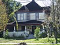
Historic Buildings and Homes
Volusia County is home to many old buildings and houses that tell stories of the past.
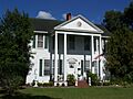
Important Homes
Many famous or important people lived in Volusia County. Their homes are now historic sites.
Mary McLeod Bethune Home

The Mary McLeod Bethune Home is on the Bethune-Cookman University campus in Daytona Beach. This house was the home of Mary McLeod Bethune, a very important educator and civil rights leader. She worked hard to create educational opportunities for African American students. Her home is so important that it's a National Historic Landmark! It was added to the list on December 2, 1974.
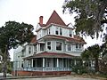
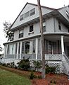
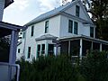
John B. Stetson House

The John B. Stetson House is located at 1031 Camphor Lane in DeLand. John B. Stetson was a famous hat maker and a big supporter of education. He helped start Stetson University. His house was listed on November 21, 1978.
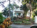
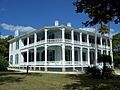
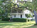
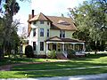
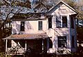
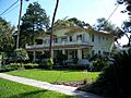
Delos A. Blodgett House

The Delos A. Blodgett House is at 404 Ridgewood Avenue in Daytona Beach. This house is a great example of old architecture. It was added to the list on August 2, 1993.
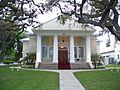
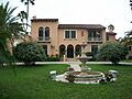
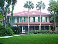
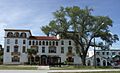
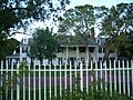
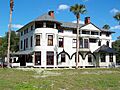
The Casements

Located at 15 East Granada Avenue in Ormond Beach, The Casements is a beautiful historic home. It was once the winter home of John D. Rockefeller, a very wealthy businessman. It was listed on June 30, 1972. There's also a nearby building called Casements Annex, listed on October 6, 1988.
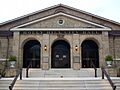
Historic Schools and Public Buildings
Several schools and public buildings in Volusia County are recognized for their history.
Barberville Central High School

The Barberville Central High School is at 1776 Lightfoot Lane in Barberville. This old school building has a lot of history. It was added to the list on February 3, 1993.
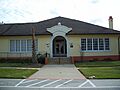
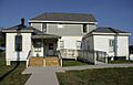
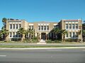
Cypress Street Elementary School

In Daytona Beach, the Cypress Street Elementary School at 868 West George W Engram Boulevard is a historic site. It was listed on December 2, 1996.
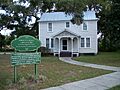
DeLeon Springs Colored School

The DeLeon Springs Colored School at 330 East Retta Street in DeLeon Springs is an important historic school. It was listed on August 1, 2003, as part of Florida's Historic Black Public Schools.
Orange City Colored School

Another significant school is the Orange City Colored School at 200 East Blue Springs Avenue in Orange City. It was also listed on August 1, 2003, as part of the same historic schools project.
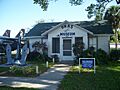
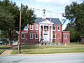
Holly Hill Municipal Building

The Holly Hill Municipal Building at 1065 Ridgewood Avenue in Holly Hill serves as a historic civic building. It was listed on April 8, 1993.
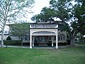
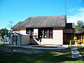
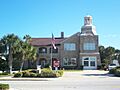
Orange City Town Hall

The Orange City Town Hall at 205 East Graves Avenue in Orange City is another historic public building. It was added to the list on May 16, 2002.
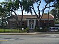
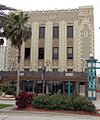
U.S. Post Office (Daytona Beach)

The U.S. Post Office at 220 North Beach Street in Daytona Beach is a historic building. It was listed on June 30, 1988.
Churches and Religious Sites
Volusia County has several historic churches and religious sites.
All Saints Episcopal Church

All Saint's Episcopal Church is at the corner of DeBary Avenue Northeast and Clark Street in Enterprise. This church was listed on May 3, 1974.
Grace Episcopal Church and Guild Hall

Grace Episcopal Church and Guild Hall is at 4100 Ridgewood Avenue in Port Orange. It was listed on February 5, 1998.
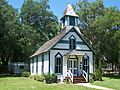
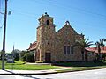
St. Rita's Colored Catholic Mission

St. Rita's Colored Catholic Mission at 314 Duss Street in New Smyrna Beach is a historic mission. It was listed on April 13, 2007.
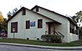
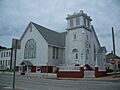
Tourist Church

The Tourist Church at 501 North Wild Olive Avenue in Daytona Beach is a unique historic church. It was listed on October 6, 1995.
Historic Districts
Historic districts are areas with many buildings that together create a sense of a historic time or place.
Bethune-Cookman College Historic District

The Bethune-Cookman College Historic District is at 620 Dr. Mary McLeod Bethune Boulevard in Daytona Beach. This district includes several historic buildings on the university campus. It was listed on March 21, 1996.
Downtown DeLand Historic District

The Downtown DeLand Historic District is roughly bounded by Florida and Rich Avenues, Woodland Boulevard, and Howry Avenue in DeLand. This area shows the historic heart of the city. It was listed on December 23, 1987.
New Smyrna Beach Historic District

The New Smyrna Beach Historic District is roughly bounded by Riverside Drive, U.S. Route 1, Ronnoc Lane, and Smith Street in New Smyrna Beach. This district preserves the historic character of the city. It was listed on April 26, 1990.
Southern Cassadaga Spiritualist Camp Historic District

The Southern Cassadaga Spiritualist Camp Historic District is roughly bounded by Cassadaga Road and Marion, Stevens, Lake, and Chauncey Streets in Cassadaga. This unique district is known for its spiritualist community. It was listed on March 14, 1991.
Stetson University Campus Historic District

The Stetson University Campus Historic District in DeLand includes many historic buildings on the university campus. It was listed on March 14, 1991.
Historic Sites and Landmarks
Volusia County also has important historic sites that aren't just buildings.
Ponce de Leon Inlet Lightstation

The Ponce de Leon Inlet Lightstation is at 4931 South Peninsula Drive in Ponce Inlet. This historic lighthouse is a National Historic Landmark. It's one of the tallest lighthouses in the United States and has guided ships for many years. It was listed on September 22, 1972.
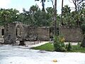
Dunlawton Plantation-Sugar Mill Ruins

The Dunlawton Plantation and Sugar Mill ruins are at 950 Old Sugar Mill Road in Port Orange. These ruins are what's left of an old sugar mill from the 1800s. It was listed on August 28, 1973.
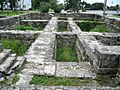
New Smyrna Sugar Mill Ruins

Similar to Dunlawton, the New Smyrna Sugar Mill Ruins at 600 Old Mission Road in New Smyrna Beach are also historic sugar mill remains. They were listed on August 12, 1970.
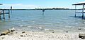
Turtle Mound

Turtle Mound is located in the Canaveral National Seashore, south of Bethune Beach, near New Smyrna Beach. This is a large shell midden, which is a mound made of oyster and clam shells left behind by ancient Native Americans. It's a very important archaeological site and was listed on September 29, 1970.
Jackie Robinson Ballpark

The Jackie Robinson Ballpark is on City Island in Daytona Beach. This ballpark is famous because Jackie Robinson, the first African American to play in Major League Baseball, played his first professional game here in 1946. It was listed on October 22, 1998.
Daytona Beach Bandshell and Oceanfront Park Complex

The Daytona Beach Bandshell and Oceanfront Park Complex is on Ocean Avenue in Daytona Beach. This outdoor music venue and park has been a popular spot for entertainment for many years. It was listed on March 5, 1999.
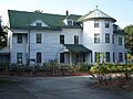
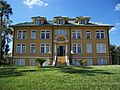
DeBary Hall

DeBary Hall is located in DeBary Mansion State Park in DeBary. This historic estate was once the winter home of a wealthy wine merchant. It was listed on July 24, 1972.
Archaeological Sites
Volusia County has several important archaeological sites that help us learn about ancient cultures. Many of these sites are "Address Restricted" to protect them from harm.
- Airport Clear Zone Archeological Site (New Smyrna Beach, listed 2008)
- Blanchette Archeological Site (New Smyrna Beach, listed 2008)
- First Presbyterian Church Archeological Site (New Smyrna Beach, listed 2008)
- Grange Archeological Site (New Smyrna Beach, listed 2008)
- Hawks Archeological Site (Edgewater, listed 2008)
- Janet's Archeological Site (New Smyrna Beach, listed 2008)
- Old Fort Park Archeological Site (New Smyrna Beach, listed 2008)
- Old Stone Wharf Archeological Site (New Smyrna Beach, listed 2008)
- Sleepy Hollow Archeological Site (New Smyrna Beach, listed 2008)
- Spruce Creek Mound Complex (Port Orange, listed 1990)
- Three Chimneys Archaeological Site (Ormond Beach, listed 2010)
- Turnbull Canal System (New Smyrna Beach, listed 2007)
- Turnbull Colonists' House Archeological Site (New Smyrna Beach, listed 2008)
- Turnbull Colonists' House No. 2 Archeological Site (New Smyrna Beach, listed 2008)
- White-Fox House Archeological Site (New Smyrna Beach, listed 2008)
These sites are part of the "Archeological Resources of the 18th-Century Smyrnea Settlement of Dr. Andrew Turnbull," which means they are connected to an early settlement in the area.
Images for kids
-
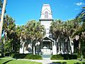
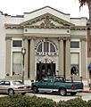
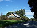
The Abbey in Daytona Beach.
-
The John Anderson Lodge.
-
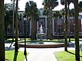
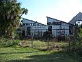
The Anderson-Price Memorial Library Building.
-
Faith Hall at Bethune-Cookman College.
-
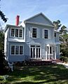
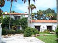
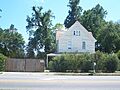
The Delos A. Blodgett House.
-
The Casements Annex.
-
The Casements.
-
The Chief Master at Arms House.
-
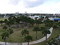
City Island in Daytona Beach.
-
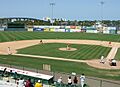
Jackie Robinson Ballpark.
-
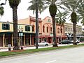
The Coronado Historic District.
-
Cypress Street Elementary School.
-
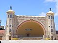
The Daytona Beach Bandshell.
-
A street in the Daytona Beach Surfside Historic District.
-
DeBary Hall.
-
DeLand Hall at Stetson University.
-
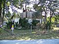
The DeLeon Springs Colored School.
-
The Dickinson Memorial Library and Park.
-
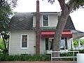
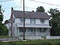
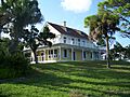
The Dix House.
-
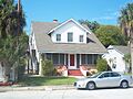
The Bartholomew J. Donnelly House.
-
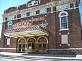
The Athens Theatre in the Downtown DeLand Historic District.
-
The Dunlawton Avenue Historic District.
-
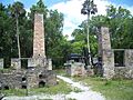
The Dunlawton Plantation-Sugar Mill Ruins.
-
A building in the El Pino Parque Historic District.
-
El Real Retiro.
-
The Seth French House.
-
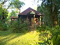
Gamble Place Historic District.
-
Grace Episcopal Church and Guild Hall.
-
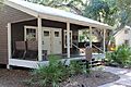
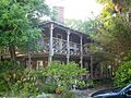
The Hammocks.
-
The Alexander Haynes House.
-
The Holly Hill Municipal Building.
-
The Kilkoff House.
-
The Amos Kling House.
-
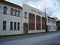
The S.H. Kress and Co. Building.
-
A building in the Lake Helen Historic District.
-
The Lippincott Mansion.
-
The Merchants Bank Building.
-
The Meyer-Davis House-Hasty Cottage.
-
The Moulton-Wells House.
-
The New Smyrna Beach Historic District.
-
The New Smyrna Sugar Mill Ruins.
-
The Old DeLand Memorial Hospital.
-
The Old Fort Park Archeological Site.
-
The Old Stone Wharf Archeological Site.
-
Nocoroco.
-
Olds Hall.
-
The Orange City Colored School.
-
The Albertus Cottage in the Orange City Historic District.
-
The Orange City Town Hall.
-
The Ormond Fire House.
-
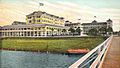
The Ormond Hotel (now demolished).
-
The Ormond Yacht Club.
-
Persimmon Mound.
-
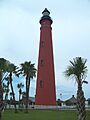
The Ponce De Leon Inlet Lightstation.
-
The Porches.
-
The Port Orange Florida East Coast Railway Freight Depot.
-
The Rogers House.
-
Rowallan.
-
St. Rita's Colored Catholic Mission.
-
A building in the Seabreeze Historic District.
-
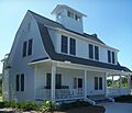
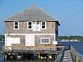
Seminole Rest.
-
The Seybold Baking Company Factory.
-
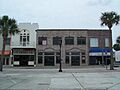
The South Beach Street Historic District.
-
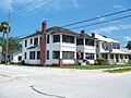
A house in the South Peninsula Historic District.
-
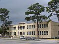
South Ridgewood Elementary School.
-
A building in the Southern Cassadaga Spiritualist Camp Historic District.
-
The Howard Thurman House.
-
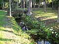
Aerial view of the Spruce Creek Mound Complex.
-
Sampson Hall at Stetson University.
-
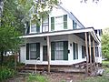
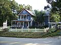
The John B. Stetson House.
-
The Ann Stevens House.
-
The Stockton-Lindquist House.
-
The Strawn Historic Agricultural District.
-
The Strawn Historic Citrus Packing House District.
-
The Strawn Historic Sawmill District.
-
Talahloka.
-
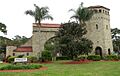
The Tarragona Tower.
-
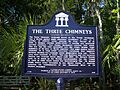
The Three Chimneys Archaeological Site.
-
The Louis P. Thursby House.
-
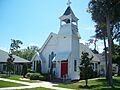
The Tourist Church.
-
The Turnbull Canal System.
-
The Turnbull Colonists' House Archeological Site.
-
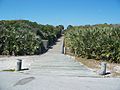
Turtle Mound.
-
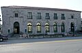
The U.S. Post Office in Daytona Beach.
-
A house in the West DeLand Residential District.
-
White Hall.
-
The Woman's Club of New Smyrna.
-
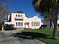
The S. Cornelia Young Memorial Library.


_0786.JPG)


