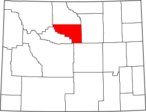
National Register of Historic Places listings in Washakie County, Wyoming facts for kids
Hey there, history explorers! Did you know that places like old houses, stores, or even fire lookouts can be super important for understanding the past? In Washakie County, Wyoming, there's a special list of places that are recognized for their historical value. This list is called the National Register of Historic Places. It's like a hall of fame for buildings and areas that tell amazing stories about how people lived, worked, and built communities long ago.
Washakie County has 7 different places on this important list. These spots help us remember and learn about the county's unique history. Let's take a look at some of these cool historic sites!
| Albany - Big Horn - Campbell - Carbon - Converse - Crook - Fremont - Goshen - Hot Springs - Johnson - Laramie - Lincoln - Natrona - Niobrara - Park - Platte - Sheridan - Sublette - Sweetwater - Teton - Uinta - Washakie - Weston |
Discovering Washakie County's Historic Treasures
The National Register of Historic Places is a way to celebrate and protect buildings, sites, and objects that are important to American history. When a place is added to this list, it means it has special meaning because of its history, architecture, or what happened there.
Historic Homes and Buildings
Many places on the National Register are old homes or businesses that show us how people lived and worked in the past.
- Ainsworth House in Big Trails, Wyoming: This house was added to the list in 1986. It's a reminder of the early days in Big Trails.
- Emerson Parks House in Ten Sleep, Wyoming: Located on 2nd Street, this house became historic in 2016. It helps us imagine life in Ten Sleep years ago.
- Ten Sleep Mercantile in Ten Sleep, Wyoming: This old store, found at 2nd and Pine Streets, was listed in 1986. Mercantile stores were once vital places where people bought everything they needed.
- Worland House in Worland, Wyoming: This house on Culbertson Street was recognized in 1986. It's part of Worland's rich history.
Important Landscapes and Structures
Sometimes, it's not just a building but a larger area or a special structure that gets listed.
- James T. Saban Lookout in Ten Sleep, Wyoming: Also known as the High Point Lookout, this spot in Bighorn National Forest was listed in 2016. Fire lookouts were crucial for spotting wildfires and keeping forests safe.
- Worland Ranch in Worland, Wyoming: This ranch, located near the junction of U.S. Route 20 and Wyoming Highway 433, was added to the list in 1992. Ranches played a huge role in Wyoming's development and economy.
These places are like open books, telling us stories about the people and events that shaped Washakie County. Protecting them helps future generations understand their heritage.


