National Register of Historic Places listings in Natrona County, Wyoming facts for kids
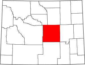
This page lists amazing historic places in Natrona County, Wyoming, that are part of the National Register of Historic Places. Think of it like a special list of important buildings, sites, and areas that are worth protecting because of their history. These places tell us stories about the past in Wyoming and the United States.
You can even see where some of these places are on a map if their exact location (latitude and longitude) is shared. Natrona County has 39 of these special places. Two of them are even more important and are called National Historic Landmarks!
| Albany - Big Horn - Campbell - Carbon - Converse - Crook - Fremont - Goshen - Hot Springs - Johnson - Laramie - Lincoln - Natrona - Niobrara - Park - Platte - Sheridan - Sublette - Sweetwater - Teton - Uinta - Washakie - Weston |
Contents
What is the National Register of Historic Places?
The National Register of Historic Places is the official list of the nation's historic places that are worth saving. It's like a hall of fame for buildings, structures, objects, sites, and districts that are important to American history, architecture, archaeology, engineering, or culture. When a place is on this list, it means it's recognized for its special value and efforts are made to protect it.
Why are places added to the list?
Places get added to the National Register for many reasons. Maybe they were home to a famous person, or they saw an important event happen. Some are great examples of old buildings or show how people lived long ago. For example, an old school building might be listed because it's a beautiful example of architecture from its time, or an ancient campsite might be listed because it teaches us about early human life.
National Historic Landmarks
Some places are so important that they get an even higher honor: they become a National Historic Landmark. These are places that have played a truly special role in the history of the United States. Natrona County is proud to have two of these super important landmarks!
Historic Places in Natrona County
Natrona County is full of history, from ancient sites to buildings from the early 1900s. Let's explore some of these cool places!
| Name on the Register | Image | Date listed | Location | City or town | Description | |
|---|---|---|---|---|---|---|
| 1 | Archeological Site No. 48NA83 |
(#94000440) |
Address Restricted |
Arminto | This is an archaeological site, meaning it holds clues about past human life. Its exact location is kept secret to protect it from harm. | |
| 2 | Big Horn Hotel |
(#78002831) |
Main St. 43°10′42″N 107°15′24″W / 43.178333°N 107.256667°W |
Arminto | The Big Horn Hotel is an old hotel in Arminto. Hotels like this were once very important for travelers and people working in the area. | |
| 3 | Bishop House |
(#01000270) |
818 E. 2nd St. 42°29′18″N 106°18′26″W / 42.488333°N 106.307222°W |
Casper | The Bishop House is a historic home in Casper. Many old houses are listed for their unique architecture or connection to important people. | |
| 4 | Bridger Immigrant Road-Waltman Crossing |
(#75001905) |
49 miles west of Casper on U.S. Route 20 43°04′20″N 107°12′41″W / 43.072222°N 107.211389°W |
Casper | This site marks a crossing point on the Bridger Immigrant Road. This was an important route for pioneers traveling west long ago. | |
| 5 | Casper Army Air Base |
(#01000789) |
8500 Fuller St. 42°53′31″N 106°50′34″W / 42.891944°N 106.842778°W |
Casper | This was once a military air base. It played a role in training pilots during World War II. Today, it's the Casper-Natrona County International Airport. | |
| 6 | Casper Buffalo Trap |
(#74002027) |
Address Restricted |
Casper | This is another archaeological site. It's a place where Native Americans once hunted buffalo using clever trapping methods. Its location is kept secret to protect it. | |
| 7 | Casper Downtown Historic District |
(#16000732) |
Generally bounded by Midwest Ave., W. B, W. C, & Beech Sts. 42°50′55″N 106°19′31″W / 42.848722°N 106.325186°W |
Casper | This district includes many historic buildings in downtown Casper. It shows how the city grew and developed over time. | |
| 8 | Casper Federal Building |
(#98001536) |
111 S. Wolcott St. 42°50′59″N 106°19′22″W / 42.849722°N 106.322778°W |
Casper | This building serves as a federal courthouse. It's an important part of the government and legal system in the area. | |
| 9 | Casper Fire Department Station No. 1 |
(#93001187) |
302 S. David St. 42°50′52″N 106°19′35″W / 42.847778°N 106.326389°W |
Casper | This was the first fire station in Casper. It's a reminder of how the city protected its citizens from fires in the past. | |
| 10 | Casper Motor Company-Natrona Motor Company |
(#94000042) |
230 W. Yellowstone Highway 42°50′55″N 106°19′36″W / 42.848611°N 106.326667°W |
Casper | This building once housed car companies. It shows the early days of cars and transportation in Casper. | |
| 11 | Chicago and Northwestern Railroad Depot |
(#87002296) |
35231 W. Dakota Ave. 43°02′04″N 106°59′10″W / 43.034444°N 106.986111°W |
Powder River | Railroad depots were busy places where trains stopped and people traveled. This one in Powder River is a piece of railroad history. | |
| 12 | Church of Saint Anthony |
(#96001631) |
604 S. Center St. 42°50′37″N 106°19′29″W / 42.843611°N 106.324722°W |
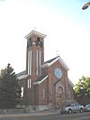
Casper | This church is recognized for its historical or architectural importance in Casper. | |
| 13 | Consolidated Royalty Building |
(#93001186) |
137-141 S. Center St. 42°50′57″N 106°19′27″W / 42.849167°N 106.324167°W |
Casper | This building was important for businesses related to the oil industry in Casper's early days. | |
| 14 | DUX Bessemer Bend Bridge |
(#85000428) |
County Road CN1-58 42°46′18″N 106°31′50″W / 42.771667°N 106.530556°W |
Bessemer Bend | This historic bridge helped people cross the river. Bridges are often listed for their engineering and how they helped communities connect. | |
| 15 | Elks Lodge No. 1353 |
(#96001632) |
108 E. 7th St. 42°50′38″N 106°19′27″W / 42.843889°N 106.324167°W |
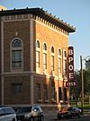
Casper | The Elks Lodge is a building used by a community organization. These lodges were often important social centers in towns. | |
| 16 | Fort Caspar |
(76002282 #71000887; 76002282) |
14 Fort Caspar Rd.; also an area on the northern side of the fort along the Platte River 42°50′09″N 106°22′19″W / 42.835833°N 106.371944°W |
Casper | Fort Caspar was an important military post and trading center in the 1800s. It played a big role in the history of the American West. | |
| 17 | Grant Street Grocery and Market |
(#08001005) |
815 S. Grant St. 42°51′30″N 107°19′02″W / 42.858333°N 107.317222°W |
Casper | This old grocery store and market was a vital part of the community, where people bought their food and supplies. | |
| 18 | Independence Rock |
(#66000757) |
60 miles southwest of Casper on Wyoming Highway 220 42°29′38″N 107°07′48″W / 42.493889°N 107.13°W |
Casper | Independence Rock is a huge granite rock that was a famous landmark for pioneers traveling on the Oregon Trail. Many travelers carved their names into the rock. It's one of Natrona County's National Historic Landmarks! | |
| 19 | Martin's Cove |
(#77001383) |
West of Casper 42°27′16″N 107°14′43″W / 42.454444°N 107.245278°W |
Casper | Martin's Cove is a historic site known for a difficult journey by a group of Mormon pioneers in 1856. It's a place of great historical significance. | |
| 20 | Masonic Temple |
(#05000926) |
105 N. Center St. 42°51′01″N 106°19′27″W / 42.850278°N 106.324167°W |
Casper | The Masonic Temple is a building used by the Masons, a fraternal organization. These buildings often have unique architecture. | |
| 21 | Midwest Oil Company Hotel |
(#83004302) |
136 E. 6th St. 42°50′41″N 106°19′25″W / 42.844722°N 106.323611°W |
Casper | This hotel was built by the Midwest Oil Company. It shows the importance of the oil industry in Casper's history. | |
| 22 | Dean Morgan Junior High School |
(#16000229) |
1440 South Elm St. 42°50′09″N 106°19′46″W / 42.835852°N 106.329570°W |
Casper | This old school building is recognized for its historical value. Schools are important parts of a community's past. | |
| 23 | Natrona County High School |
(#93001491) |
930 S. Elm St. 42°50′36″N 106°19′43″W / 42.843333°N 106.328611°W |
Casper | This high school has been a center of education for many generations in Natrona County. | |
| 24 | North Casper Clubhouse |
(#94000043) |
1002 E. L St. 42°51′43″N 106°18′42″W / 42.861944°N 106.311667°W |
Casper | Clubhouses like this were important gathering places for people in the community. | |
| 25 | Odd Fellows Building |
(#09000455) |
136 S. Wolcott St. 42°50′58″N 106°19′26″W / 42.849578°N 106.323806°W |
Casper | Similar to the Masonic Temple, this building was used by another fraternal organization, the Odd Fellows. | |
| 26 | Ohio Oil Company Building |
(#01000791) |
159 N. Wolcott St. 42°51′04″N 106°19′22″W / 42.851111°N 106.322778°W |
Casper | This building was part of the Ohio Oil Company, showing the importance of the oil industry in Wyoming's past. | |
| 27 | Pathfinder Dam |
(#71000888) |
45 miles southwest of Casper 42°28′05″N 106°51′12″W / 42.468056°N 106.853333°W |
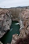
Casper | The Pathfinder Dam is an impressive engineering feat. It was built to help manage water resources for irrigation and power. | |
| 28 | Pathfinder Dam Historic District |
(#15000357) |
12 mi. SW. of Alcova 42°28′05″N 106°51′13″W / 42.468056°N 106.8536°W |
Alcova vicinity | This district includes the dam itself, its operating buildings, and even the remains of the camp where workers lived during its construction. | |
| 29 | Rialto Theater |
(#93000037) |
102 E. 2nd St. 42°50′55″N 106°19′09″W / 42.848611°N 106.319167°W |
Casper | The Rialto Theater was a popular movie theater. It's a great example of entertainment buildings from a past era. | |
| 30 | Roosevelt School |
(#96001633) |
140 E. K St. 42°51′59″N 106°19′25″W / 42.866389°N 106.323611°W |
Casper | Another historic school building in Casper, showing the growth of education in the area. | |
| 31 | South Wolcott Street Historic District |
(#88002609) |
Roughly bounded by S. Center St., E. 9th St., S. Wolcott St., E. 7th St., S. Beech St., and E. 13th St. 42°50′25″N 106°19′21″W / 42.840278°N 106.3225°W |
Casper | This district includes a collection of historic buildings along South Wolcott Street, showing the area's development. | |
| 32 | Split Rock, Twin Peaks |
(#76001959) |
Northwest of Muddy Gap 42°28′51″N 107°31′44″W / 42.480833°N 107.528889°W |
Muddy Gap | Split Rock was another important landmark for pioneers traveling west. Its unique shape made it easy to spot. | |
| 33 | Stone Ranch Stage Station |
(#82001834) |
Northwest of Casper on U.S. Routes 20/26 42°57′44″N 106°38′56″W / 42.962222°N 106.648889°W |
Casper | Stage stations were places where stagecoaches would stop for fresh horses, food, and rest. This one was important for travelers. | |
| 34 | Tom Sun Ranch |
(#66000753) |
6 miles west of Independence Rock on Wyoming Highway 220 42°26′40″N 107°14′36″W / 42.444444°N 107.243333°W |
Independence Rock | The Tom Sun Ranch is a historic ranch that shows what ranching life was like in early Wyoming. It's another of Natrona County's National Historic Landmarks! | |
| 35 | Teapot Rock |
(#74002028) |
Off U.S. Route 87 43°14′00″N 106°18′37″W / 43.233333°N 106.310278°W |
Midwest | Teapot Rock is a natural rock formation that looks like a teapot. It's famous for its unique shape and connection to the Teapot Dome oil scandal in the 1920s. | |
| 36 | Townsend Hotel |
(#83004303) |
115 N. Centre St. 42°50′56″N 106°19′27″W / 42.848889°N 106.324167°W |
Casper | The Townsend Hotel was another important hotel in Casper, providing lodging for travelers and residents. | |
| 37 | Tribune Building |
(#94000041) |
216 E. 2nd St. 42°50′56″N 106°19′22″W / 42.848889°N 106.322778°W |
Casper | This building once housed the Tribune newspaper. Newspapers were very important for sharing news and information in the past. | |
| 38 | Turner-Cottman Building |
(#15000856) |
120-130 W. 2nd St. 42°50′55″N 106°19′33″W / 42.848684°N 106.325913°W |
Casper | The Turner-Cottman Building is another historic structure in Casper's downtown area. | |
| 39 | Edness Kimball Wilkins No. 1 Site |
(#15000520) |
Address Restricted |
Evansville | This is an archaeological site, meaning it contains important clues about ancient cultures or events. Its location is kept private to protect its historical value. |


