
National Register of Historic Places listings in Yavapai County, Arizona facts for kids

Yavapai County in Arizona is home to many amazing places that tell stories about the past! Imagine old buildings, ancient homes, and important sites that show us how people lived long ago. These special spots are listed on the National Register of Historic Places. It's like a national scrapbook of important buildings, structures, and areas that are worth protecting and remembering.
There are 132 places in Yavapai County on this special list. A big chunk of them, 65 to be exact, are in the city of Prescott and have their own separate list. The rest, including one super important spot called a National Historic Landmark, are found all over the county. Let's explore some of these cool historic treasures!
Contents
What is the National Register of Historic Places?
The National Register of Historic Places is the official list of the United States' historic places worth saving. It's managed by the National Park Service. When a place is added to this list, it means it's important to the history, architecture, archaeology, engineering, or culture of the country. It helps protect these places and makes people more aware of their value.
Amazing Places in Yavapai County
Yavapai County has a wide variety of historic places. From ancient Native American pueblos to old mining towns and early ranch houses, each site offers a glimpse into different times and ways of life.
Ancient Homes: Pueblos and Ruins
Long before modern towns, people lived in amazing communities built right into the landscape.
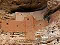
- Montezuma Castle National Monument: This is a famous Sinagua cliff dwelling near Camp Verde. Imagine a five-story apartment building built into a limestone cliff over 800 years ago! It's incredible to see how people lived and built their homes in such a unique way.
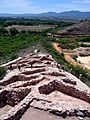
- Tuzigoot National Monument Archeological District: Near Clarkdale, this is another large Sinagua pueblo. It was built on a hilltop overlooking the Verde River, giving its residents a great view and protection. The Tuzigoot Museum nearby helps you learn more about the Sinagua people and their artifacts.
- Clear Creek Pueblo and Caves: Also near Camp Verde, this site holds more secrets of the Sinagua people. These ancient ruins show us how early communities thrived in the area.
- Loy Butte Pueblo and Sycamore Cliff Dwelling: These Sinagua ruins near Sedona are hidden gems, showing more examples of how these early people lived and built their homes in the beautiful red rock country.
Old Buildings and Bridges
Many historic buildings and bridges still stand, showing us the architecture and engineering of the past.
- Ash Fork Maintenance Camp No. 1: Located on old U.S. Route 66 in Ash Fork, this camp was important for maintaining the famous highway. It reminds us of the early days of road travel in America.
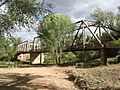
- Broadway Bridge (Clarkdale, Arizona): This bridge in Clarkdale crosses Bitter Creek. Old bridges like this are important because they show us how engineers built structures long ago, often using different materials and techniques than today.
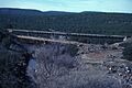
- Hell Canyon Bridge and Little Hell Canyon Bridge: These bridges are found on the abandoned U.S. Route 89 near Drake. They are examples of early road construction in tough terrain.
- Perkinsville Bridge: This bridge crosses the Verde River near Perkinsville. It was a vital link for transportation in the region.
Mining History and Old Towns
Mining was a huge part of Arizona's history, and some towns grew up around these operations.
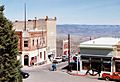
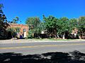
- Jerome Historic District: This entire town, Jerome, is a National Historic Landmark! It's known as "America's Most Vertical City" because it's built on a steep hillside. Jerome was once a booming copper mining town, and its historic buildings and streets tell the story of its rise and fall.
- Clark Memorial Clubhouse: In Clarkdale, this clubhouse was a central gathering spot for the community, especially for those working in the nearby smelter.
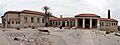
- Cottonwood Commercial Historic District: The main street of Cottonwood has many historic buildings. Places like the Building at 826 North Main Street, the Edens House, the Master Mechanic's House, and the Superintendent's Residence were all part of the UVX smelter complex, which processed copper. The Willard House is also a beautiful historic home from 1890.
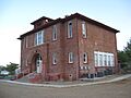
- Clemenceau Public School: Also in Cottonwood, this old school building is now the Clemenceau Heritage Museum, preserving local history.
- Mayer Business Block, Mayer Apartments, and Mayer Red Brick Schoolhouse: These buildings in Mayer show what a small, historic town looked like. They were important parts of the community's daily life.
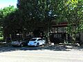
- Cottage Hotel: In Seligman, this hotel was a popular stop along U.S. Route 66. The Seligman Commercial Historic District also preserves the historic feel of this famous Route 66 town.
Ranger Stations and Ranches
Many historic sites are connected to the natural beauty and early settlement of the area.
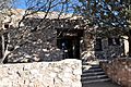
- Beaver Creek Ranger Station, Copper Creek Guard Station, Crown King Ranger Station, and Sycamore Ranger Station: These stations were important for managing the vast Coconino National Forest and Prescott National Forest. Rangers lived and worked here, protecting the forests and helping visitors.
- Hyde Mountain Lookout House and Mingus Lookout Complex: These fire lookouts were crucial for spotting wildfires in the forests, helping to protect natural resources and communities.
- Kay-El-Bar Ranch: North of Wickenburg, this guest ranch offers a look into the early days of tourism and ranching in Arizona.
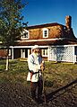
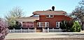
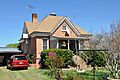
- Hank and Myrtle Wingfield Homestead and Robert W. Wingfield House: These homes in Camp Verde represent the early settlers and their way of life in the area.
- Woolsey Ranchhouse Ruins: Near Humboldt, these are the ruins of King Woolsey's ranch from the 1870s, showing early ranching history.
Images for kids
-
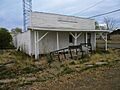
Ash Fork Maintenance Camp No. 1
-
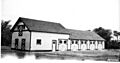
Beaver Creek Ranger Station Barn
-
Broadway Bridge in Clarkdale
-
Building at 826 North Main Street in Cottonwood
-
Childs-Irving Hydroelectric Facilities
-
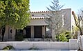
Clark Memorial Clubhouse
-
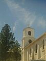
St. Cecilia's Rectory, part of the Clarkdale Historic District
-
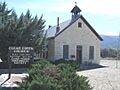
Clear Creek Church
-
Clemenceau Public School, now a museum
-
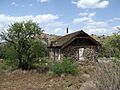
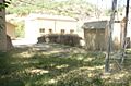
Copper Creek Guard Station
-
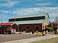
Cottage Hotel in Seligman
-
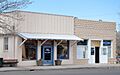
Cottonwood Commercial Historic District
-
Edens House in Cottonwood
-
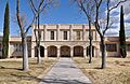
Fort Verde State Historic Park
-
Hell Canyon Bridge
-
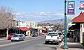
High Street in Jerome, part of the Jerome Historic District
-
Mayer Apartments
-
Mayer Business Block
-
Mayer Red Brick Schoolhouse
-
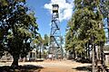
Mingus Lookout Complex
-
Montezuma Castle National Monument
-
Pecan Lane Rural Historic Landscape
-
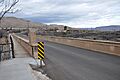
Perkinsville Bridge
-
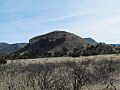
Sacred Mountain
-

Historic Seligman Sundries, part of the Seligman Commercial Historic District
-
Superintendent's Residence in Cottonwood
-
Tuzigoot Museum
-
Tuzigoot National Monument
-
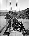
Verde River Sheep Bridge (now demolished)
-
Willard House in Cottonwood
-

Hank and Myrtle Wingfield Homestead

.jpg)
.jpg)
.jpg)


.jpg)


.jpg)
.jpg)


.jpg)
.jpg)


.jpg)

