
Newcastle, Oklahoma facts for kids
Quick facts for kids
Newcastle, Oklahoma
|
|
|---|---|

Location of Newcastle, Oklahoma
|
|
| Country | United States |
| State | Oklahoma |
| County | McClain |
| Founded | March 26, 1894 |
| Incorporated as South Newcastle | January 18, 1962 |
| Incorporated as Newcastle | 1965 |
| Government | |
| • Type | Council-Manager |
| Area | |
| • Total | 61.210 sq mi (158.530 km2) |
| • Land | 60.057 sq mi (155.548 km2) |
| • Water | 1.153 sq mi (2.987 km2) |
| Elevation | 1,214 ft (370 m) |
| Population
(2020)
|
|
| • Total | 10,984 |
| • Estimate
(2022)
|
13,055 |
| • Density | 217.4/sq mi (83.93/km2) |
| Time zone | UTC−6 (Central (CST)) |
| • Summer (DST) | UTC−5 (CDT) |
| ZIP Code |
73065
|
| Area code(s) | 405 |
| FIPS code | 40-51150 |
| GNIS feature ID | 2411241 |
| Sales tax | 9.0% |
Newcastle is a city located in McClain County, Oklahoma, in the United States. It's part of the larger Oklahoma City Metropolitan Area. In 2020, about 10,984 people lived there.
Contents
A Look Back: Newcastle's History

Newcastle officially started when a new post office opened on March 26, 1894. At that time, only 25 people lived there. Before this, mail was handled by the William P. Leeper Post Office, which closed in 1892.
The first postmaster for Newcastle was Eulalie V. Kelley. In 1905, the post office moved to Alonzo Haun's general store.
Early Settlers and Growth
Newcastle was located in the Chickasaw Nation. The first people to live in the community included members of the Choctaw and Chickasaw tribes. Many early residents were involved in ranching. By 1907, Newcastle had a school, a cotton gin, two stores, and two blacksmith shops.
Building the Future: Bridges and Highways
The 1920s brought big changes to Newcastle. In 1920, the town's post office moved again. This time, it was to land given for a new public school and a church.
In 1922, work began on a bridge over the South Canadian River. This bridge was special because it was Oklahoma's first federal aid project. It was part of the Ozark Trail, which was planned to connect Oklahoma City to Amarillo, Texas. The bridge opened on April 23, 1923, and cost over $321,000 to build.
The new bridge helped Newcastle grow by attracting businesses. It also allowed for Highway 62 to be built through the town in 1927. Before the bridge, farmers often crossed the river by a shallow area called a ford. They would travel to the Oklahoma City Farmer's Market. Today, only a small part of the old Newcastle Bridge remains next to the Interstate 44 bridge.
Newcastle During World War II
During World War II, Newcastle had about 100 residents. Several local men served in the war. Some bravely gave their lives, and one was held as a prisoner of war for over three years.
Soon after the war ended in 1945, a tornado hit Newcastle. It destroyed the school and many businesses.
Becoming a City: Expansion and Name Change
For many years, Newcastle's boundaries were mainly its post office and school district. Around 1960, Oklahoma City started expanding its borders. To prevent Oklahoma City from growing too close, Newcastle officially became a town called South Newcastle on January 18, 1962. It grew to cover about 16,000 acres. Nearby towns like Tuttle and Blanchard also expanded.
In 1965, the town's name was changed to Newcastle.
Modern Growth and Economy
In 1970, Newcastle had 1,271 people. By the mid-1970s, Oklahoma City's growth near Interstate 44 led to more people moving to Newcastle. The population reached 3,076 in 1980 and 5,434 by 2000. In the 1980s, Newcastle also added land near Norman, Oklahoma.

Farming activities like cotton, ranching, and dairy farming used to be very important to Newcastle's economy. However, as more homes and businesses were built, these activities became less common. By the end of the 1900s, the public school system was the biggest employer in Newcastle.
The 2010 census showed 7,685 residents. The population has continued to grow, reaching over 10,000 by 2020. In 2019, Newcastle was even ranked as the 36th "Best City to Live" in the United States by 24/7 Wall St.
Tornadoes in Newcastle's History
Newcastle has experienced several powerful tornadoes over the years.
The 1893 Tornado
On April 25, 1893, a very large tornado, reportedly over a mile wide, moved through the area. It traveled northeast for 15 miles, destroying at least 30 homes. Thirty-three people lost their lives, with many dying in just a few homes. This was one of several strong tornadoes in central Oklahoma that day.
The 1999 Bridge Creek–Moore Tornado
On May 3, 1999, a very strong tornado, rated F5, hit parts of Newcastle. It destroyed several homes within the city limits. Even more damage happened in nearby Bridge Creek and Moore. This tornado was part of a huge outbreak of nearly 60 tornadoes in central Oklahoma.
Tornadoes in 2011 and 2013
On May 24, 2011, another tornado swept through parts of Newcastle. About 160 homes were damaged or destroyed, and over 20 businesses were affected. Luckily, no lives were lost in the city.
On May 20, 2013, another powerful tornado caused damage in Newcastle. It hit the historic Ozark Trail Bridge. This tornado grew very large as it moved north across the Canadian River, causing a lot of damage in neighboring Moore and southern Oklahoma City.
Understanding Newcastle's Geography
According to the United States Census Bureau, Newcastle covers about 61.210 square miles (158.530 square kilometers). Most of this area, about 60.057 square miles (155.548 square kilometers), is land. The rest, about 1.153 square miles (2.987 square kilometers), is water.
Newcastle is part of a fast-growing area in northern McClain and Grady counties. It's also part of what's known as the "Tri-City Area," along with Tuttle and Blanchard. Newcastle is the largest incorporated community in McClain County.
Newcastle's Climate
| Climate data for Newcastle, OK (1991-2020 precipitation normals)Elevation: 1,321 feet (403 metres). Lat: 35.2981° N Lon: 97.6314° W | |||||||||||||
|---|---|---|---|---|---|---|---|---|---|---|---|---|---|
| Month | Jan | Feb | Mar | Apr | May | Jun | Jul | Aug | Sep | Oct | Nov | Dec | Year |
| Average precipitation inches | 1.33 | 1.56 | 2.62 | 3.61 | 5.00 | 4.84 | 3.70 | 3.70 | 3.60 | 3.23 | 1.74 | 1.99 | 36.92 |
| Average precipitation mm | 34 | 40 | 67 | 92 | 127 | 123 | 94 | 94 | 91 | 82 | 44 | 51 | 939 |
| Source: NOAA | |||||||||||||
Who Lives in Newcastle: Demographics
| Historical population | |||
|---|---|---|---|
| Census | Pop. | %± | |
| 1970 | 1,271 | — | |
| 1980 | 3,076 | 142.0% | |
| 1990 | 4,214 | 37.0% | |
| 2000 | 5,434 | 29.0% | |
| 2010 | 7,685 | 41.4% | |
| 2020 | 10,984 | 42.9% | |
| 2022 (est.) | 13,055 | 69.9% | |
| U.S. Decennial Census 2020 Census |
|||
Population Details from the 2010 Census
In 2010, Newcastle had 7,685 people living in 2,839 households. About 2,271 of these were families. The city's population density was about 122.9 people per square mile.
Most residents, about 84.53%, were White. About 5.26% were Native American, and 4.31% were Hispanic or Latino.
In terms of households, 72.5% were married couples living together. About 20.6% of households had children under 18. The average household had 2.75 people, and the average family had 3.02 people.
The median age in the city was 38 years old. This means half the people were younger than 38, and half were older.
The median income for a household in Newcastle was $74,167. For families, it was $77,064. About 7.2% of the population lived below the poverty line.
Learning in Newcastle: Education
The Newcastle School District has four main school buildings. These include the Early Childhood Center (PreK-1st grade), Elementary School (2nd-5th grade), Middle School (6th-8th grade), and High School (9th-12th grade). All the schools are located near Main Street/US Highway 62. The school colors are royal blue and black, and their mascot is the "Newcastle Racer."
Students in Newcastle attend classes four days a week, from Monday to Thursday.
Newcastle Public Library
The Newcastle Public Library is part of the Pioneer Library System. This system provides library services to many cities and towns in the south-central Oklahoma City metropolitan area.
Images for kids
-
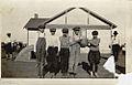
Children on playground at Pleasant Hill School in 1914. Newcastle, Oklahoma
-
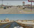
Photo of Newcastle, Oklahoma before and after expansion of Main Street / Highway 62 to 4 lanes
See also
 In Spanish: Newcastle (Oklahoma) para niños
