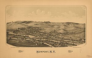
Newport, New York facts for kids
Quick facts for kids
Newport, New York
|
|
|---|---|

Location of Newport in Herkimer County
|
|
| Country | United States |
| State | New York |
| County | Herkimer |
| Government | |
| • Type | Town Council |
| Area | |
| • Total | 32.45 sq mi (84.05 km2) |
| • Land | 32.01 sq mi (82.90 km2) |
| • Water | 0.44 sq mi (1.15 km2) |
| Population
(2010)
|
|
| • Total | 2,302 |
| • Estimate
(2019)
|
2,225 |
| • Density | 70.86/sq mi (27.36/km2) |
| Time zone | EST |
| • Summer (DST) | EDT |
| ZIP code |
13416
|
| Area code(s) | 315 |
| FIPS code | 36-043-50584 |
Newport is a small town in Herkimer County, New York, United States. It's known for its quiet charm and natural beauty. In 2010, about 2,302 people lived here. The town is found on the western edge of Herkimer County, not far from the city of Utica. The village of Newport is also part of this town.
Contents
History of Newport
People first started settling in the area that is now Newport after the year 1786. The town of Newport was officially created in 1805. It was formed by taking parts from four other nearby towns: Fairfield, Herkimer, Norway, and Schuyler.
Historic Buildings in Newport
Newport is home to two special buildings that are listed on both the New York State Register of Historic Places and the National Register of Historic Places. These places are important because they help us remember the past.
- James Keith House
- Brown-Morey-Davis Farm
Geography of Newport
Newport covers a total area of about 84 square kilometers (32.45 square miles). Most of this area, about 82.9 square kilometers (32.01 square miles), is land. The rest, about 1.1 square kilometers (0.44 square miles), is water.
The western border of the town is also the border of Oneida County. A stream called West Canada Creek flows through Newport. This creek is a branch of the Mohawk River. It also helps form part of the town's eastern boundary.
Population of Newport
| Historical population | |||
|---|---|---|---|
| Census | Pop. | %± | |
| 1820 | 1,746 | — | |
| 1830 | 1,863 | 6.7% | |
| 1840 | 2,020 | 8.4% | |
| 1850 | 2,125 | 5.2% | |
| 1860 | 2,113 | −0.6% | |
| 1870 | 1,954 | −7.5% | |
| 1880 | 1,953 | −0.1% | |
| 1890 | 1,835 | −6.0% | |
| 1900 | 1,613 | −12.1% | |
| 1910 | 1,490 | −7.6% | |
| 1920 | 1,700 | 14.1% | |
| 1930 | 1,768 | 4.0% | |
| 1940 | 1,481 | −16.2% | |
| 1950 | 1,626 | 9.8% | |
| 1960 | 1,907 | 17.3% | |
| 1970 | 1,992 | 4.5% | |
| 1980 | 2,206 | 10.7% | |
| 1990 | 2,148 | −2.6% | |
| 2000 | 2,202 | 2.5% | |
| 2010 | 2,302 | 4.5% | |
| 2019 (est.) | 2,225 | −3.3% | |
| U.S. Decennial Census | |||
In the year 2000, there were 2,192 people living in Newport. These people lived in 831 households, and 595 of these were families. The average number of people in a household was about 2.64.
The population was made up of people of different ages. About 26.6% of the people were under 18 years old. About 14.1% were 65 years old or older. The average age of people in Newport was 38 years.
Communities and Locations in Newport
The town of Newport includes several smaller communities and specific locations. Here are some of them:
- Farrel Corner – A small community located west of the village of Newport.
- Harter Hill – Two hills found west of Middleville.
- Honey Hill – A hill located west of Newport.
- Irish Settlement – A community near the southern border of the town.
- Martin Corner – A place near the western border of the town.
- Middleville – Part of this village is in Newport. It's located on Route 28 near the eastern town line and West Canada Creek.
- Newport – This is the main village within the town. It's also on Route 28 by the eastern town line and West Canada Creek.
- Poland – The southern part of this village is in the northwestern corner of Newport.
- Old City – A community located at the eastern border of the town.
- Schrader Hill – A hill west of Middleville, partly in the town of Herkimer.
- Tanner Hill – A hill located west-northwest of Middleville.
- Welch Corners – A location at the eastern town line, south of Old City.
- Woodchuck Hill – A hill located east of Newport.
See also
 In Spanish: Newport (Nueva York) para niños
 | Bessie Coleman |
 | Spann Watson |
 | Jill E. Brown |
 | Sherman W. White |


