Nez Perce Pass facts for kids
Quick facts for kids Nez Perce Pass |
|
|---|---|
| Elevation | 6,587 ft (2,008 m) |
| Traversed by | Unpaved road |
| Location | Idaho County, Idaho / Ravalli County, Montana, United States |
| Range | Bitterroot Mountains Rocky Mountains |
| Coordinates | 45°43.0′N 114°30.2′W / 45.7167°N 114.5033°W |
| Topo map | Nez Perce Peak Quad |
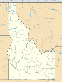
The Nez Perce Pass is a mountain pass located in the Bitterroot Mountains. It sits right on the border between the U.S. states of Idaho and Montana. This pass is very high up, reaching about 6,587 feet (or 2,008 meters) above sea level. It's a special spot because it gives you access to two huge natural areas: the Selway-Bitterroot Wilderness and the Frank Church—River of No Return Wilderness.
Exploring the Wilderness
Nez Perce Pass is surrounded by vast natural areas. To the north, you'll find the 1.2-million-acre Selway-Bitterroot Wilderness. To the south, there's the even larger 2.2-million-acre Frank Church-River of No Return Wilderness. These two wilderness areas are massive. Together, they cover more than 11% of all the protected wilderness land in the lower 48 United States! A wilderness area is a place kept wild and natural, where human activity is limited to protect the environment.
At the pass, you'll find signs honoring important people. On the Montana side, there's a sign for Doris Milner from Hamilton, Montana. On the Idaho side, a sign honors Idaho Senator Frank Church. Both Doris Milner and Frank Church were very important. They helped add thousands of square miles of forest in Montana and Idaho to the nation's wilderness system. This means they helped protect these beautiful wild places for everyone to enjoy.
The Magruder Corridor Road
The road that crosses Nez Perce Pass is called Forest Road 468, also known as Nez Perce Road or the Magruder Corridor Road. This road is unpaved, meaning it's a dirt or gravel road, not smooth asphalt. It's also very remote, with no services like gas stations or stores for 117 miles!
This road has a long history. It hasn't changed much since it was built in the 1930s by the Civilian Conservation Corps (CCC). The CCC was a group of young men who worked on conservation projects during the Great Depression. Over the years, the road has been known by several names, including The Southern Nez Perce Trail and The Montana Road. The landscape around the road looks much the same today as it did when the Nez Perce people and early travelers first crossed this area.
Getting There
If you want to visit Nez Perce Pass from Darby, Montana, here's how you can get there:
- First, travel south on Highway 93 for about 4.3 miles.
- Then, turn south onto the West Fork Road and continue for about 14.3 miles.
- Next, turn west (right) onto Forest Road 468, which is the Nez Perce Road.
- Drive for about 16.1 miles, and you'll reach the Nez Perce Pass trailhead.
At the pass, there's a paved parking area that even has a helicopter pad.
Time Zone Change
Nez Perce Pass is also interesting because it marks a change in time zone. If you're traveling from northern Idaho, you'll be in the Pacific Time Zone. But once you cross into Montana at the pass, you'll enter the Mountain Time Zone. So, remember to adjust your watch!
 | Calvin Brent |
 | Walter T. Bailey |
 | Martha Cassell Thompson |
 | Alberta Jeannette Cassell |


