Niut Range facts for kids
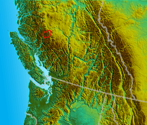
The Niut Range is a mountain range in British Columbia, Canada. It covers about 3,600 square kilometers (1,390 square miles). This range is part of the larger Coast Mountains and is often seen as a subrange of the Pacific Ranges. Sometimes, it's also considered part of the Chilcotin Ranges.
The Niut Range sits between the Homathko River and its western branch, Mosley Creek. These rivers make the range feel like an island, separating it from other nearby mountains. Both rivers start on the Chilcotin Plateau, which is behind the range. The highest point in the Niut Range is Razorback Mountain.
Northwest of the Niut Range, across Mosley Creek, you'll find the Pantheon Range. To the west is the Waddington Range, and further south is the Whitemantle Range. Even further northwest is the Klinaklini Icefield, beyond the Klinaklini River. To the southeast, across the deep canyon of the Homathko River, is the Homathko Icefield. East of that, near Mount Queen Bess, is Tsy'los Provincial Park.
Contents
A Look at Niut Range History
The Chilcotin War and Waddington's Road
The Niut Range has an important place in the history of British Columbia. Near where Mosley Creek meets the Homathko River, a historical event took place. In 1864, a group of Tsilhqot'in people were hired to help build a road called Waddington's Road. This road was meant to connect the coast to the interior of British Columbia.
However, a conflict broke out between the Tsilhqot'in workers and the road company. This led to the start of the Chilcotin War of 1864. This war was a major conflict between some of the Chilcotin people and the government of the Crown Colony of British Columbia.
Plans for a Railway and Power
After the Chilcotin War, the area near the Niut Range was considered for a very important project. People thought about building the main line of the Canadian Pacific Railway through this route. The idea was to connect the railway to Vancouver Island and then to Victoria. However, another location, Burrard Inlet, was chosen instead. This decision led to the creation of the City of Vancouver.
Later, in the 20th century, there were plans to use the Homathko River and nearby rivers to create hydroelectric power. This means using the power of flowing water to make electricity. The Homathko River has a lot of potential for this. Some big plans even included diverting water from Taseko Lakes and Chilko Lake into the Homathko River system. This would have created a huge amount of power.
Protecting the Environment
However, these large-scale plans changed when Tsʼilʔos Provincial Park and Big Creek Provincial Park were created. These parks help protect the natural environment. Because of these parks, Chilko Lake and Taseko Lakes are now protected. Their waters cannot be moved to other river systems. This is also important for salmon that live in these waters.
Even with these protections, the idea of generating power from the Homathko Canyon is still being considered. There are plans for a smaller, more environmentally friendly project called a run-of-the-river project. This type of project uses the natural flow of the river without building large dams that block the entire river.
See also
 In Spanish: Cordillera Niut para niños
 | Stephanie Wilson |
 | Charles Bolden |
 | Ronald McNair |
 | Frederick D. Gregory |


