Normandy, Surrey facts for kids
Quick facts for kids Normandy |
|
|---|---|
| Village and civil parish | |
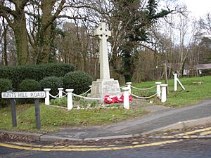
 Normandy war memorial |
|
| Area | 16.37 km2 (6.32 sq mi) |
| Population | 2,981 (Civil Parish) |
| • Density | 182/km2 (470/sq mi) |
| OS grid reference | SU926516 |
| Civil parish |
|
| District | |
| Shire county | |
| Region | |
| Country | England |
| Sovereign state | United Kingdom |
| Post town | Guildford |
| Postcode district | GU3 |
| Dialling code | 01483 |
| Police | Surrey |
| Fire | Surrey |
| Ambulance | South East Coast |
| EU Parliament | South East England |
| UK Parliament |
|
Normandy is a village in Surrey, England. It's part of the Guildford area. The village is located west of Guildford, near the A323 road and the North Downs hills. In 2011, about 3,000 people lived here. Normandy has lots of woods, open common lands, and even some special nature areas called SSSIs (Sites of Special Scientific Interest). Famous people like William Cobbett have lived in Normandy.
Contents
Exploring Normandy's Landscape
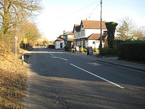
Normandy village is centered around the crossroads of the Guildford-Aldershot Road (the A323), Hunts Hill Road, and Glaziers Lane. The wider area, called the parish, also includes smaller communities like Christmas Pie, Willey Green, Wyke, Flexford, and Pinewoods. These smaller areas are mostly homes, but Pinewoods is a bit more separate with open land around it.
Green Spaces and Nature
Normandy Common is a great place for picnics, with a stream and paths for walking. From Normandy Hill in Wyke, you can see parts of the nearby common lands. North of the village, there are four joint commons: Ash, Wyke, Cleygate, and Pirbright. These are special nature areas (SSSIs). However, parts of them are also "Danger Areas" used by the MOD, so the public cannot enter.
In the south of the parish, you'll find Wanborough railway station. It's named after a nearby village because the person who owned the land lived there. Building new homes in Normandy is limited because it's part of the Metropolitan Green Belt, which protects open spaces around cities. The northern part of Normandy has small woods and heathland, while the south is mostly farmland.
Local Communities in Normandy
Normandy is made up of several unique smaller communities, each with its own history.
Flexford and Christmas Pie
Flexford, in the south, was once called Flaxford. This name came from "flax vard," meaning flax meadows by a stream. Long ago, people here made linen from flax plants.
Flexford and Christmas Pie are very close together, almost like one continuous settlement. The railway line passes over the road here, and the Wanborough railway station is nearby. Flexford has a garage and some building businesses. You can also easily get to Wood Street Village or Guildford by car or bus.
Christmas Pie gets its interesting name from a local family called Christmas. They owned property here a long time ago, even back to the time of King Henry VIII. The "Pie" part comes from an old Saxon word "pightle," which meant a small piece of farmland. Before homes were built in the 1920s, there was a small field called Pie Field near the Christmas Pie crossroads.
Wyke
Wyke is in the western part of Normandy. It was mentioned in the Domesday Book way back in 1086 as "Wucca." This old record also talked about a hall, which is thought to have been where East Wyke Farm is now. Old pottery has been found there! Over time, the name changed from Wuccha to Wicca, Week, and Wick, before finally becoming Wyke. Since 1847, Wyke has also been the name of the local church parish, St Mark's Wyke.
Pinewoods
This area in the far west of the parish grew around a pub called the Nightingale in the 1800s. The "woods" in its name are only to the north of the community. Pinewoods is still quite separate from the other parts of Normandy, with open land between them. The old Nightingale pub building is now an Indian restaurant.
Willey Green
Willey Green is in the lowest part of the parish and used to flood often. Because it was so damp, it was a perfect place for willow trees to grow. That's where the name comes from: "the place where willows grow." This area used to be the western part of the neighboring parish of Worplesdon.
Normandy's Past
The history of Normandy is really the story of all its smaller communities combined.
Where Did the Name "Normandy" Come From?
The name Normandy first appeared in records in 1604. Before that, the area was sometimes called Frimsworth. The village has no direct link to the Duchy of Normandy in France, and it's not mentioned in the Domesday Book.
One popular idea is that the name came from a pub called "The Duke of Normandy," built in the 1860s. However, it's more likely the pub was named after the village, not the other way around. Another idea is that monks from Waverley Abbey named it after their home in northern France because the landscapes looked similar. But the abbey didn't own land as far as Normandy village. A third idea is that Normandy Common was once called "Noebodies Common" or "No Man's Land" because it was on the edge of two different land areas. This name might have slowly changed into "Normandy."
Early History of the Area
Evidence of ancient Roman-British settlements has been found on the eastern border of the parish. In late Saxon times, the land belonged to Godwin, Earl of Wessex, who was the father of King Harold Godwinson. The Domesday Book mentions a large area called the manor of Henley, which included much of what is now Normandy. The name Normandy itself wasn't known until 1604.
Later, a new area called the manor of Cleygate was formed. King Henry VI of England gave this land to his half-brother, Jasper Tudor. The land changed hands many times over the centuries, sometimes even returning to the crown.
Normandy Since the 1800s
By 1876, most of the land in the Cleygate Manor had been sold to private owners. This included much of what is now Normandy parish. The famous writer and reformer William Cobbett, who wrote Rural Rides, lived his final years at Normandy Farm.
Into the 1900s, Normandy remained mostly a farming area. There was even a plan in 1943 to build a "New Town" here called "New Norman." However, this never happened, and Normandy remains a protected green space today.
Foot-and-Mouth Outbreak (2007)
On August 3, 2007, a serious animal disease called foot-and-mouth disease was found in cattle on a farm in Normandy. This was the first time this disease had appeared in the UK in six years.
Life in Normandy
Normandy is a rural area with many footpaths and bridleways. These are perfect for horse riding, cycling, and walking. The Christmas Pie trail starts here and leads into Guildford through woods and meadows.
Normandy has many local clubs, especially for sports. These include:
- Normandy Tennis Club
- Normandy Train Club
- Normandy Historians
- Normandy Cricket Club
- Normandy Football Club
- Normandy Youth Club–The N-Factor
- Normandy Scouts
- Normandy Archery
- Normandy Short Mat Bowls Club
The village doesn't have any food shops or essential stores anymore, as several closed in 2002.
Events in Normandy
Normandy holds an annual Guy Fawkes Night firework display. It takes place in a field behind The Elms Centre on Glaziers Lane, usually on November 5th. Volunteers carry torches in a parade and throw them onto a large bonfire to light it. The fireworks are set off by hand, which is quite a sight!
Education in Normandy
Normandy Village School (also known as Wyke Primary) opened in 1875. It's a school for boys and girls aged 4 to 11. The school is on the edge of Normandy village and welcomes children from the local area and nearby.
Normandy's Population
In 2011, Normandy had a population of 2,981 people living in 1,310 homes. It's one of the largest civil parishes in Surrey, covering about 16.37 square kilometers.
The civil parish of Normandy was created in 1955. Before that, it was part of "Ash and Normandy." This means population figures for Normandy alone are only available from 1951, 1961, and then after a gap, from 2001 onwards.
| Year | 1951 | 1961 | 2001 | 2011 |
|---|---|---|---|---|
| Population | 2,174 | 2,434 | 2,987 | 2,981 |
Nearby Places
 |
Mytchett Ash Vale |
Pirbright Deepcut |
Worplesdon |  |
| Ash | Wood Street Village | |||
| Ash Green, Tongham | Wanborough | Guildford |
 | Anna J. Cooper |
 | Mary McLeod Bethune |
 | Lillie Mae Bradford |


