
North Branford, Connecticut facts for kids
Quick facts for kids
North Branford, Connecticut
|
|
|---|---|
| Town of North Branford | |

North Branford Town Hall
|
|
 New Haven County and Connecticut New Haven County and Connecticut South Central Connecticut Planning Region and Connecticut South Central Connecticut Planning Region and Connecticut |
|
| Country | |
| U.S. state | |
| County | New Haven |
| Region | South Central CT |
| Incorporated | 1831 |
| Government | |
| • Type | Council-manager |
| Area | |
| • Total | 26.7 sq mi (69.2 km2) |
| • Land | 24.9 sq mi (64.5 km2) |
| • Water | 1.7 sq mi (4.5 km2) |
| Elevation | 107 ft (35 m) |
| Population
(2020)
|
|
| • Total | 13,544 |
| • Density | 507.3/sq mi (195.72/km2) |
| Time zone | UTC-5 (Eastern) |
| • Summer (DST) | UTC-4 (Eastern) |
| ZIP code |
06471, 06472
|
| Area code(s) | 203/475 |
| FIPS code | 09-53890 |
| GNIS feature ID | 0213477 |
North Branford is a town in New Haven County, Connecticut, United States. It is part of the South Central Connecticut Planning Region. In 2020, about 13,544 people lived here.
North Branford is known for its farms and interesting places like Lake Gaillard and the Northford Ice Pavilion. It shares borders with several other towns. These include Wallingford and Durham to the north, Guilford to the east, Branford to the south, and North Haven and East Haven to the west.
The town has several neighborhoods. Some of these are Totoket, Wood Chase, Sea Hill, Twin Lakes, Ashley Park, and Doral Farms. The village of Northford is also part of North Branford.
Contents
History of North Branford
North Branford started as a community with mills and farms. It became its own town, separate from Branford, in 1831.
In the early days, a man named Maltby Fowler opened a button-making shop. His six sons were very creative. They invented machines to make things like screws, silk, pins, and horseshoe nails. This led to new factories along the town's Farm River.
Later, in the early 1900s, North Branford became known for its "trap rock." This special type of rock was used to build roads. Today, the town's factories mainly make electronics and electronic parts.
Geography and Nature
North Branford covers about 24.9 square miles (64.5 square kilometers) of land. About 1.7 square miles (4.5 square kilometers) is water. The town is surrounded by other towns. These include Wallingford and Durham to the north, Guilford to the east, Branford to the south, and North Haven and East Haven to the west.
Mountains and Lakes
A large part of North Branford is covered by Totoket Mountain. This mountain is part of the Metacomet Ridge. This is a long chain of mountains made of trap rock that stretches across Connecticut. The northern side of Saltonstall Mountain is also in North Branford.
Totoket Mountain is home to Lake Gaillard. This lake is a reservoir, which means it stores water for people to use. It was created in 1926. The South Central Connecticut Regional Water Authority (SCCRWA) manages the lake. They also take care of hiking trails on Totoket Mountain in an area called Big Gulph in Northford. The SCCRWA owns about one-third of the town's land.
Totoket Mountain is the highest point in town, reaching 720 feet high in the Northford neighborhood.
Population and People
| Historical population | |||
|---|---|---|---|
| Census | Pop. | %± | |
| 1850 | 998 | — | |
| 1860 | 1,050 | 5.2% | |
| 1870 | 1,035 | −1.4% | |
| 1880 | 1,025 | −1.0% | |
| 1890 | 825 | −19.5% | |
| 1900 | 814 | −1.3% | |
| 1910 | 833 | 2.3% | |
| 1920 | 1,110 | 33.3% | |
| 1930 | 1,329 | 19.7% | |
| 1940 | 1,438 | 8.2% | |
| 1950 | 2,017 | 40.3% | |
| 1960 | 6,771 | 235.7% | |
| 1970 | 10,778 | 59.2% | |
| 1980 | 11,554 | 7.2% | |
| 1990 | 12,996 | 12.5% | |
| 2000 | 13,906 | 7.0% | |
| 2010 | 14,407 | 3.6% | |
| 2020 | 13,544 | −6.0% | |
| U.S. Decennial Census | |||
In 2000, there were 13,906 people living in North Branford. About 6,303 of these people lived in the village of Northford. The town had 5,132 households.
The population included people of all ages. About 25.6% were under 18 years old. The average age in town was 39 years.
Long ago, the Totoket tribe lived in the Branford and North Branford area. They spoke an Algonkian language.
Education in North Branford
Students in North Branford attend local schools.
- North Branford High School is the high school in town. Its sports teams are called the North Branford Thunderbirds.
- North Branford Intermediate School is the middle school. It recently had a big renovation and added new space. Its teams are also the North Branford Thunderbirds.
- There are two elementary schools: Jerome Harrison (JHS) and Totoket Valley (TVES).
In 2010, the Stanley T. Williams elementary school in Northford closed. The grades were rearranged among the other schools.
Preserving History
The Totoket Historical Society, Inc. helps preserve the town's history. It was started in 1958. The society manages four historic buildings in North Branford:
- The Reynolds Beers House, which is their main museum and office.
- The Miller Barn.
- The "Little White Gas Station".
- The Little Red Schoolhouse.
The society collects many local historical items. These include old photographs, business papers, and documents about land and the town's founding. The Miller Barn has a collection of old farm equipment. The Reynolds-Beers House is usually open to the public. Other buildings can be visited on special dates or by appointment.
Places to Visit
North Branford has several interesting places:
- Branford Steam Railroad: This was a freight railroad used to move products.
- Northford Ice Pavilion: A popular place for ice skating and hockey.
- Lake Gaillard: A large reservoir surrounded by nature.
- Northford Center Historic District: This area was added to the National Register of Historic Places in 2002 because of its historical importance.
Businesses in Town
North Branford is home to many businesses. Some well-known companies include Tilcon and Fire-Lite Alarms. Many other businesses are located along the main roads in North Branford and Northford.
Famous People from North Branford
Several notable people have connections to North Branford:
- Charlotte Fowler Baldwin (1805–1873): An American missionary who worked in Hawaii.
- Agnes G. Doody (1930-2023): A professor of speech communication.
- Adam Erne (born 1995): An NHL player for the Detroit Red Wings.
- Leslie Hotson (1897-1992): A literary scholar.
- Robert Ward (died 2021): A politician who served as a leader in the Connecticut House of Representatives.
- Paul F. Zukunft (born 1955): A former Commandant of the United States Coast Guard.
Images for kids
-
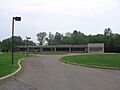
North Branford Town Hall
See also
 In Spanish: North Branford para niños
