La Veta Pass facts for kids
Quick facts for kids La Veta Pass |
|
|---|---|

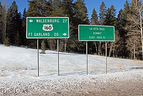
Two signs on the south side of the pass.
|
|
| Elevation | 9,413 ft (2,869 m) |
| Traversed by | |
| Location | Costilla / Huerfano counties, Colorado, United States |
| Range | Sangre de Cristo Mountains |
| Coordinates | 37°36′50″N 105°11′21″W / 37.61389°N 105.18917°W |
| Topo map | USGS La Veta Pass |
La Veta Pass refers to two mountain passes in the Sangre de Cristo Mountains of south-central Colorado, United States. These passes are important routes through the mountains. They sit on the border between Costilla and Huerfano counties.
Contents
Exploring La Veta Pass: Old and New
There are two main passes known as La Veta Pass. They are close to each other but serve different purposes today. Understanding both helps us see how travel routes change over time.
Old La Veta Pass: A Historic Route
The original Old La Veta Pass is officially called La Veta Pass. It sits at an elevation of 9,380 ft (2,860 m). This pass was once a very important travel route. It connected the San Luis Valley with Walsenburg.
First, a narrow-gauge train line, the Denver and Rio Grande Railway, used this pass. Later, a wagon road and then a highway followed the same path. The eastern side of the pass had two very tight curves. These curves made it possible for trains to climb the mountain. However, they were not ideal for modern highway traffic. Today, Old La Veta Pass is an unpaved and quiet back road.
New La Veta Pass: Modern Highway Travel
The New La Veta Pass is officially known as North La Veta Pass. It is about 1.6 miles northeast of the old pass. This pass is slightly higher, at an elevation of 9,413 ft (2,869 m). It is now the main highway route through this part of the mountains.
U.S. Highway 160 uses New La Veta Pass. Even though it's a bit higher, this new route has no sharp curves. This makes it much better and safer for today's cars and trucks.
Understanding Veta Pass
It's easy to confuse La Veta Pass with another pass nearby called Veta Pass. This pass is about 7.7 miles southeast of Old La Veta Pass. Its elevation is 9,220 ft (2,810 m).
In 1899, the Denver and Rio Grande Railway decided to change its train line. They wanted to switch from narrow-gauge tracks to standard-gauge tracks. For this big change, they chose a new route over Veta Pass.
Later, in 2003, the San Luis and Rio Grande Railroad took over the train line. The Rio Grande Scenic Railroad used to run fun steam train trips. These trips went between Alamosa and La Veta over Veta Pass. However, the Rio Grande Scenic Railroad stopped operating in 2019.

