North Potomac, Maryland facts for kids
North Potomac is a community in Montgomery County, Maryland, United States. It's not an officially incorporated city or town, but it's recognized as a "census-designated place" (CDP) by the government for counting people. North Potomac is located less than 5 miles (8 km) north of the Potomac River and is about 20 miles (32 km) from Washington, D.C.. In 2020, about 23,790 people lived there.
This area was first used for growing tobacco. Later, farmers switched to growing wheat and raising dairy cows when the soil became tired. The Chesapeake and Ohio Canal (C&O Canal) was very important because farmers used it to ship their crops. You can still see two old canal locks nearby in the Chesapeake and Ohio Canal National Historical Park.
North Potomac didn't really have its own name until 1989. Before that, it was mostly a collection of neighborhoods, farms, and parks. The United States Post Office allowed the name "North Potomac" to be used. The United States Census Bureau started recognizing North Potomac as a census-designated place in 2000. Today, the community is a great place to live because it's close to many jobs, like those at Shady Grove Hospital and the technology companies along I-270. Many people in North Potomac have advanced college degrees.
Quick facts for kids
North Potomac, Maryland
|
|
|---|---|
 |
|
 |
|
| Country | United States |
| State | |
| County | |
| Area | |
| • Total | 6.56 sq mi (16.99 km2) |
| • Land | 6.52 sq mi (16.89 km2) |
| • Water | 0.04 sq mi (0.10 km2) |
| Elevation | 390 ft (120 m) |
| Population
(2020)
|
|
| • Total | 23,790 |
| • Density | 3,648.21/sq mi (1,408.48/km2) |
| Time zone | UTC−5 (Eastern (EST)) |
| • Summer (DST) | UTC−4 (EDT) |
| ZIP code |
20878, 20850
|
| Area code(s) | 301 and 240 |
| FIPS code | 24-56875 |
| GNIS feature ID | 2389581 |
Contents
History of North Potomac
In 1608, Captain John Smith explored the Potomac River and made maps of the area, including what is now Montgomery County. The first European settlements were built around 1688 near Rock Creek and what became Rockville. Later, more settlements appeared further west near Darnestown and Poolesville.
Before the European settlers arrived, Native American groups like the Piscataway Confederation lived here. Modern-day Darnestown Road, which is the northern edge of North Potomac, was once an old trail used by the Seneca people. It's one of the oldest roads in Montgomery County.
Farming and Trade in Early North Potomac
At first, settlers used the land around North Potomac to grow tobacco and corn. In the 1800s, new roads, mills, and the Chesapeake and Ohio Canal (C&O Canal) made it easier for farmers to sell their crops. Dufief Mill Road, which goes through North Potomac, leads to the DuFief Mill (built in 1850). This was one of the mills used by farmers in this part of Montgomery County.
By 1840, much of the county's soil was worn out. Quakers introduced better farming methods, which helped the land recover. By 1860, farmers were growing corn, wheat, and oats.
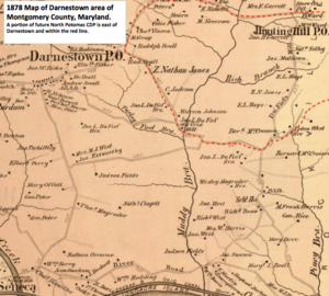
In 1878, North Potomac was still mostly farmland. The closest general stores and post offices were in Hunting Hill, Travilah, and Darnestown. The Hunting Hill Post Office also offered services like fixing wheels and blacksmithing.
Growth and Modern Identity
During the Great Depression, some farmers had to sell their land because of financial problems. Wealthy people started buying property in the Potomac area for horse riding and hunting. Some of this horse-riding tradition continues today at the Potomac Horse Center in North Potomac. This training facility for horses and riders was started in the early 1960s. Montgomery County bought it in 1981, and it has hosted horse shows.
Several large farms, like the 355-acre Maple Spring Farm, continued operating well into the 1900s. Much of this farm's land was sold in the 1970s and became the Dufief neighborhood in North Potomac.
In 1970, the United States Census Bureau considered North Potomac part of the Darnestown and Travilah areas. By 1989, North Potomac had about 25 housing neighborhoods mixed with old farms. Most of these neighborhoods were built after 1983. In late 1989, the United States Postal Service officially approved the name "North Potomac" for the area. In 1990, the Census Bureau began listing North Potomac as a census-designated place.
Historic Places to Visit
The historic DuFief Mill site is located near Turkey Foot Road and the Muddy Branch. John L. DuFief built a mill complex here in the 1850s, about 3 miles (5 km) from the C&O Canal. A road connected his gristmill (for grinding grain), blacksmith's shop, and miller's house to the Pennyfield Lock on the C&O Canal. There, he had a warehouse and a wharf. The canal was important because the Potomac River wasn't easy to travel on by boat near Great Falls. The C&O Canal, finished in 1850, opened up the region to important markets and made shipping cheaper.
Other important historic sites in North Potomac include:
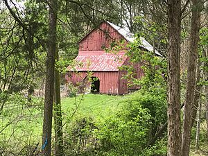
- Maple Spring Barns: These privately owned barns are at the corner of Dufief Mill Road and Darnestown Road. They were once part of one of Maryland's largest dairy farms in the 1900s.
- Pleasant View Historic Site: This site includes the Pleasant View Methodist Episcopal Church (built in 1914), Pleasant View Cemetery, and the Quince Orchard Colored School (built in 1901). These buildings are on Darnestown Road near the Quince Orchard area.
- Poplar Grove Baptist Church: Located on Jones Lane, this is the only surviving Baptist church from the 1800s for an African-American congregation in Montgomery County. It was built in 1893.
Geography and Climate
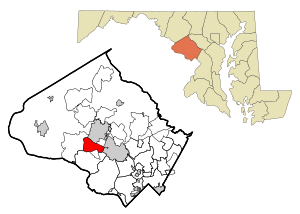
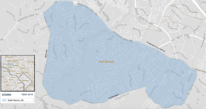
North Potomac doesn't have official city limits because it's an unincorporated area. However, the United States Census Bureau defines its boundaries for census purposes. North Potomac is located north of the Potomac River in western Montgomery County, about 20 miles (32 km) from Washington, D.C.
It is bordered by:
- Gaithersburg to the north (beyond Maryland Route 28/Darnstown Road).
- Rockville to the east (along Glen Road).
- The Travilah CDP to the south (mostly along Travilah Road).
- The Darnestown CDP to the west (along Jones Lane and Turkey Foot Road).
Some people mistakenly think North Potomac is part of Gaithersburg, but it's its own recognized community.
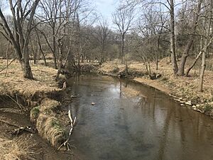
North Potomac has a total area of about 6.6 square miles (17.1 km²), and almost all of it is land. The Muddy Branch and its smaller stream, Rich Branch, flow through North Potomac. The Muddy Branch eventually empties into the Potomac River. The average elevation for the North Potomac Census Designated Place is 390 feet (119 meters) above sea level.
North Potomac's Climate
North Potomac has a humid subtropical climate. This means it has four distinct seasons. Winters are usually cold with some snow, while summers are warm and humid. July is the warmest month, and January is the coldest. The amount of rain each month is usually between 2.5 and 4 inches (6.4 to 10 cm). The highest temperature ever recorded was 105.0°F (40.6°C), and the lowest was -13.0°F (-25.0°C).
| Climate data for Gaithersburg, MD (same zip code as North Potomac) | |||||||||||||
|---|---|---|---|---|---|---|---|---|---|---|---|---|---|
| Month | Jan | Feb | Mar | Apr | May | Jun | Jul | Aug | Sep | Oct | Nov | Dec | Year |
| Mean daily maximum °F (°C) | 40 (4) |
44 (7) |
53 (12) |
65 (18) |
73 (23) |
81 (27) |
85 (29) |
83 (28) |
76 (24) |
65 (18) |
55 (13) |
44 (7) |
64 (18) |
| Mean daily minimum °F (°C) | 27 (−3) |
29 (−2) |
36 (2) |
46 (8) |
55 (13) |
64 (18) |
69 (21) |
67 (19) |
60 (16) |
48 (9) |
39 (4) |
31 (−1) |
48 (9) |
| Average precipitation inches (mm) | 2.88 (73) |
2.81 (71) |
3.61 (92) |
3.22 (82) |
4.13 (105) |
3.49 (89) |
3.67 (93) |
2.90 (74) |
3.83 (97) |
3.29 (84) |
3.53 (90) |
3.00 (76) |
40.36 (1,026) |
| Source: Weather Channel | |||||||||||||
People and Community
| Historical population | |||
|---|---|---|---|
| Census | Pop. | %± | |
| 1970 | 12,546 | — | |
| 1990 | 18,456 | — | |
| 2000 | 23,044 | 24.9% | |
| 2010 | 24,410 | 5.9% | |
| 2020 | 23,790 | −2.5% | |
| source: 2010–2020 |
|||
In 2018, North Potomac had about 24,148 residents. The average household income was nearly $160,000, and only about 2.3 percent of residents lived in poverty. The average age in North Potomac is 43.4 years, which is a bit older than the national average of 37.9 years. About 25.5 percent of residents were under 18, and 14.2 percent were 65 or older. There are slightly more females (51.9%) than males (48.1%).
North Potomac is a very diverse community. The racial makeup in 2018 was:
- 51.6 percent White
- 35.8 percent Asian
- 7.3 percent Black or African American
- 5 percent from other categories
More than half of the Asian population is Chinese, and there are also many people of Asian Indian and Korean descent.
Education levels in North Potomac are very high. About 97.8 percent of adults have a high school diploma or higher, compared to 87.7 percent nationally. Nearly half (47.6 percent) of adults in North Potomac have a graduate or professional degree.
Economy and Jobs
North Potomac is home to many businesses. In 2012, there were 2,292 businesses, and 362 of them had paid employees, totaling 1,579 jobs. The biggest industries in North Potomac include:
- Professional, Scientific, and Technical Services: This category has the most businesses and employees, with many jobs in areas like consulting, research, and technical support.
- Health Care and Social Assistance: This includes jobs at hospitals, clinics, and other health services.
- Administrative and Support Services: These jobs help other businesses run smoothly, such as office administration and cleaning services.
North Potomac is close to major employers like Shady Grove Hospital and many technology companies along Interstate 270. This area, known as the I-270 Technology Corridor, has over 25 biotech companies and over 25 technology companies in nearby Rockville, Gaithersburg, and Germantown.
Residents who travel further for work often use Interstate 270 or the Shady Grove subway station, which is part of the Washington Metro system.
Shopping and Services
North Potomac has two shopping centers within its boundaries and several others nearby.
- Travilah Square Shopping Center: Located at Travilah Road and Darnestown Road, it has a grocery store, a pizza place, and other shops.
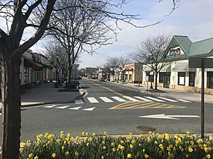
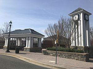
- Traville Village Center: Found on Traville Gateway Drive near Shady Grove Road and the Universities at Shady Grove. It has space for 25 stores, including a grocery store and many restaurants.
Transportation and Utilities
Maryland Route 28, a state highway, connects North Potomac to Rockville and provides access to Interstate 270. Darnestown Road and Route 28 run along most of North Potomac's northern border. Dufief Mill Road and Quince Orchard Road go through the middle of the community and connect to Darnstown Road.
The closest major highways are to the north and east. Maryland's Interstate 270 is a big highway that goes north-south and connects to Washington's Capital Beltway (also known as Interstate 495). Interstate 370 and the Intercounty Connector toll road (MD 200) are nearby east-west highways that connect to Interstate 95.
Public Transportation
The Washington Metropolitan Area Transit Authority's Metrorail system has stations in Montgomery County that are close to North Potomac. These include the Shady Grove (Gaithersburg), Rockville, and Twinbrook (south Rockville) stations on the Red Line.
At least four Montgomery County Ride-On bus routes serve North Potomac. These buses connect riders to places like the Traville Transit Center, Universities at Shady Grove, Shady Grove and Rockville Metro stations, Shady Grove Hospital, and Quince Orchard Library.
Utilities and Healthcare
- Electricity: Provided by Pepco (Potomac Electric Power Company).
- Natural Gas: Provided by Washington Gas.
- Waste Management: The Montgomery County Department of Environmental Protection handles garbage, recycling, and yard waste collection. There's also a county waste facility in Rockville for dropping off waste.
- Water and Wastewater: The Washington Suburban Sanitary Commission (WSSC) provides drinking water from the Potomac River and treats sewage.
The closest hospital is the Adventist HealthCare Shady Grove Medical Center in Rockville. This hospital has a five-star rating from the Centers for Medicare & Medicaid Services.
Education in North Potomac
North Potomac is served by Montgomery County Public Schools. Public high school students in North Potomac attend either Thomas S. Wootton High School or Quince Orchard High School. Quince Orchard High School is located on the northwest side of North Potomac, while Wootton High School is in Rockville, on the east side. Many residents choose to live in North Potomac because of the excellent schools, especially the Wootton school cluster. In 2019, U.S. News & World Report ranked Wootton High School as the 2nd best in Maryland and 125th in the entire nation.
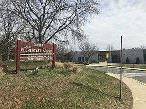
Each high school has two middle schools that feed into it, and several elementary schools contribute to the middle schools. Some elementary schools are located within North Potomac.
Higher Education Opportunities
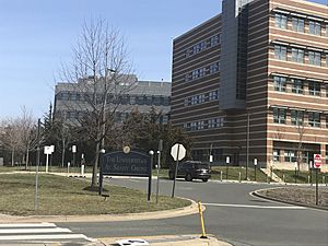
The Universities at Shady Grove is located within North Potomac. This campus offers specific degree programs from nine different public universities in Maryland. It's not a university itself, but a partnership where other universities offer courses for upper-level undergraduate, graduate, and certificate programs. The universities handle admissions.
Johns Hopkins University also has a campus in Rockville, near the Universities at Shady Grove. Montgomery College has a campus in Rockville and a training center in Gaithersburg, both close to North Potomac. Montgomery College has three campuses and online classes, serving about 54,000 students. They offer associate degrees and courses that can be transferred to other colleges.
Public Libraries
Several libraries are located in or very close to North Potomac:
- Quince Orchard Library: Part of the Montgomery County Public Library system, it's located across from Quince Orchard High School in North Potomac.
- Priddy Library: Part of the University of Maryland Libraries system, it's located at the Universities at Shady Grove in North Potomac.
- Rockville Memorial Library: Also part of the county library system, it's in Rockville, three blocks from the Rockville Metro station.
The Rockville Memorial Library is much older, celebrating its 50th anniversary in 2001, while the Quince Orchard Library was only a year old then. The Priddy Library opened in 2007.
Culture and Recreation
Arts and Museums
North Potomac doesn't have its own art centers, but there are museums in nearby communities:
- Beall–Dawson House: Built around 1815 in Rockville, it has exhibits about life in Rockville in the 1800s.
- Gaithersburg Community Museum: Located in an old railroad complex in Olde Town Gaithersburg, it teaches children about Gaithersburg's history.
- Glenstone: A modern art museum south of North Potomac.
- Strathmore Music and Arts Center: In North Bethesda, it has a concert hall and art exhibits.
Parks and Fun Activities
- Nancy H. Dacek North Potomac Recreation Center: Located on Travilah Road, it has a gym, basketball court, and other recreation facilities.
- Potomac Horse Center: At the intersection of Dufief Mill Road and Quince Orchard Road, this center offers horse training and hosts horse shows.
- Westleigh Recreation Club: A private pool and tennis club on Dufief Mill Road.
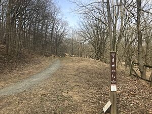
Montgomery County's Park System has over 200 miles (320 km) of hiking trails. The Muddy Branch Greenway Trail passes by North Potomac's Potomac Horse Center. This trail is 9 miles (14 km) long and goes between Darnestown Road and Blockhouse Point Conservation Park. The Powerline Trail (also called Pepco Trail) began construction in 2018 and will connect North Potomac (Muddy Branch Stream Valley Park) to the South Germantown Recreation Park, where the Maryland SoccerPlex is located.
North Potomac has five county parks. Four of them are 10 to 15 acres (4 to 6 ha) in size and usually have sports facilities, a playground, and a picnic area. The fifth park, Muddy Branch Stream Valley Park, is much larger at 876 acres (355 ha) and includes the Muddy Branch Greenway Trail.
Many neighborhoods also have their own playgrounds, parks, and short hiking trails. Some even have their own swimming pools.
Other nearby attractions include:
- Pennyfield Lock House (Lock #22): Located near North Potomac along the C&O Canal, it's part of the Chesapeake and Ohio Canal National Historical Park.
- Blockhouse Point Conservation Park: A 630-acre (250 ha) park also along the Potomac River and C&O Canal.
- Maryland SoccerPlex: Less than 10 miles (16 km) away, it has indoor and outdoor facilities for soccer and other activities.
See also
 In Spanish: North Potomac (Maryland) para niños


