Darnestown, Maryland facts for kids
Quick facts for kids
Darnestown, Maryland
|
|
|---|---|
 |
|
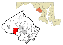
Location of Darnestown, Maryland
|
|
| Country | |
| State | |
| County | |
| Area | |
| • Total | 17.70 sq mi (45.8 km2) |
| • Land | 16.39 sq mi (42.4 km2) |
| • Water | 1.31 sq mi (3.4 km2) |
| Elevation | 374 ft (114 m) |
| Population
(2020)
|
|
| • Total | 6,723 |
| • Density | 379.83/sq mi (146.65/km2) |
| Time zone | UTC−5 (Eastern (EST)) |
| • Summer (DST) | UTC−4 (EDT) |
| ZIP codes |
20878, 20874, 20834
|
| Area code(s) | 301, 240 |
| FIPS code | 24-21825 |
| GNIS feature ID | 2389395 |
| Website | https://darnestowncivic.org/ |
| 2389395 | |
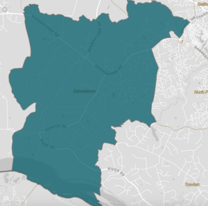
Darnestown is a community in Montgomery County, Maryland. It's a "census-designated place" (CDP), which means it's a special area defined by the government for counting people. Darnestown covers about 17.70 square miles (45.8 square kilometers). The Potomac River forms its southern border. Muddy Branch and Seneca Creek are also important natural boundaries.
Nearby communities include Travilah, North Potomac, and Germantown. The city of Gaithersburg is also close by. In 2020, about 6,723 people lived in the Darnestown CDP. The original village of Darnestown is much smaller. Downtown Washington, D.C. is about 22 miles (35 km) to the southeast.
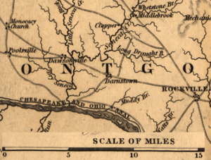
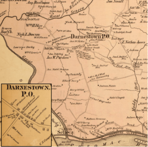
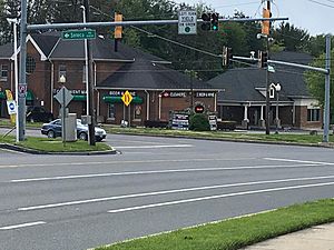
The small village of Darnestown started around 1800. It is located where Darnestown Road and Seneca Road meet today. The community was named after William Darne. He owned a lot of land in the early 1800s. The area was first settled around 1750. It was called Mount Pleasant, then Darnes, before becoming Darnestown.
In the 1800s, Darnestown grew because of the Chesapeake and Ohio Canal. This canal helped farmers transport their goods to markets. But growth slowed down when a new railway was built in the late 1800s. This railway bypassed Darnestown.
In the 1960s, wealthy families started buying land in Montgomery County. They built new homes and used the land for horseback riding. Today, many Darnestown residents are well-off. They live in large homes on big lots. This is why the area has a high average income. Many residents also have college degrees. The community is close to major workplaces. These include Shady Grove Hospital and the I-270 Technology Corridor.
Contents
- Darnestown's Past: A Look at Its History
- Where is Darnestown? Understanding its Geography
- Who Lives in Darnestown? Demographics
- Darnestown's Economy: How People Make a Living
- Getting Around Darnestown: Transportation and Services
- Learning in Darnestown: Schools and Libraries
- Fun in Darnestown: Culture and Recreation
- See also
Darnestown's Past: A Look at Its History
The first European settlers came to what is now Montgomery County, Maryland, in 1688. They settled near Rock Creek and Rockville. Later, more settlements appeared further west. These were along the Potomac River, near today's Darnestown and Poolesville. Before Europeans arrived, Native Americans of the Piscataway Confederation lived here.
Ninian Beall was the first European to own land in the Darnestown area. This was around 1749. His daughter, Ruth Beall, married Charles Gassaway. Charles built a brick house called Pleasant Hills around 1765. This was one of the first brick homes in the county. It is still standing today. Gassaway bought land from his father-in-law. This land later became the village of Darnestown.
In the late 1700s, a small village grew. It was at the crossing of what are now Darnestown Road and Seneca Road. Darnestown Road was then called "the road from Georgetown to the mouth of the Monocacy River". It was an old Seneca Indian trail. Seneca Road led from Darnestown to Seneca Mill. This mill was less than 4 miles (6.4 km) away.
Gassaway's daughter Elizabeth married William Darne in 1798. William Darne was an important leader. He served in the Maryland House of Delegates. He was also a judge and a director of the Chesapeake and Ohio Canal. He became one of the biggest landowners. The community was first called Mount Pleasant. Around 1803, a post office opened. The area then became known as "Darnes" to honor William Darne. By the mid-1820s, it was called Darnestown.
Darnestown's first store was run by John Candler. He was also the first postmaster. By the 1820s, the community had many businesses. These included a wheelwright, a mill, a blacksmith, and a doctor.
How the C&O Canal Helped Darnestown Grow
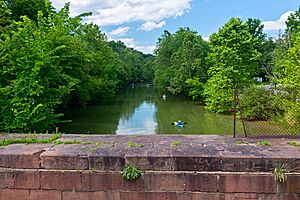
Early European settlers in Darnestown grew tobacco and corn. The Chesapeake and Ohio Canal (C&O Canal) opened between Georgetown and Seneca in 1832. This canal made it easier for farmers to sell their crops. Roads and mills were built to connect farmers to the canal. Local mills included Seneca Mill (around 1780) and Black Rock Mill (built in 1815).
William Darne died in 1845. His farm went to his son, Alexander. By 1860, farmers were growing corn, wheat, and oats. During the American Civil War, the Union Army occupied the Darnestown area. They had 18,000 troops there in 1861. Major General Nathaniel P. Banks had his headquarters at the Samuel Thomas Magruder farm. This spot offered good views of the Potomac River. After the war, Darnestown remained a farming community.
In the 1870s, Darnestown's good location for transport changed. Freight traffic on the C&O Canal started to decline in 1871. The canal closed permanently in 1924. Also, the Baltimore and Ohio Railroad opened a new line in 1873. This line bypassed Darnestown. It went through Rockville, Gaithersburg, and Germantown instead. These changes limited Darnestown's growth. Nearby towns on the new rail line grew much faster.
The Darnestown Post Office closed on May 31, 1911. It had been open for over 100 years. The population around Darnestown did not grow much until after 1940. Other nearby villages like Hunting Hill, Travilah, and Seneca became almost empty. Darnestown grew slowly until the 1960s. That's when wealthy families started buying farmland for homes and horse riding. From 1970 to 1976, the population along Maryland Route 28 nearly tripled.
Historic Places to Visit in Darnestown
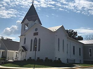
The Darnestown Presbyterian Church was started in 1855. Its cornerstone was laid on September 14, 1856. John L. DuFief, a community leader, gave 3 acres (1.2 ha) of land for the church. The church was finished and opened on May 22, 1858. It was made bigger in the late 1890s. A bell tower was added then. Stained glass windows were put in in 1905. A back part was added in the 1950s.
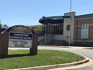
The church's cemetery has graves of early settlers. These include members of the Darne and Clagett families. It also has graves of C&O Canal lock keepers. Andrew Small, a generous person, is also buried there. His donation of $40,000 in 1868 helped build the Andrew Small Academy. This school building was very large for its time. It became a public high school in 1907. The building was torn down in 1955. The current Darnestown Elementary School was built in its place.
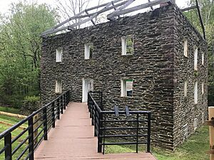
Other historic spots include Black Rock Mill. It is in Seneca Creek State Park. This mill started working in 1815. It continued operating into the 1900s. The Samuel Thomas Magruder farmhouse is now privately owned. It was Major General Nathaniel P. Banks's headquarters during the Civil War.
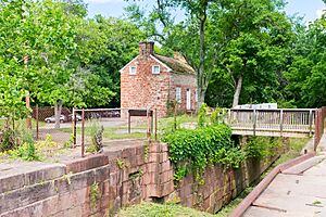
Further south, Riley's Lock and Violette's Lock are along the C&O Canal. They are part of the Chesapeake and Ohio Canal National Historical Park. Pennyfield Lock is also part of the park. It is less than 3 miles (4.8 km) east of Violette's Lock. The community of Seneca is near Riley's Lock. It lost its importance when the C&O Canal declined. Today, only a few homes, a schoolhouse, a store, and ruins of mills and a quarry remain there.
Where is Darnestown? Understanding its Geography
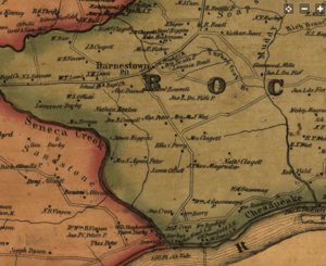
Darnestown is an unincorporated area. This means its exact borders are not officially set like a city. However, the U.S. Census Bureau created a "Darnestown District" in 1878. This district was used to count people in that part of the county. The district was about 40 square miles (100 km2). It was the fifth largest of eight districts in the county.
Little Seneca Creek and Great Seneca Creek formed the western border of this old district. The Potomac River formed the southern border. The communities of Seneca, Hunting Hill, and Travilah were part of this district.
In 2000, the Census Bureau created a new "Census-designated place" (CDP) called Darnestown. This Darnestown CDP is smaller than the old district. It has about 16.39 square miles (42.4 km2) of land. The Muddy Branch forms most of its eastern border. Great Seneca Creek is still its western border. Washington, D.C. is about 25 miles (40 km) away. The Travilah and North Potomac CDPs are to the east of Darnestown.
What are Darnestown's ZIP Codes?
Darnestown does not have its own unique ZIP code. Most of the area uses 20878. This ZIP code is also used for Gaithersburg and North Potomac. Some parts use 20874, which is also for Germantown. The area around Seneca uses 20834, a Poolesville ZIP code. For example, Darnestown Elementary School uses 20878. Black Rock Mill uses 20874. Riley's Lock uses 20834.
Darnestown's Weather: What's the Climate Like?
Darnestown has a humid subtropical climate. This means it has four clear seasons. Winters are usually cold with some snow. Summers are warm and humid. July is the hottest month. January is the coldest.
The average rainfall each month is about 2.5 to 4 inches (6.4 to 10.2 cm). The highest temperature ever recorded was 105.0 °F (40.6 °C). The lowest was -13.0 °F (-25.0 °C). There's a 50% chance of the first frost by October 21. There's a 50% chance of the last frost by April 16.
| Climate data for Gaithersburg, MD (same zip code as part of Darnestown) | |||||||||||||
|---|---|---|---|---|---|---|---|---|---|---|---|---|---|
| Month | Jan | Feb | Mar | Apr | May | Jun | Jul | Aug | Sep | Oct | Nov | Dec | Year |
| Mean daily maximum °F (°C) | 40 (4) |
44 (7) |
53 (12) |
65 (18) |
73 (23) |
81 (27) |
85 (29) |
83 (28) |
76 (24) |
65 (18) |
55 (13) |
44 (7) |
64 (18) |
| Mean daily minimum °F (°C) | 27 (−3) |
29 (−2) |
36 (2) |
46 (8) |
55 (13) |
64 (18) |
69 (21) |
67 (19) |
60 (16) |
48 (9) |
39 (4) |
31 (−1) |
48 (9) |
| Average precipitation inches (mm) | 2.88 (73) |
2.81 (71) |
3.61 (92) |
3.22 (82) |
4.13 (105) |
3.49 (89) |
3.67 (93) |
2.90 (74) |
3.83 (97) |
3.29 (84) |
3.53 (90) |
3.00 (76) |
40.36 (1,026) |
| Source: Weather Channel | |||||||||||||
Who Lives in Darnestown? Demographics
| Historical population | |||
|---|---|---|---|
| Census | Pop. | %± | |
| 1880 | 1,658 | — | |
| 1890 | 1,684 | 1.6% | |
| 1900 | 1,675 | −0.5% | |
| 1910 | 1,589 | −5.1% | |
| 1920 | 1,489 | −6.3% | |
| 1930 | 1,566 | 5.2% | |
| 1940 | 1,632 | 4.2% | |
| 1950 | 2,697 | 65.3% | |
| 1960 | 3,526 | 30.7% | |
| 1970 | 4,999 | 41.8% | |
| 2000 | 6,378 | — | |
| 2010 | 6,802 | 6.6% | |
| 2020 | 6,723 | −1.2% | |
| Note: Darnestown District 1880-1970 Darnestown CDP beg. 2000 Source: United States Census |
|||
In 1879, the village of Darnestown had about 200 people. It had a church, a school, a post office, and several businesses. The larger Darnestown District (No. 6) had 1,658 people in 1880. This district included the village, Seneca, Hunting Hill, and Travilah.
Darnestown in 2010
In 2010, the Darnestown CDP had a population of 6,802. It was the 162nd largest community in Maryland. The land area was 16.39 square miles (42.4 km2). The population density was about 415 people per square mile (160 people per km2). This was much lower than the nearby city of Rockville.
Darnestown Today: Recent Population Facts
In 2018, Darnestown had a high median household income of $227,962. Only 0.3% of residents lived in poverty. In 2020, Bloomberg ranked Darnestown as the 50th richest community in the United States. There are about 2,209 households. Each household has an average of 2.9 people.
About 22.4% of residents are under 18 years old. About 13.1% are 65 or older. The population is 52.0% male and 48.0% female.
Most residents are White (74.6%). About 6.0% are African American. About 16.1% are Asian. And 3.1% are from two or more races. About 6.9% of the population is Hispanic or Latino. Darnestown residents are highly educated. About 96.2% of adults (25 or older) have a high school diploma or more. About 72.6% have a bachelor's degree or higher.
Darnestown's Economy: How People Make a Living
In 2012, there were 881 businesses in Darnestown. About 162 of these businesses had paid employees. These businesses employed 1,068 people. The "Professional, Scientific, and Technical Services" category had the most businesses (78). It also had the highest annual payroll. Retail stores had the most employees (245) and sales. Education services are also important.
Darnestown is close to big employers. These include Shady Grove Hospital. Many technology companies are along Interstate 270. Over 25 biotech and 25 technology companies are in the I-270 Technology Corridor. This area is near Rockville, Gaithersburg, and Germantown. Darnestown residents who travel further for work often use Interstate 270 or River Road. These roads connect to the Capital Beltway. The Washington Metro system (Red Line) is also available.
Darnestown residents have local shops at Darnestown Road and Seneca Road. These include a grocery store, gas station, and bank. Two more shopping centers are further east on Darnestown Road. These are Quince Orchard Market Place and The Shops at Potomac Valley. More shopping is available in Germantown, North Potomac, and Gaithersburg.
Getting Around Darnestown: Transportation and Services
Maryland Route 28 is a state highway. It connects Darnestown to Rockville. It also provides access to Interstate 270. Other main roads are Germantown Road (Maryland Route 118) and Seneca Road (Maryland 112). River Road (Maryland Route 190) is also important.
Interstate 270 is a major highway east of Darnestown. It connects to Washington's Capital Beltway (Interstate 495). Interstate 370 and the Intercounty Connector toll road (MD 200) are nearby east-west highways. They connect to Interstate 95.
The Washington Metropolitan Area Transit Authority's Metrorail system has stations in Montgomery County. Red Line stations are closest to Darnestown. These include Shady Grove (Gaithersburg) and Rockville. A Montgomery County Ride-On bus runs through Darnestown village. It connects riders to the Shady Grove Metro station.
Utilities and Healthcare in Darnestown
Electric power in Darnestown is provided by Pepco. Washington Gas provides natural gas. The county does not provide garbage or recycling pickup. Residents must hire private companies. The Shady Grove Processing Facility is available for dropping off waste. The Washington Suburban Sanitary Commission (WSSC) provides water and treats wastewater. Drinking water comes from the Potomac River. Sewage is treated in Washington, D.C.
The closest hospital is Adventist HealthCare Shady Grove Medical Center in Rockville. It has a five-star rating. Adventist Health Care also has an emergency center in Germantown. MedStar Health Urgent Care is in Gaithersburg.
Learning in Darnestown: Schools and Libraries
Darnestown is served by Montgomery County Public Schools. Most high school students go to Northwest High School in Germantown. Some students on the eastern side go to Quince Orchard High School in Gaithersburg. Elementary schools include Darnestown Elementary and Jones Lane Elementary. Private schools in the area are Butler Montessori, Mary of Nazareth Catholic School, and Seneca Academy.
Higher Education Opportunities
Montgomery College has campuses in Germantown, Rockville, and Gaithersburg. The Universities at Shady Grove is in North Potomac. It offers degree programs from nine public Maryland universities. It's not a university itself. Instead, it partners with other universities. It offers courses for many undergraduate and graduate programs. Johns Hopkins University also has a campus in Rockville.
Public Libraries Near Darnestown
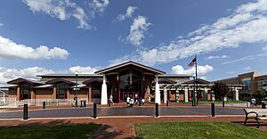
Several libraries are close to Darnestown. Three are part of the Montgomery County Public Library system. Quince Orchard library is closest to Darnestown village. It's across from Quince Orchard High School. Germantown Library opened in 2007. Rockville Memorial Library is a larger library in Rockville. Potomac library opened in 1985. Priddy Library is part of the University of Maryland Libraries system. It is at the Universities at Shady Grove.
Fun in Darnestown: Culture and Recreation
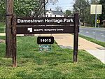
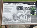
Darnestown Heritage Park is a small county park. It's like an outdoor museum. It has historical markers that tell Darnestown's story. Black Rock Mill is a partly restored mill in Seneca Creek State Park. It shows how mills worked in the 1800s. Riley's Lock and its lock house are part of the C&O Canal National Historical Park. Local Girl Scouts give tours of the lock house.
Darnestown doesn't have its own art centers. But there are museums nearby. The Beall–Dawson House in Rockville shows life in the 1800s. The Gaithersburg Community Museum teaches kids about Gaithersburg's history. Glenstone Modern Art Museum is east of Darnestown. It has indoor and outdoor art. The Strathmore Music and Arts Center in North Bethesda has a concert hall and art exhibits.
Parks and Outdoor Fun
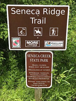
Seneca Creek State Park is a large park. It follows Seneca Creek for 14 miles (23 km). The park has 50 miles (80 km) of trails. You can hike, ride horses, or bike there. Riley's Lock and Violette's Lock are two canal locks in the C&O Canal National Historical Park. These locks are popular for kayakers, bikers, and hikers. They are also good places to see wildlife. The Dierssen Waterfowl Sanctuary is a place to observe birds.
Darnestown CDP has six county parks. It also has an undeveloped conservation area. Darnestown Heritage Park and Darnestown Local Park are in Darnestown village. The local park has a playground, softball field, and tennis courts. More county parks are near the Potomac River. Seneca Landing Special Park has a boat landing near Riley's Lock. Blockhouse Point Conservation Park has views of the Potomac River. It also has ruins from the Civil War. Callithea Farm Special Park is a horse farm. Muddy Branch Stream Valley Park has trails along the Muddy Branch.
The Montgomery County Park System has over 200 miles (320 km) of hiking trails. The Muddy Branch Greenway Trail is one of them. It passes the Potomac Horse Center. The Potomac Horse Center offers training for horses and riders. The Powerline Trail is being built. It will connect Muddy Branch Stream Valley Park to South Germantown Recreation Park. This park is home to the Maryland SoccerPlex. The Maryland SoccerPlex is less than 5 miles (8.0 km) from Darnestown village. It has indoor and outdoor facilities for soccer and other activities.
See also
 In Spanish: Darnestown (Maryland) para niños
 | Jessica Watkins |
 | Robert Henry Lawrence Jr. |
 | Mae Jemison |
 | Sian Proctor |
 | Guion Bluford |


