Seneca, Maryland facts for kids
Quick facts for kids
Seneca, Maryland
|
|
|---|---|
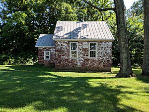
Seneca Schoolhouse Museum in Seneca, Montgomery County, Maryland
|
|
| Country | United States |
| State | Maryland |
| County | Montgomery |
| Time zone | UTC-5 (Eastern (EST)) |
| • Summer (DST) | UTC-4 (EDT) |
| ZIP code |
20834
|
Seneca is a small community in Montgomery County, Maryland, in the United States. It's not an official town, but a historic area. You can find it near where River Road meets Seneca Creek. It's also close to the famous Chesapeake and Ohio Canal (C&O Canal) and the Potomac River.
Seneca has a long history, even before the American Revolutionary War. It grew into a busy place when the C&O Canal was used for shipping goods. It had many buildings like warehouses, mills, a store, a hotel, and a school. During the American Civil War, some battles happened in the area. When the canal stopped being used, Seneca became much quieter.
Today, Seneca uses a Poolesville ZIP code. The old Seneca schoolhouse is now a museum. Nearby, Riley's Lock and its lock house are part of the Chesapeake and Ohio Canal National Historical Park. Seneca is also close to the Dierssen Wildlife Management Area and the McKee-Beshers Wildlife Management Area. Since 1978, Seneca and the land around it have been part of the Seneca Historic District.
Contents
History of Seneca
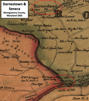
Seneca is located in Montgomery County, Maryland, right on Seneca Creek near the Potomac River. Seneca Creek was once very powerful. Before 1800, eight of Montgomery County's 44 mills were on this creek.
The Seneca Mill, which ground grain, started working around 1780. It was on Seneca Creek, close to the Potomac River. In 1781, the state of Maryland took land from Daniel Dulany the Younger. He was loyal to the British King during the American Revolution. His land, which included red sandstone quarries, was sold to help Maryland pay for the American Revolutionary War.
Robert Peter bought about 2,500 acres of this land. In 1787, John Garrett started a community nearby. He called it Newport. It was on the west side of Seneca Creek's mouth, about 22 miles upriver from Georgetown. But people living there soon started calling it Seneca instead. Robert Peter died in 1806, and his son Thomas inherited the land with the quarry.
The C&O Canal Arrives
Building the Chesapeake and Ohio Canal (C&O Canal) along the Potomac River began on July 4, 1828. The canal was needed because parts of the river were too shallow and rocky for large boats carrying goods. By then, John Parke Custis Peter, Thomas Peter's son, owned the Seneca Quarry.
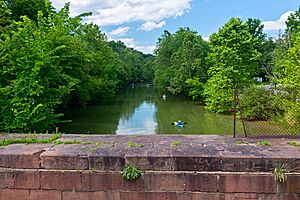
The canal made Seneca much more important. C&O Canal Lock 24, now called Riley's Lock, is where the Seneca Aqueduct carries the canal over Seneca Creek. By 1833, enough of the canal was finished to allow boats to travel between Georgetown and Lock 24. This opened up new markets for Peter's sandstone quarry.
The quarry's special red sandstone was used to build parts of the canal locks and lock houses. It was also used for famous buildings in Washington, D.C., like the Smithsonian Institution Building. The canal also helped local farmers sell their crops. In 1855, John Darby and his son Upton bought the Seneca grist mill. Their company shipped goods on the C&O Canal. They even had their own warehouse and canal boats.
War and Decline
The American Civil War was a tough time for the Peter family and the area. There were several small battles between Union and Confederate soldiers nearby. In 1863, about 5,000 Confederate soldiers crossed the Potomac River near Lock 24. They damaged the canal, drained water, and burned canal boats. This hurt the canal's operations.
After the war, in 1866, the Peter family sold the quarry to the new Seneca Sandstone Company. Upton Darby gave land for a one-room schoolhouse. It was built using the local red sandstone. By 1879, Seneca had schools, churches, a store, and a post office.
However, freight traffic on the C&O Canal reached its highest point in 1871. After that, it started to go down. The canal finally closed for good in 1924. As the canal declined, so did Seneca. The school closed in 1910.
Seneca Today
In 1955, Seneca was home to the Mills Cross Array, a huge radio telescope. It was used to make the first observations of radio waves coming from a planet, Jupiter! This discovery helped start a new field called radio astronomy.
The old Seneca Mill, also known as the Darby Mill, burned down around 1956. Its ruins were removed when River Road was made wider in the 1960s.
Today, the radio telescope is gone. Its site is now part of the McKee-Beshers Wildlife Management Area. A historical marker on River Road tells about the discovery. All that's left of the old Seneca are a few homes, the schoolhouse (now a museum), the store, and some ruins of the stone-cutting mill and quarry.
Where is Seneca?
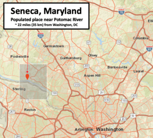
Seneca is a "populated place" in Montgomery County, Maryland. This means it has buildings and people living there, but it's not an official city or town with legal borders. It was once called Newport.
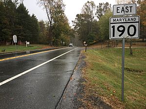
Seneca is located near where River Road (Maryland Route 190), Seneca Road (Maryland route 112), and Rileys Lock Road meet. It's east of Great Seneca Creek and north of the Potomac River. The C&O Canal runs along the river, and Riley's Lock is the closest canal lock.
The southern part of Seneca Creek State Park is nearby, as is the Bretton Woods Golf Course. The community is about 187 feet above sea level.
Local Weather
| Climate data for Poolesville, MD (same zip code as Seneca) | |||||||||||||
|---|---|---|---|---|---|---|---|---|---|---|---|---|---|
| Month | Jan | Feb | Mar | Apr | May | Jun | Jul | Aug | Sep | Oct | Nov | Dec | Year |
| Mean daily maximum °F (°C) | 39 (4) |
44 (7) |
53 (12) |
65 (18) |
75 (24) |
83 (28) |
89 (32) |
87 (31) |
79 (26) |
67 (19) |
54 (12) |
45 (7) |
65 (18) |
| Mean daily minimum °F (°C) | 27 (−3) |
29 (−2) |
36 (2) |
46 (8) |
56 (13) |
64 (18) |
69 (21) |
67 (19) |
61 (16) |
51 (11) |
39 (4) |
33 (1) |
48 (9) |
| Average precipitation inches (mm) | 3.7 (94) |
4.4 (110) |
4.6 (120) |
4.4 (110) |
5.9 (150) |
5.0 (130) |
5.4 (140) |
5.4 (140) |
5.0 (130) |
5.6 (140) |
3.6 (91) |
4.8 (120) |
57.8 (1,475) |
| Source: WeatherWX | |||||||||||||
People in Seneca
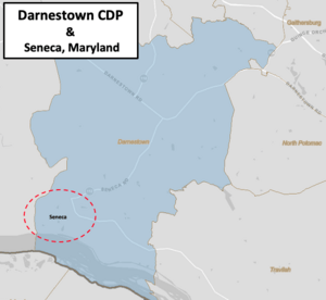
Seneca is part of the Darnestown census-designated place (CDP). A CDP is an area that the government uses for counting people, but it's not an official town. The Darnestown CDP covers about 17.70 square miles. The Potomac River is its southern border. Seneca Creek forms parts of its northern and western borders.
In 2010, the Darnestown CDP had 6,802 people living there. Seneca's population is a small part of that total.
Getting Around and Services
Transportation in Seneca
The main roads in Seneca are River Road (Maryland Route 190) and Seneca Road (Maryland Route 112). Major highways like Interstate 270 and Interstate 95 are not too far away. These highways connect to the Capital Beltway around Washington, D.C.
The Washington Metropolitan Area Transit Authority's Metrorail system has stations in Montgomery County. The Red Line stations on the west side of the county are closest to Seneca. The Grosvenor-Strathmore station is one option with parking.
Local Services
Electricity in Seneca is provided by Pepco. Washington Gas provides natural gas. For trash and recycling, residents can use the Shady Grove Processing Facility and Transfer Station in Rockville.
The closest hospital is Adventist HealthCare Shady Grove Medical Center in Rockville. It's a highly-rated medical facility.
Education in Seneca
Seneca is served by Montgomery County Public Schools. Depending on where they live, students attend different schools:
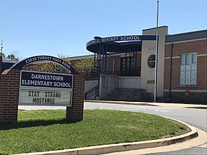
- Those living on or east of Rileys Lock Road go to Darnestown Elementary, Lakelands Park Middle School, and Northwest High School.
- Those living west of Seneca Creek attend Poolesville elementary, middle, and high schools.
There are also private schools nearby, such as Butler Montessori, Mary of Nazareth Catholic School, and Seneca Academy. Bullis School is a bit further away in Potomac, Maryland.
Colleges and Universities
Montgomery College has campuses in Germantown and Rockville. The Universities at Shady Grove in North Potomac offers many degree programs from different Maryland public universities. Johns Hopkins University also has a campus in Rockville.
Public Libraries
Two libraries are less than 10 miles from Seneca. The Poolesville Library (Maggie Nightingale Library) is northwest in Poolesville. The Potomac Library is east in Potomac. The Priddy Library, part of the University of Maryland Libraries system, is at the Universities at Shady Grove and is open to the public.
Fun Things to Do in Seneca
Arts and Culture
The Seneca Schoolhouse Museum offers tours for students. They can experience what a school day was like on March 13, 1880! The Glenstone Modern Art Museum is about six miles east of Seneca. The Strathmore Music and Arts Center in North Bethesda has concerts and art shows.
Outdoor Fun
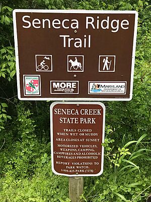
Seneca Creek State Park is a large park with 6,300 acres. It follows Seneca Creek for 14 miles to the Potomac River. The park has 50 miles of trails for hiking, horseback riding, and biking.
Riley's Lock and Violette's Lock are in the Chesapeake and Ohio Canal National Historical Park. These locks are popular for kayakers, bikers, and hikers. They are also great places to see wildlife. The 40-acre Dierssen Waterfowl Sanctuary is nearby. The McKee-Beshers Wildlife Management Area is also close by. It's a 1,971-acre area that provides homes for deer, turkeys, squirrels, and birds.
On the Potomac River, Seneca Landing Special Park has a boat landing near Riley's Lock. The 630-acre Blockhouse Point Conservation Park offers views of the Potomac River and has ruins from the American Civil War. The Callithea Farm Special Park is a 91-acre horse farm. Montgomery County has over 200 miles of hiking trails. One of these is the Muddy Branch Greenway Trail, which is 9 miles long.
 | John T. Biggers |
 | Thomas Blackshear |
 | Mark Bradford |
 | Beverly Buchanan |


