
Oakley, Kansas facts for kids
Quick facts for kids
Oakley, Kansas
|
|
|---|---|
|
City and County seat
|
|

Gas station on US Route 40 near I-70 (2011)
|
|

Location within Logan County and Kansas
|
|

|
|
| Country | United States |
| State | Kansas |
| Counties | Logan, Thomas, Gove |
| Founded | 1884 |
| Incorporated | 1887 |
| Named for | Elizabeth Oakley Gardner Hoag |
| Area | |
| • Total | 1.93 sq mi (4.99 km2) |
| • Land | 1.93 sq mi (4.99 km2) |
| • Water | 0.00 sq mi (0.00 km2) |
| Elevation | 3,051 ft (930 m) |
| Population
(2020)
|
|
| • Total | 2,046 |
| • Density | 1,060.1/sq mi (410.0/km2) |
| Time zone | UTC-6 (CST) |
| • Summer (DST) | UTC-5 (CDT) |
| ZIP code |
67748
|
| Area code | 785 |
| FIPS code | 20-51825 |
| GNIS ID | 2395293 |
Oakley is a city located in the state of Kansas, USA. It's special because it's in three different counties: Gove, Logan, and Thomas. Oakley is also the main town, or county seat, for Logan County. In 2020, about 2,046 people lived here.
Contents
History of Oakley
The area that is now Oakley was first settled in the 1870s and 1880s. Travelers on the Smoky Hill Trail helped start the community.
Oakley was officially founded in 1884 by Judge Fredman and David D. Hoag. It had a couple of different names at first. It was called Carlyle, then Cleveland. Finally, in 1885, it was named Oakley. The city was named after David D. Hoag's mother, Elizabeth Oakley Gardner Hoag.
Geography and Climate
Oakley is located in the High Plains part of the Great Plains region. It sits about 1 mile (1.6 km) south of the South Fork of the Saline River.
Location and Area
The city is in northwest Kansas. It is found where three major roads meet: Interstate 70, U.S. Route 40, and U.S. Route 83.
Oakley is mostly in the northeast part of Logan County. However, some small parts of the city reach into Gove County and Thomas County.
The city covers a total area of about 1.94 square miles (4.99 square kilometers). All of this area is land.
Weather in Oakley
Oakley has a type of weather called a humid continental climate. This means it has hot and often humid summers. The winters are usually mild to cool.
| Climate data for Oakley, Kansas, 1991–2020 normals, extremes 1920–present | |||||||||||||
|---|---|---|---|---|---|---|---|---|---|---|---|---|---|
| Month | Jan | Feb | Mar | Apr | May | Jun | Jul | Aug | Sep | Oct | Nov | Dec | Year |
| Record high °F (°C) | 82 (28) |
85 (29) |
92 (33) |
96 (36) |
103 (39) |
111 (44) |
111 (44) |
108 (42) |
105 (41) |
96 (36) |
87 (31) |
84 (29) |
111 (44) |
| Mean maximum °F (°C) | 66.0 (18.9) |
70.9 (21.6) |
80.6 (27.0) |
87.0 (30.6) |
93.9 (34.4) |
101.2 (38.4) |
103.3 (39.6) |
101.4 (38.6) |
98.0 (36.7) |
90.3 (32.4) |
77.1 (25.1) |
66.8 (19.3) |
104.6 (40.3) |
| Mean daily maximum °F (°C) | 42.4 (5.8) |
45.3 (7.4) |
55.9 (13.3) |
64.5 (18.1) |
74.2 (23.4) |
86.3 (30.2) |
91.6 (33.1) |
89.0 (31.7) |
81.4 (27.4) |
68.0 (20.0) |
53.9 (12.2) |
43.5 (6.4) |
66.3 (19.1) |
| Daily mean °F (°C) | 28.9 (−1.7) |
31.5 (−0.3) |
40.6 (4.8) |
49.2 (9.6) |
59.6 (15.3) |
71.4 (21.9) |
76.7 (24.8) |
74.4 (23.6) |
66.0 (18.9) |
52.5 (11.4) |
39.5 (4.2) |
30.2 (−1.0) |
51.7 (11.0) |
| Mean daily minimum °F (°C) | 15.5 (−9.2) |
17.6 (−8.0) |
25.3 (−3.7) |
33.9 (1.1) |
45.0 (7.2) |
56.5 (13.6) |
61.8 (16.6) |
59.7 (15.4) |
50.5 (10.3) |
37.0 (2.8) |
25.1 (−3.8) |
16.9 (−8.4) |
37.1 (2.8) |
| Mean minimum °F (°C) | −2.4 (−19.1) |
0.0 (−17.8) |
8.0 (−13.3) |
20.1 (−6.6) |
31.4 (−0.3) |
44.0 (6.7) |
52.9 (11.6) |
50.9 (10.5) |
36.4 (2.4) |
20.8 (−6.2) |
9.1 (−12.7) |
−1.2 (−18.4) |
−8.4 (−22.4) |
| Record low °F (°C) | −20 (−29) |
−27 (−33) |
−19 (−28) |
−2 (−19) |
23 (−5) |
33 (1) |
41 (5) |
41 (5) |
22 (−6) |
2 (−17) |
−10 (−23) |
−21 (−29) |
−27 (−33) |
| Average precipitation inches (mm) | 0.36 (9.1) |
0.52 (13) |
1.02 (26) |
1.79 (45) |
3.03 (77) |
2.66 (68) |
3.75 (95) |
2.93 (74) |
1.76 (45) |
1.58 (40) |
0.76 (19) |
0.51 (13) |
20.67 (524.1) |
| Average snowfall inches (cm) | 4.5 (11) |
6.6 (17) |
4.2 (11) |
1.8 (4.6) |
0.4 (1.0) |
0.0 (0.0) |
0.0 (0.0) |
0.0 (0.0) |
0.0 (0.0) |
1.2 (3.0) |
2.5 (6.4) |
4.5 (11) |
25.7 (65) |
| Average precipitation days (≥ 0.01 in) | 3.1 | 3.9 | 4.8 | 7.1 | 9.7 | 8.8 | 9.1 | 8.8 | 6.2 | 5.6 | 3.2 | 3.0 | 73.3 |
| Average snowy days (≥ 0.1 in) | 2.6 | 3.2 | 1.9 | 1.0 | 0.1 | 0.0 | 0.0 | 0.0 | 0.0 | 0.5 | 1.4 | 2.7 | 13.4 |
| Source 1: NOAA | |||||||||||||
| Source 2: National Weather Service | |||||||||||||
People of Oakley
| Historical population | |||
|---|---|---|---|
| Census | Pop. | %± | |
| 1890 | 176 | — | |
| 1900 | 269 | 52.8% | |
| 1910 | 681 | 153.2% | |
| 1920 | 768 | 12.8% | |
| 1930 | 1,159 | 50.9% | |
| 1940 | 1,138 | −1.8% | |
| 1950 | 1,915 | 68.3% | |
| 1960 | 2,190 | 14.4% | |
| 1970 | 2,327 | 6.3% | |
| 1980 | 2,343 | 0.7% | |
| 1990 | 2,045 | −12.7% | |
| 2000 | 2,173 | 6.3% | |
| 2010 | 2,045 | −5.9% | |
| 2020 | 2,046 | 0.0% | |
| U.S. Decennial Census | |||
Population in 2020
The 2020 United States census found 2,046 people living in Oakley. There were 896 households and 540 families. About 1,064 people lived per square mile.
Most of the people (almost 90%) were white. A small number were from other racial backgrounds. About 8% of the population identified as Hispanic or Latino.
About 29% of households had children under 18. Nearly half (48.8%) were married couples living together. About 16% of households had someone living alone who was 65 or older. The average household had 2.3 people.
The median age in Oakley was 40.1 years old. About 24.5% of the population was under 18. About 20.8% were 65 years or older.
Population in 2010
In the census of 2010, Oakley had 2,045 residents. There were 920 households and 562 families.
Most people (96.6%) were White. Other groups included African American, Native American, and Asian people. About 2.8% of the population was Hispanic or Latino.
About 25.9% of households had children under 18. Nearly 50% were married couples. Many households (35%) were made up of just one person.
The median age was 44.8 years. About 22.1% of residents were under 18. Also, 22.6% were 65 years or older.
Museums in Oakley
The Fick Fossil and History Museum is a cool place to visit. It shows off huge dinosaur fossils that were found in Kansas. You can also see old tools, different kinds of minerals, and art made from shells and minerals. The museum is free, but donations are welcome. It's open seven days a week in the summer.
Education in Oakley
The public schools in Oakley are part of the Oakley USD 274 school district. There are three public schools in the city:
- Oakley Elementary School (for students from Pre-K to 5th grade)
- Oakley Middle School (for students in 6th to 8th grade)
- Oakley High School (for students in 9th to 12th grade)
There is also a Catholic school called St. Joseph School, which teaches students from Pre-K to 5th grade.
High School Achievements
The Oakley Plainsmen sports teams have won several state championships from the Kansas State High School:
- 1974 Wrestling - Class 2-1A
- 1970, 1971 Boys Cross Country - Class 2-1A
- 1976 Boys Basketball - Class 2A
- 2005 Girls Cross Country - Class 2A
- 2007 Girls Basketball - Class 2A
- 1981, 1982, 1983, 1984, 1993 Volleyball - Class 3A
- 2000 Speech and Drama - Class 3A
- 1998 Two Speaker Debate - Class 3-2-1A
Media and News
Oakley has its own weekly newspaper called The Oakley Graphic. The very first edition of this newspaper was published a long time ago, on November 22, 1889.
Transportation in Oakley
Oakley is a hub for travel in northwest Kansas.
Roads
U.S. Route 40 runs along the southern edge of the city. U.S. Route 83 runs north and south. It meets U.S. 40 south of Oakley, then they run together for a mile before U.S. 83 turns north. East of the city, U.S. 40 joins Interstate 70, which comes from the northwest.
Airport
The Oakley Municipal Airport is located southeast of the city. It is used for general aviation, which means smaller private planes and non-commercial flights.
Railroad
The Kansas Pacific (KP) Line of the Union Pacific Railroad runs through Oakley from east to west. There is also a branch line that splits off and goes northwest towards Colby.
Images for kids
-
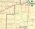
KDOT map of Logan County (legend)
See also
 In Spanish: Oakley (Kansas) para niños
