Old Noarlunga, South Australia facts for kids
Quick facts for kids Old NoarlungaAdelaide, South Australia |
|||||||||||||||
|---|---|---|---|---|---|---|---|---|---|---|---|---|---|---|---|

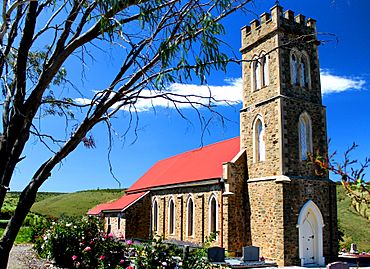
Old Noarlunga Church
|
|||||||||||||||
| Established | 1840 | ||||||||||||||
| Location | 30 km (19 mi) from Adelaide | ||||||||||||||
| LGA(s) | City of Onkaparinga | ||||||||||||||
| Region | Southern Adelaide | ||||||||||||||
| County | Adelaide | ||||||||||||||
| State electorate(s) | Kaurna | ||||||||||||||
| Federal Division(s) | |||||||||||||||
|
|||||||||||||||
| Footnotes | Location Coordinates Adjoining suburbs |
||||||||||||||
Old Noarlunga, which was once just called Noarlunga, is a suburb in the Australian state of South Australia. It's located about 30 kilometers (18.6 miles) south of Adelaide, the capital city of South Australia. This town was first settled around 1840. Even though new suburbs are growing around it, Old Noarlunga still feels like a charming old village.
Contents
What's in a Name?
The name 'Noarlunga' comes from the Kaurna language, spoken by the Aboriginal people of this area. Experts believe it combines two Kaurna words: nurlo, which means 'corner', 'curve', or 'bend', and ngga, which means 'place'. So, 'Noarlunga' likely means 'place of the bend' or 'place at the curve', referring to the bend in the Onkaparinga River.
A Look Back in Time
Early Settlement and Farming
When settlers first arrived, they cleared the land around Old Noarlunga to grow wheat. In 1843, a flour mill was built in the town. There were also wharves (docks) where farm products were loaded onto barges. These barges would travel down the Onkaparinga River to Port Noarlunga.
Old Noarlunga still has a stone bridge crossing the Onkaparinga River. This bridge made the town an important crossing point for people traveling along the coast.
How the Area Was Divided
In 1846, a land division called the Hundred of Noarlunga was created. This area stretched along the coast from the Sturt River to the Onkaparinga River. It was named after the Aboriginal word nurlo, which describes the horseshoe-shaped bend of the Onkaparinga River.
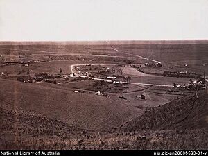
In 1850, the South Australia Company planned out the 'No-orlunga Township' right at this 'Horseshoe' bend of the Onkaparinga River.
Forming a Local Council
By 1856, people living on both sides of the Onkaparinga River decided to form their own local government. This led to the creation of the District Council of Noarlunga. This new council was formed by taking parts from two existing councils: the District of Morphett Vale (on the north bank) and the District Council of Willunga (on the south bank).
Growing into a Town
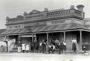
By the 1860s, Old Noarlunga had grown quite a bit. It had important buildings like a post office and a council chamber. There were also two churches, two hotels, a mill, a brewery, and a brickworks. It was a busy and active community.
A Popular Spot for Fun
Old Noarlunga became well-known for sports. Cycling clubs often visited the town. Throughout the 20th century, it was a popular stop for tourists. Many people would visit Old Noarlunga on their way to the beautiful beaches in the region.
Changing Roads and Names
In 1972, a new road called Main South Road was built. This new road went around the town, bypassing it. Then, in 1978, the local council decided to officially change the town's name to Old Noarlunga. However, many people living in the town at the time were not happy about this name change.
 | Aaron Henry |
 | T. R. M. Howard |
 | Jesse Jackson |


