Sturt River facts for kids
Quick facts for kids Sturt |
|
|---|---|

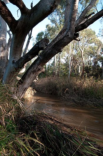
The Sturt River in Warriparinga
|
|
|
Location of the river mouth in South Australia
|
|
| Native name | Kaurna: Warri Parri |
| Other name(s) | Sturt Creek |
| Country | Australia |
| State | South Australia |
| Region | Adelaide |
| Physical characteristics | |
| Main source | Adelaide Hills Upper Sturt 395 m (1,296 ft) |
| River mouth | confluence with the Patawalonga River Glenelg North 0 m (0 ft) 34°57′40″S 138°30′56″E / 34.9611°S 138.5156°E |
| Length | 27 km (17 mi) |
| Basin features | |
| Basin size | 120 km2 (46 sq mi) |
| Protected area | Sturt Gorge Recreation Park |
The Sturt River is an important waterway in Adelaide, South Australia. It is also known as the Sturt Creek. The local Kaurna people call it Warri Parri, which means 'the windy place by the river'. This river flows from the hills down to the sea, playing a big role in the area's history and environment.
Contents
Where Does the Sturt River Flow?
The Sturt River begins high up in the Adelaide Hills, near a place called Upper Sturt. From there, it travels about 27 kilometers (17 miles) towards the coast. Along its journey, the river passes through several areas, including Coromandel Valley and the beautiful Sturt Gorge Recreation Park.
As it gets closer to the sea, the river flows through suburbs like Marion and Morphettville. Finally, it joins another river, the Patawalonga River, in Glenelg North. The Sturt River is one of the most important rivers that feed into the Patawalonga. Its entire water collection area, called a catchment area, covers about 120 square kilometers (46 square miles).
A Look Back in Time: The Sturt River's History
How Did the Kaurna People Use the River?
For thousands of years, the Indigenous Kaurna people lived along the Sturt River. They called it Warri Parri. This river was like a natural highway for them, helping them travel between the hills and the sea.
The Sturt River is also very special in Kaurna Dreaming stories. One important spot is Warriparinga, where the river leaves its rocky gorge and spreads out onto the flat plains of Adelaide. Other significant Kaurna campsites were found near where the Sturt River meets the Patawalonga, and in Chambers Gully in Coromandel Valley.
European Settlement and Naming
When British settlers arrived, they named the river after the famous explorer Charles Sturt. In 1836, when the new colony was being planned, Colonel William Light first thought about building the capital city of Adelaide right on the Sturt River, where the suburb of Marion is now. However, he later decided to build the city on the River Torrens instead.
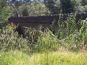
Many old buildings, some from the 1850s, can be found along the river, especially in the Coromandel Valley and Craigburn Farm areas. The very first bridge built over the river was Horner's Bridge in Corom6andel Valley, constructed in 1866.
Controlling Floods
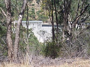
Over the years, people have worked to control the river's flow. In 1879, efforts were made to stop floods from damaging properties in Glenelg and the Morphettville Racecourse. Later, in 1965, a concrete channel was built to guide the river's path in some areas. Also in 1965, a special dam was constructed in the Sturt Gorge Recreation Park near Flagstaff Hill to help control floods.
The Sturt River Today
Where the River Flows Now
The Sturt River starts in Upper Sturt, then goes through quiet, semi-rural areas like Ironbank and Coromandel East. In these parts, it's hard to reach the river because the land is steep and covered in thick plants.
After that, it flows through residential suburbs such as Coromandel Valley and Craigburn Farm. Then it enters the Sturt Gorge Recreation Park, which stretches across Craigburn Farm, Flagstaff Hill, and Bellevue Heights. Once it leaves the gorge at South Road, the river continues through busy urban and residential areas. It also forms the northern border between the City of Onkaparinga and the City of Mitcham.
Protecting the River's Health
Because of cities growing and farming activities, the Sturt River's water quality and natural environment have been affected. To help fix this, a plan called the Sturt River Linear Park Master Plan was started in 2005.
This plan aims to create a continuous public green space along the river, from Glenelg North all the way to Coromandel Valley. It also focuses on making the river healthier for plants and animals. There are even ideas to connect this new park to Belair National Park using Minno Creek.
A government group called Waterwatch Adelaide involves primary school children in checking the river's water. They say the Sturt River's water quality is "generally good". This means it has low levels of salt, cloudiness, phosphorus, and nitrogen, and a medium pH level.
For people who love to be active outdoors, there's a paved path for walking and cycling along the Sturt River. This path runs between the Southern Expressway and Glenelg. At its southern end, it connects to the Adelaide Southern Veloway. This means you can have an almost continuous bike ride from Glenelg all the way to Willunga by linking up with the Coast to Vines Rail Trail.
 | Precious Adams |
 | Lauren Anderson |
 | Janet Collins |


