Orange, Virginia facts for kids
Quick facts for kids
Orange, Virginia
|
|
|---|---|
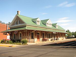
Restored train depot in Orange, now used as a visitors' center
|
|
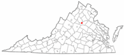
Location of Orange, Virginia
|
|
| Country | United States |
| State | Virginia |
| County | Orange |
| Incorporated | 1834; Officially in 1872 |
| Area | |
| • Total | 3.38 sq mi (8.75 km2) |
| • Land | 3.36 sq mi (8.71 km2) |
| • Water | 0.02 sq mi (0.04 km2) |
| Elevation | 522 ft (159 m) |
| Population
(2020)
|
|
| • Total | 4,880 |
| • Density | 1,516.22/sq mi (585.36/km2) |
| Time zone | UTC−5 (Eastern (EST)) |
| • Summer (DST) | UTC−4 (EDT) |
| ZIP code |
22960
|
| Area code(s) | 540 |
| FIPS code | 51-59496 |
| GNIS feature ID | 1498525 |
| Website | Town of Orange official website: http://www.townoforangeva.org/index.asp?NID=31 |
Orange is a town in Orange County, Virginia, United States. It is also the county seat, which means it's where the local government offices are located. In 2020, about 4,880 people lived here.
The town of Orange is located about 28 miles (45 km) northeast of Charlottesville. It's also 88 miles (142 km) southwest of Washington, D.C.. A famous historical site, Montpelier, the home of James Madison, the fourth U.S. president, is just 4 miles (6 km) east of Orange.
What is the History of Orange, Virginia?
Long ago, before Europeans arrived, the Piedmont area of Virginia was home to Native American tribes. These tribes spoke languages from the Siouan family.
How Did Orange Begin?
Before the late 1800s, the town we know as Orange was called Orange Court House. In 1749, the county courthouse was moved to this spot. At first, the court met in a man's house. By 1752, a new courthouse was built.
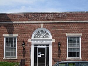
Back then, the town was very small. It had the courthouse, a few homes, some stores, and a tavern. The first U.S. Post Office opened in Orange in 1796. Between 1801 and 1804, a new courthouse, clerk's office, and jail were built.
In 1799, a man named Paul Verdier bought a large farm. He divided this land into smaller lots. This helped the town grow and shaped how it looks today. His house, called Montpeliso, is still standing. As new roads were built, Orange Court House became an important center for the region. In 1834, the state government tried to make Orange Court House an official town, but it didn't fully happen yet.
Growth Before the Civil War
Orange Court House kept growing. Many important buildings were built before the Civil War. These include the Sparks Building (1829), the Holladay House (1830), and the St. Thomas Episcopal Church (1833). You can still see these buildings in the Orange Commercial Historic District.
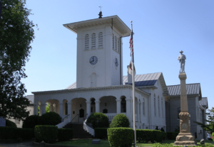
In 1847, the Orange and Alexandria Railroad decided to build its railway through Orange. This meant the courthouse had to be moved to a new spot. The fourth and current courthouse was finished in 1859. It is built in the Italian Villa style and is still used today. It was added to the National Register of Historic Places in 1979. The town officially became incorporated in 1872, after the Civil War ended.
Orange During the Civil War
Orange was a very important place during the American Civil War. The Rapidan River, just north of town, was the northern border of the Confederacy for a long time. Because of this, many soldiers moved through the area. There were also many small battles and army camps.
General Robert E. Lee, a famous Confederate leader, had his headquarters in Orange. He attended services at the St. Thomas Episcopal Church. This church also became a hospital for wounded Confederate soldiers after battles. County records from 1734 were saved by a clerk. He moved them to a safe place when Federal troops came through Orange.
Orange After the Civil War
Many buildings were constructed in the downtown area soon after the Civil War. In 1872, Orange Court House officially became a town. Its first town council meeting was held on June 28, 1872. In 1890, the town's name was officially changed to Orange.
The town's economy and population grew until a big fire in 1909. This fire destroyed much of the eastern part of town. Like other towns, Orange's importance as a railroad center began to decline. However, because of its location on two major roads, Orange became a center for car sales and services. This helped the town's economy stay strong even during the Great Depression.
A notable company in Orange was American Silk Mills, Inc., started in 1929. It turned raw silk into finished fabric. During World War II, the mill made parachutes for Allied troops. It even received an award from the president! Even though some industries moved away, Orange's population has continued to grow.
As of 2013, seven places within the town of Orange are listed on the National Register of Historic Places. This means they are important historical sites.
What is the Geography and Climate of Orange?
Orange is located at 38°14′45″N 78°6′35″W / 38.24583°N 78.10972°W.
The town covers about 3.38 square miles (8.75 square kilometers). Most of this area is land, with a very small amount of water.
Climate in Orange
| Climate data for Orange, Virginia (Piedmont Research Station) 1991–2020 normals, extremes 1946–present | |||||||||||||
|---|---|---|---|---|---|---|---|---|---|---|---|---|---|
| Month | Jan | Feb | Mar | Apr | May | Jun | Jul | Aug | Sep | Oct | Nov | Dec | Year |
| Record high °F (°C) | 81 (27) |
81 (27) |
88 (31) |
94 (34) |
95 (35) |
102 (39) |
106 (41) |
103 (39) |
106 (41) |
98 (37) |
86 (30) |
79 (26) |
106 (41) |
| Mean daily maximum °F (°C) | 44.4 (6.9) |
47.8 (8.8) |
55.6 (13.1) |
66.8 (19.3) |
74.3 (23.5) |
82.6 (28.1) |
86.5 (30.3) |
84.8 (29.3) |
78.6 (25.9) |
68.2 (20.1) |
57.3 (14.1) |
47.9 (8.8) |
66.2 (19.0) |
| Daily mean °F (°C) | 34.9 (1.6) |
37.7 (3.2) |
44.9 (7.2) |
55.5 (13.1) |
64.1 (17.8) |
72.5 (22.5) |
76.7 (24.8) |
75.1 (23.9) |
68.7 (20.4) |
57.3 (14.1) |
46.9 (8.3) |
38.6 (3.7) |
56.1 (13.4) |
| Mean daily minimum °F (°C) | 25.3 (−3.7) |
27.6 (−2.4) |
34.3 (1.3) |
44.2 (6.8) |
53.8 (12.1) |
62.5 (16.9) |
66.9 (19.4) |
65.4 (18.6) |
58.7 (14.8) |
46.3 (7.9) |
36.5 (2.5) |
29.2 (−1.6) |
45.9 (7.7) |
| Record low °F (°C) | −9 (−23) |
−11 (−24) |
4 (−16) |
18 (−8) |
28 (−2) |
41 (5) |
47 (8) |
44 (7) |
33 (1) |
22 (−6) |
9 (−13) |
−4 (−20) |
−11 (−24) |
| Average precipitation inches (mm) | 2.90 (74) |
2.61 (66) |
3.56 (90) |
3.38 (86) |
4.14 (105) |
4.79 (122) |
4.29 (109) |
3.38 (86) |
4.27 (108) |
3.62 (92) |
3.39 (86) |
3.41 (87) |
43.74 (1,111) |
| Average snowfall inches (cm) | 4.6 (12) |
5.6 (14) |
2.7 (6.9) |
0.1 (0.25) |
0.0 (0.0) |
0.0 (0.0) |
0.0 (0.0) |
0.0 (0.0) |
0.0 (0.0) |
0.0 (0.0) |
0.2 (0.51) |
3.2 (8.1) |
16.4 (42) |
| Average precipitation days (≥ 0.01 in) | 8.9 | 7.8 | 9.5 | 10.5 | 11.9 | 10.6 | 11.2 | 8.9 | 8.4 | 7.3 | 7.9 | 8.3 | 111.2 |
| Average snowy days (≥ 0.1 in) | 2.8 | 2.7 | 1.5 | 0.0 | 0.0 | 0.0 | 0.0 | 0.0 | 0.0 | 0.0 | 0.2 | 1.8 | 9.0 |
| Source: NOAA | |||||||||||||
How Do People Get Around in Orange?
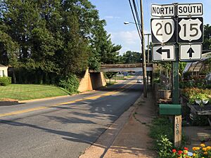
The main roads in Orange are U.S. Route 15 and Virginia State Route 20. U.S. 15 goes north to Culpeper and south to Gordonsville. SR 20 goes west to Charlottesville and east toward Fredericksburg.
Virginia Regional Transit runs a local bus service called Town of Orange Transit (TOOT). There's also a bus that connects Orange to Culpeper.
What is the Population of Orange?
| Historical population | |||
|---|---|---|---|
| Census | Pop. | %± | |
| 1870 | 731 | — | |
| 1880 | 547 | −25.2% | |
| 1890 | 571 | 4.4% | |
| 1900 | 536 | −6.1% | |
| 1910 | 674 | 25.7% | |
| 1920 | 1,078 | 59.9% | |
| 1930 | 1,381 | 28.1% | |
| 1940 | 1,980 | 43.4% | |
| 1950 | 2,571 | 29.8% | |
| 1960 | 2,955 | 14.9% | |
| 1970 | 2,768 | −6.3% | |
| 1980 | 2,631 | −4.9% | |
| 1990 | 2,582 | −1.9% | |
| 2000 | 4,123 | 59.7% | |
| 2010 | 4,721 | 14.5% | |
| 2020 | 4,880 | 3.4% | |
| U.S. Decennial Census | |||
In 2010, there were 4,721 people living in Orange. The town had 1,779 households and 1,058 families. About 1,423 people lived in each square mile.
Most people in Orange were White (72.1%). About 22.9% were African American. Other groups included Native American, Asian, and people of two or more races. About 3.5% of the population was Hispanic or Latino.
About 27.5% of households had children under 18. Many households were married couples living together (36.0%). About 34.2% of households had someone living alone. The average household had 2.32 people.
The median age in Orange was 40.3 years old. This means half the people were older than 40.3 and half were younger. About 21.1% of the population was under 18.
The median income for a household in Orange was $37,191. For a family, it was $49,524. About 21.2% of the total population lived below the poverty line. This included 29.4% of those under 18 and 24.6% of those 65 or older.
What Schools are in Orange County?
The Orange County School System includes several schools:
- Orange County High School
- Prospect Heights Middle School
- Locust Grove Middle School
- Locust Grove Elementary School
- Orange Elementary School
- Unionville Elementary School
- Gordon-Barbour Elementary School
- Lightfoot Elementary School (grades 3–5)
- Locust Grove Primary School
- Taylor Educational Administration Complex (this is where the school administrative offices are)
Who are Some Famous People from Orange?
Here are some notable people who have connections to Orange:
- Norman C. Bailey (1890–1969), a former mayor of Orange and state delegate.
- Cathy Baker, an actress known for the TV show Hee Haw.
- Nannie Helen Burroughs, an important African American educator and religious leader.
- Chris Haney, a Major League Baseball (MLB) pitcher.
- Larry Haney, an MLB catcher and coach.
- Patrick Kilpatrick, an actor.
- Randolph Scott, a famous western film actor.
- James Taliaferro, a U.S. senator for Florida.
- Jeanette Walls, a journalist and author of books like The Glass Castle.
What Local News Does Orange Have?
The Orange County Review is a weekly newspaper based in Orange. It focuses on local community news. It also publishes public notices from Orange County officials. The newspaper is owned by Berkshire Hathaway Inc..
See also
 In Spanish: Orange (Virginia) para niños
 | Valerie Thomas |
 | Frederick McKinley Jones |
 | George Edward Alcorn Jr. |
 | Thomas Mensah |


