
Orrell, Greater Manchester facts for kids
Quick facts for kids Orrell |
|
|---|---|
.JPG) St. Luke's Parish Church |
|

Orrell
|
|
| Population | 12,000 |
| OS grid reference | SD531051 |
| Metropolitan borough |
|
| Metropolitan county | |
| Region | |
| Country | England |
| Sovereign state | United Kingdom |
| Post town | WIGAN |
| Postcode district | WN5 |
| Dialling code | 01942 01695 |
| Police | Greater Manchester |
| Fire | Greater Manchester |
| Ambulance | North West |
| EU Parliament | North West England |
| UK Parliament |
|
Orrell is a lively area located in Greater Manchester, England. It's a suburb of the larger town of Wigan. A suburb is like a neighborhood just outside a main city or town.
Orrell is about 3 miles (5 km) west of Wigan town centre. It's right next to another area called Pemberton. In 2011, about 11,513 people lived in the Orrell area.
Historically, Orrell was part of Lancashire. It was once a very important place for coal mining. Today, you won't see much evidence of its industrial past. Orrell is now mostly a residential area. Many people who live here travel to work in nearby towns and cities.
Contents
History of Orrell
Orrell's name comes from old Anglo-Saxon words. Ora means "ore" and hyll means "hill". So, Orrell means "a hill where ore is dug". Over time, its name was written in different ways, like Horul or Orel.
Long ago, before the Norman Conquest of England, Orrell was part of a larger area called Newton-in-Makerfield. In 1212, a person named Richard de Orrell owned the land. Over many centuries, the ownership of Orrell changed hands several times. Different families, like the Hollands and the Lovels, owned parts of it.
Orrell's Industrial Past
From about 1740 to 1850, coal mining was a huge industry in Orrell. The area was rich in coal. To move the coal, a special railway was built in 1812. It connected the coal pits to the Leeds and Liverpool Canal. This canal was like a highway for boats, used to transport goods.
At the same time, many people in Orrell made nails at home. This was called a "cottage industry". There was also a cotton mill called Sandbrook. Here, raw cotton was spun into thread.
Today, Orrell doesn't have big industries like it used to. It's mainly a place where people live.
Orrell After the Wars
After World War II, Orrell changed a lot. Two major roads, the M6 and M58 motorways, were built through the area. These motorways divided Orrell into two parts.
One part is near the railway station. The other part is called Orrell Post. This name comes from an old "post" or sign. It marked a stopping point on a main road long ago. You can still see the original "post" outside the Stag public house. Because Orrell is close to Wigan and has good motorway links, it's a popular place for people who travel for work.
How Orrell is Governed
From 1894 to 1974, Orrell had its own local government. It was called the Orrell Urban District. It was part of Lancashire.
In 1974, big changes happened in local government. Orrell's urban district was removed. The area became part of the new Metropolitan Borough of Wigan. This borough is part of Greater Manchester.
Orrell is also part of the Makerfield parliamentary constituency. This means people in Orrell vote for a Member of Parliament (MP) to represent them in the UK Parliament. The current MP for Makerfield is Yvonne Fovargue from the Labour Party.
Orrell's Location
Orrell is located near Junction 26 of the M6 motorway. The M6 motorway runs right through the area. The part of Orrell east of the M6 is directly next to Pemberton. Orrell and Pemberton together form one continuous residential area.
Orrell is one of 25 electoral wards in the Metropolitan Borough of Wigan. It is the most western ward in Greater Manchester.
Education in Orrell
Orrell has several schools and colleges.
- St John Rigby College is located at the northern edge of Orrell.
- St Peter's Catholic High School is known for its strong academic results. It's near Orrell Library.
- Dean Trust Wigan is on the eastern side of the M6 Motorway.
Community Places
Orrell Library used to be on Orrell Road. In 2010, it moved to the new Abraham Guest High School. The old library building is now home to 'Book Cycle'. This is a volunteer-run place where you can swap books for a small donation.
To the south of Orrell is Orrell Water Park. This used to be a place for storing water. Now, it's a fun place for people to visit. You can go for walks, fish, or have a picnic there.
The radio station Wish FM used to have its studios in Orrell. It broadcasted to the Wigan and St Helens areas. In 2020, Wish FM joined other stations to become Greatest Hits Radio North West. The old studio building is now used by a training company.
Getting Around Orrell
The main road in Orrell is the A577. This road connects Boothstown to Ormskirk. The M6 motorway also runs through Orrell.
Other important roads nearby include the East Lancashire Road and the M62. These roads make it easy to get to places like Salford and Manchester. The M58 connects the Wigan area to West Lancashire and Liverpool.
Orrell railway station is in the southern part of Orrell. From here, you can catch trains going east to Manchester Victoria (stopping at Wigan Wallgate). You can also go west to Kirkby.
Sports in Orrell
Orrell is home to Orrell Rugby Union Football Club. They play in the South Lancashire & Cheshire Division 2. The junior teams of the Wigan RLFC rugby league club also play their home games here. Orrell Rugby Union Football Club moved its home games to St John Rigby College in 2007.
The Orrell Otters Football Club is another local team. They play in the South Lancs Counties Second Division. They even won the Third Division championship in their first season! In 2010, they also won the Houghton Memorial Cup.
Gallery
-
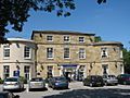
The Mount Public House
-
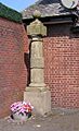
The Post at Orrell Post
-
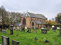
The Parish Church of St. Luke's
-
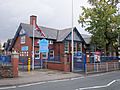
Newfold C.P. School


.JPG)

