Pemberton, Greater Manchester facts for kids
Quick facts for kids Pemberton |
|
|---|---|
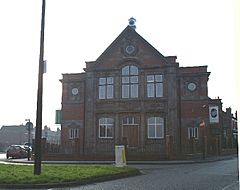
 Pemberton Carnegie Library |
|
| Population | 13,982 (2011 Census) |
| OS grid reference | SD555045 |
| Metropolitan borough |
|
| Metropolitan county | |
| Region | |
| Country | England |
| Sovereign state | United Kingdom |
| Post town | WIGAN |
| Postcode district | WN5 |
| Dialling code | 01942 |
| Police | Greater Manchester |
| Fire | Greater Manchester |
| Ambulance | North West |
| EU Parliament | North West England |
| UK Parliament |
|
Pemberton is a part of Wigan, located in Greater Manchester, England. It sits near the River Douglas and close to the M6 motorway. Pemberton is right next to Orrell. In 2011, about 13,982 people lived here.
Long ago, Pemberton was part of Lancashire. During the Industrial Revolution, it grew into a busy area. Many coal mines, stone quarries, brick factories, and cotton mills were built here. Coal mining was the main job.
Contents
History of Pemberton
What's in a Name?
The name Pemberton comes from old words. Penn is a Celtic word meaning "hill." Bere is an Old English word for "barley." And tūn means "farm" or "settlement." So, Pemberton likely means "barley farm on a hill."
Early Records
Pemberton isn't mentioned in the Domesday Book from 1086. We first see it in records in 1212. Back then, it was a special type of estate called a "thegnage estate." This meant it was a large piece of land owned by a noble. The person living there, Alan de Windle, paid 20 shillings each year to King John.
Industrial Growth
Pemberton became very important for its industries. There were many coal mines, where people dug for coal. Sandstone was also dug out of the ground from quarries. In an area called Newtown, there were cotton mills and iron works. A well at Lamberhead Green was famous for its clean water. Today, Pemberton has its own train station, Pemberton railway station.
How Pemberton is Governed
Pemberton is part of the Wigan area. It is managed by the Wigan Council.
Electoral Ward
Pemberton is also an "electoral ward." This is a special area used for elections. People living in the ward vote for their local representatives, called councillors. Three councillors represent the Pemberton ward.
The Pemberton ward includes these neighbourhoods:
- Kitt Green
- Lamberhead Green (part of Orrell)
- Marsh Green
Your Local Councillors
The people who represent Pemberton on the Wigan Council are:
| Name | Party | Role | |
|---|---|---|---|
| Cllr. Paul Prescott | Labour | Helps with planning, environment, and transport | |
| Cllr. Jeanette Prescott | Labour | ||
| Cllr. Eileen Rigby | Labour |
A past councillor, Barbara Bourne, worked for Pemberton from 1996. She helped get a new medical centre built in Kitt Green in 2010.
Geography of Pemberton
Pemberton is mostly made up of homes. These include houses owned by people and homes managed by the local council. Some of these areas are Newtown, Worsley Mesnes, Norley Hall, Worsley Hall, and Marsh Green. Pemberton and its neighbour, Orrell, form one large living area.
The ground here is made of clay and loam. Below that, you can find Coal Measures (rock layers with coal) and stone.
 | Bayard Rustin |
 | Jeannette Carter |
 | Jeremiah A. Brown |


