
Osceola, Iowa facts for kids
Quick facts for kids
Osceola, Iowa
|
|
|---|---|

Osceola Commercial Historic District
|
|

Location of Osceola, Iowa
|
|
| Country | United States |
| State | Iowa |
| County | Clarke |
| Area | |
| • Total | 7.60 sq mi (19.68 km2) |
| • Land | 7.26 sq mi (18.81 km2) |
| • Water | 0.33 sq mi (0.86 km2) |
| Elevation | 1,119 ft (341 m) |
| Population
(2020)
|
|
| • Total | 5,415 |
| • Density | 745.56/sq mi (287.85/km2) |
| Time zone | UTC-6 (Central (CST)) |
| • Summer (DST) | UTC-5 (CDT) |
| ZIP code |
50213
|
| Area code(s) | 641 |
| FIPS code | 19-59835 |
| GNIS feature ID | 468477 |
Osceola is a city in Iowa, United States. It's the main town, or county seat, of Clarke County, Iowa. In 2020, about 5,415 people lived there.
Contents
- What's in a Name? The Story of Osceola's Name
- Osceola's Past: Key Moments in History
- Where is Osceola? Understanding its Geography
- Who Lives in Osceola? A Look at the Population
- How Osceola Works: Infrastructure and Services
- Fun Things to See and Do: Osceola's Attractions
- Famous Faces: Notable People from Osceola
- Images for kids
- See also
What's in a Name? The Story of Osceola's Name
Osceola was named after a famous Seminole Indian leader. His name was Asiyahola, which means "black drink singer." This name came from a special tea made from yaupon holly, called a "black drink." It was served while honoring a Creek god named Yaholi.
Osceola's Past: Key Moments in History

In 1872, the Masonic Building was built in Osceola's town square. This beautiful building, with its Italianate style, was used by a group called the Ancient Free & Accepted Masons. The ground floor also had a bank and a hardware store.
Dealing with Drought: Water Challenges
In late 2023, Osceola faced a serious drought, which is a long period with very little rain. The city's water supply, West Lake, was affected. Because of this, the city asked people to use bottled water instead of tap water. In early 2024, the local schools even turned off drinking water in their buildings due to the severe water shortage.
Where is Osceola? Understanding its Geography
Osceola is located where three important roads meet: Interstate 35, U.S. Route 34, and U.S. Route 69. It's about 35 miles (56 km) north of the Missouri border. It's also about 40 mi (64 km) south of Des Moines, a larger city in Iowa.
The city covers a total area of about 6.68 square miles (17.30 km2). Most of this area, about 6.48 square miles (16.78 km2), is land. The rest, about 0.20 square miles (0.52 km2), is water.
Osceola's Weather: A Look at the Climate
Osceola has a type of weather called a hot-summer humid continental climate. This means it has warm, humid summers and cold winters. On climate maps, this is often shown as "Dfa."
| Climate data for Osceola, Iowa, 1991–2020 normals, extremes 1894–present | |||||||||||||
|---|---|---|---|---|---|---|---|---|---|---|---|---|---|
| Month | Jan | Feb | Mar | Apr | May | Jun | Jul | Aug | Sep | Oct | Nov | Dec | Year |
| Record high °F (°C) | 68 (20) |
75 (24) |
87 (31) |
90 (32) |
100 (38) |
102 (39) |
107 (42) |
105 (41) |
103 (39) |
94 (34) |
82 (28) |
74 (23) |
107 (42) |
| Mean maximum °F (°C) | 54.6 (12.6) |
59.7 (15.4) |
74.5 (23.6) |
82.0 (27.8) |
87.8 (31.0) |
92.4 (33.6) |
96.5 (35.8) |
95.1 (35.1) |
91.1 (32.8) |
83.8 (28.8) |
70.4 (21.3) |
58.6 (14.8) |
97.8 (36.6) |
| Mean daily maximum °F (°C) | 32.2 (0.1) |
36.7 (2.6) |
50.0 (10.0) |
62.4 (16.9) |
72.2 (22.3) |
82.2 (27.9) |
86.5 (30.3) |
84.7 (29.3) |
78.0 (25.6) |
64.8 (18.2) |
50.1 (10.1) |
37.3 (2.9) |
61.4 (16.3) |
| Daily mean °F (°C) | 21.8 (−5.7) |
25.9 (−3.4) |
38.2 (3.4) |
49.8 (9.9) |
60.7 (15.9) |
70.8 (21.6) |
75.2 (24.0) |
73.0 (22.8) |
64.7 (18.2) |
52.0 (11.1) |
38.5 (3.6) |
27.2 (−2.7) |
49.8 (9.9) |
| Mean daily minimum °F (°C) | 11.4 (−11.4) |
15.0 (−9.4) |
26.4 (−3.1) |
37.2 (2.9) |
49.1 (9.5) |
59.5 (15.3) |
63.9 (17.7) |
61.4 (16.3) |
51.3 (10.7) |
39.1 (3.9) |
26.9 (−2.8) |
17.1 (−8.3) |
38.2 (3.4) |
| Mean minimum °F (°C) | −10.2 (−23.4) |
−6.1 (−21.2) |
7.5 (−13.6) |
21.9 (−5.6) |
34.3 (1.3) |
45.8 (7.7) |
53.6 (12.0) |
50.5 (10.3) |
36.1 (2.3) |
23.5 (−4.7) |
10.3 (−12.1) |
−2.3 (−19.1) |
−14.9 (−26.1) |
| Record low °F (°C) | −28 (−33) |
−32 (−36) |
−20 (−29) |
7 (−14) |
24 (−4) |
37 (3) |
42 (6) |
38 (3) |
23 (−5) |
9 (−13) |
−7 (−22) |
−27 (−33) |
−32 (−36) |
| Average precipitation inches (mm) | 0.97 (25) |
1.28 (33) |
2.13 (54) |
4.12 (105) |
5.50 (140) |
5.28 (134) |
4.47 (114) |
4.60 (117) |
3.85 (98) |
2.89 (73) |
2.11 (54) |
1.54 (39) |
38.74 (986) |
| Average snowfall inches (cm) | 8.2 (21) |
7.2 (18) |
3.1 (7.9) |
1.1 (2.8) |
0.2 (0.51) |
0.0 (0.0) |
0.0 (0.0) |
0.0 (0.0) |
0.0 (0.0) |
0.5 (1.3) |
2.1 (5.3) |
5.7 (14) |
28.1 (70.81) |
| Average precipitation days (≥ 0.01 in) | 5.2 | 6.2 | 8.0 | 9.8 | 12.7 | 10.8 | 8.8 | 9.0 | 7.7 | 8.3 | 6.2 | 5.7 | 98.4 |
| Average snowy days (≥ 0.1 in) | 2.9 | 3.9 | 1.5 | 0.5 | 0.0 | 0.0 | 0.0 | 0.0 | 0.0 | 0.2 | 0.9 | 2.9 | 12.8 |
| Source 1: NOAA | |||||||||||||
| Source 2: National Weather Service | |||||||||||||
Who Lives in Osceola? A Look at the Population
| Historical population | ||
|---|---|---|
| Year | Pop. | ±% |
| 1870 | 1,298 | — |
| 1880 | 1,769 | +36.3% |
| 1890 | 2,120 | +19.8% |
| 1900 | 2,505 | +18.2% |
| 1910 | 2,416 | −3.6% |
| 1920 | 2,684 | +11.1% |
| 1930 | 2,871 | +7.0% |
| 1940 | 3,281 | +14.3% |
| 1950 | 3,422 | +4.3% |
| 1960 | 3,350 | −2.1% |
| 1970 | 3,124 | −6.7% |
| 1980 | 3,750 | +20.0% |
| 1990 | 4,164 | +11.0% |
| 2000 | 4,659 | +11.9% |
| 2010 | 4,929 | +5.8% |
| 2020 | 5,415 | +9.9% |
| Source: Source: |
||
Population in 2020
In 2020, the census counted 5,415 people living in Osceola. There were 2,138 households, which are groups of people living together. The city had about 745 people per square mile.
Most of the people in Osceola, about 75.6%, were White. About 26.1% of the population were Hispanic or Latino.
The average age in the city was 36.6 years old. About 27.9% of the people were under 20 years old.
Population in 2010
The 2010 census showed that 4,929 people lived in Osceola. There were 1,974 households. The population density was about 760 people per square mile.
About 91.0% of the people were White, and 17.6% were Hispanic or Latino. The average age was 36.8 years. About 26.1% of residents were under 18 years old.
How Osceola Works: Infrastructure and Services
Getting Around: Transportation
Amtrak, the national passenger train system, has a station in Osceola. You can catch the California Zephyr train here. It travels daily between Chicago and Emeryville, California. There's also a bus that connects Osceola to Des Moines.
Water Supply
The community gets its water from West Lake. This lake is an important source of drinking water for the city.
Fun Things to See and Do: Osceola's Attractions
The historic Masonic Building was once on a list of endangered buildings because it needed a lot of repairs. But in 2011, it was fixed up with help from grants. The upper floors were turned into nice apartments. A restaurant called China Star was also updated and now uses the whole ground floor. The outside of the building was restored to look like it did originally.
Lakeside Casino Resort is a fun place located on West Lake. It's designed to look like a riverboat. This casino has been open since around 2000. It has been bought and sold a few times over the years. After a big renovation, the casino brought back its original name, Lakeside.
Famous Faces: Notable People from Osceola
- Dorothy Clark, an author who wrote under the name Clark McMeekin; she was born in Osceola.
- Dwight Harken, a surgeon who created new ways to do cardiac surgery (heart operations).
- Edgar Howard, who was the Lieutenant Governor of Nebraska and served many terms in the United States House of Representatives.
- W. Ward Reynoldson, who was the Chief Justice of the Iowa Supreme Court.
Images for kids
-
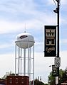
Osceola water tower
-
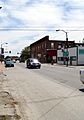
Main Street in Osceola
-
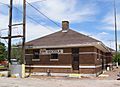
Amtrak Station in Osceola
-
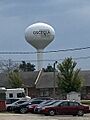
Water tower in Osceola


See also
 In Spanish: Osceola (Iowa) para niños
