
Oswego (town), New York facts for kids
Quick facts for kids
Oswego, New York
|
|
|---|---|
| Town of Oswego | |
_highlighted.svg)
Location in Oswego County and the state of New York.
|
|
| Country | United States |
| State | New York |
| County | Oswego |
| Area | |
| • Total | 29.3 sq mi (76.0 km2) |
| • Land | 27.4 sq mi (71.0 km2) |
| • Water | 1.9 sq mi (5.0 km2) |
| Elevation | 341 ft (104 m) |
| Population
(2010)
|
|
| • Total | 7,984 |
| Time zone | UTC-5 (Eastern (EST)) |
| • Summer (DST) | UTC-4 (EDT) |
| ZIP code |
13126
|
| Area code(s) | 315 |
| FIPS code | 36-55585 |
| GNIS feature ID | 0979326 |
Oswego is a town located in Oswego County, New York. It is part of the United States. In 2010, about 7,984 people lived here.
The Town of Oswego is right next to the City of Oswego. They share a common border. This town is in the western part of Oswego County.
You can find the State University of New York at Oswego (SUNY Oswego) in the northeast part of the town. It is very close to the City of Oswego.
Oswego is also famous as the birthplace of Mary Edwards Walker. She was the only woman ever to receive the Medal of Honor!
Contents
History of Oswego
The town of Oswego was first settled around 1797. It was officially created in 1818. This happened when it separated from the Town of Hannibal. Oswego is located on the western edge of Oswego County.
Over the years, parts of Oswego were used to form other areas. In 1836, some land was given to the Town of Granby. Then, in 1848, the "Village of Oswego" became the City of Oswego. This also took a piece of the town. Later, the creation of the Town of Minetto made Oswego even smaller.
Geography of Oswego
The town of Oswego covers about 29.3 square miles (76.0 square kilometers). Most of this area, about 27.4 square miles (71.0 square kilometers), is land. The rest, about 1.9 square miles (5.0 square kilometers), is water.
Lake Ontario and the Oswego River help form the town's boundaries. The western border of the town is also the border of Cayuga County.
Two important roads, New York State Route 104 and New York State Route 104A, meet in the town at a place called Southwest Oswego.
Population and People
| Historical population | |||
|---|---|---|---|
| Census | Pop. | %± | |
| 1820 | 992 | — | |
| 1830 | 2,703 | 172.5% | |
| 1840 | 4,665 | 72.6% | |
| 1850 | 2,445 | −47.6% | |
| 1860 | 3,181 | 30.1% | |
| 1870 | 3,043 | −4.3% | |
| 1880 | 3,022 | −0.7% | |
| 1890 | 2,772 | −8.3% | |
| 1900 | 2,737 | −1.3% | |
| 1910 | 2,671 | −2.4% | |
| 1920 | 1,662 | −37.8% | |
| 1930 | 1,830 | 10.1% | |
| 1940 | 1,972 | 7.8% | |
| 1950 | 2,106 | 6.8% | |
| 1960 | 2,796 | 32.8% | |
| 1970 | 6,514 | 133.0% | |
| 1980 | 7,865 | 20.7% | |
| 1990 | 8,027 | 2.1% | |
| 2000 | 7,287 | −9.2% | |
| 2010 | 7,984 | 9.6% | |
| 2014 (est.) | 7,920 | −0.8% | |
| U.S. Decennial Census | |||
In 2000, there were 7,287 people living in Oswego. These people lived in 1,734 households, and 1,255 of these were families. The population density was about 265.8 people per square mile.
Most of the people in Oswego were White (94.00%). There were also African Americans (2.46%), Asians (1.25%), and Native Americans (0.14%). About 2.00% of the population identified as Hispanic or Latino.
In 2000, 35.1% of households had children under 18 living with them. About 61.9% were married couples. The average household had 2.64 people, and the average family had 3.09 people.
The median age in the town was 22 years old. This means half the people were younger than 22, and half were older. About 41.9% of the population was between 18 and 24 years old.
The median income for a household in the town was $49,883. For families, the median income was $61,648. The average income per person in the town was $14,835. About 7.8% of the population lived below the poverty line.
Places in the Town of Oswego
The Town of Oswego has several smaller communities and locations:
- Burts Point – This is a spot west of Oswego Beach. It sticks out into Lake Ontario.
- Camp Hollis – You can find this place near Lake Ontario, north of Southwest Oswego.
- Fruit Valley – This small community is on Route 104, west of the City of Oswego. It's sometimes called "Union Village" and is one of the oldest communities in the town.
- Furniss – This is a small community located south of Oswego Center.
- Oswego Beach – This lakeside community is right on the shore of Lake Ontario, close to the City of Oswego.
- Oswego Center – This community is located near the middle of the town.
- Southwest Oswego – This community is in the northwestern part of the town, also on Route 104.
Education in Oswego
Most of the town of Oswego is part of the Oswego City School District. However, some parts of the town are in the Hannibal Central School District and the Fulton City School District.
A large part of the State University of New York at Oswego (SUNY Oswego) campus is located within the town. The SUNY Oswego census-designated place covers much of this university property.
Images for kids
-
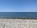
Lake Ontario as seen in the Town of Oswego.

See also
 In Spanish: Oswego (pueblo) para niños
