Outerside facts for kids
Quick facts for kids Outerside |
|
|---|---|

|
|
| Highest point | |
| Elevation | 596 m (1,955 ft) |
| Prominence | c. 70 m |
| Parent peak | Crag Hill |
| Listing | Wainwright |
| Geography | |
| Location | Cumbria, England |
| Parent range | Lake District, North Western Fells |
| OS grid | NY211214 |
| Topo map | OS Landrangers 89, 90, Explorer OL4 |
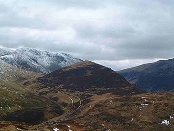
Outerside is a fell (which means a hill or mountain) located in the beautiful Lake District in Cumbria, England. It sits about 6 kilometres west of the town of Keswick. Outerside is part of a group of hills known as the Coledale fells. It's not the tallest, standing at 568 metres (1,863 feet) high. This fell is part of a long ridge. This ridge starts from the taller Scar Crags and goes down past another smaller fell called Barrow. Finally, it reaches the valley near the village of Braithwaite.
Contents
What is Outerside Like?
Outerside is part of the North Western Fells area. This area is found between two rivers, the Derwent and the Cocker. It's a hilly region shaped a bit like an oval.
Outerside is in the middle section of these fells. This part rises between Whinlatter Pass and Newlands Pass. The highest ground in the North Western Fells is a ridge that runs from east to west. This ridge starts with Grasmoor and slowly gets lower as it goes east. It passes over Crag Hill, Sail, Scar Crags, and Causey Pike.
Outerside is like a smaller hill connected to Scar Crags. It stands north of the main ridge. There's a marshy (wet and boggy) area called High Moss between them.
Outerside's Shape and Surroundings
Outerside often looks like a cone from many angles. Its upper parts are mostly covered in heather plants. To the north of the fell is the Coledale valley. This valley slopes down towards Braithwaite village.
To the south is a small valley called Stonycroft Gill. This gill (a narrow stream) starts at High Moss. It flows east between Outerside and Causey Pike. All the water from Outerside eventually flows into Bassenthwaite Lake.
Northeast of Outerside, the ridge continues over Low Moss. It then reaches a smaller peak called Stile End. Beyond Stile End is Barrow, which is a nicely shaped fell that looks over Braithwaite village.
How Was Outerside Formed?
The rocks that make up Outerside are mostly mudstone and siltstone. These types of rocks are common in the Skiddaw group of fells. In some areas, like High and Low Moss, there is also peat on top of the rocks. Peat is a type of soil made from decayed plants.
Unlike many hills in the Lake District, Outerside has no history of mining. This means people haven't dug for minerals there.
How to Climb Outerside
People usually start their climb up Outerside from either Braithwaite village or Stair in the Newlands Valley.
If you start from Stair, you can use an old mine road. This road goes up Stoneycroft Gill and crosses the side of the fell at about 460 metres (1,510 feet) high. From there, you walk north to reach the top.
If you start directly from Braithwaite, you follow Barrow Gill southwest. Then you head west to reach the highest point. Many people like to climb Outerside along with the nearby fell of Barrow. The two fells are connected by a ridge, making it easy to visit both.
What Can You See from the Top?
From the top of Outerside, there's a pile of stones called a cairn. The views from here are partly blocked by the taller Coledale fells. These include Grisedale Pike, Crag Hill, and Causey Pike, which form a curve to the west.
However, you get a great view of the Helvellyn range to the east. You can also see the Skiddaw group of fells to the northeast. There's also a clear view directly down into Coledale valley, where you can spot the Force Crag mine at its far end.
 | Claudette Colvin |
 | Myrlie Evers-Williams |
 | Alberta Odell Jones |


