Padilla Bay facts for kids
Quick facts for kids Padilla Bay |
|
|---|---|

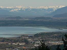
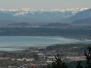
The south portion of Padilla Bay with March Point (foreground) and the Skagit River Valley in the distance
|
|
| Lua error in Module:Location_map at line 420: attempt to index field 'wikibase' (a nil value). | |
| Location | Washington, United States |
| Type | Bay |
| Part of | Salish Sea |
Padilla Bay is a beautiful bay in the U.S. state of Washington. It sits between the San Juan Islands and the mainland. To its west, you'll find Fidalgo Island and Guemes Island.
The Guemes Channel connects Padilla Bay to Rosario Strait. North of the bay is Samish Island, leading to Samish Bay and Bellingham Bay. It's a special place full of nature!
Contents
Discovering Padilla Bay's Past
In 1791, a Spanish explorer named José María Narváez discovered this bay. He named it "Seno Padillo." This name honored Juan Vicente de Güemes Padilla Horcasitas. He was a very important leader, like a governor, in New Spain at that time.
What is an Estuary?
Padilla Bay is a special type of place called a tidal bay or an estuary. This means it's where fresh water from rivers mixes with salty ocean water. It's also a place where the water level changes a lot with the tides.
High and Low Tides
When the tide is high, the bay is completely full of water. But at low tide, large areas of mud flats appear. These mud flats are like giant playgrounds for many birds and animals. They find lots of food there!
Shallow Waters and Dikes
The bay is quite shallow. Near Hat Island, the water is only about 12 feet (4 m) deep. Some parts of the estuary's mud flats are surrounded by walls called dikes. These dikes were built long ago to turn the muddy land into farms.
The Swinomish Channel
The Swinomish Channel is a saltwater path in Washington State. It links Skagit Bay in the south to Padilla Bay in the north. This channel separates Fidalgo Island from the mainland. Long ago, the Skagit River used to flow right into Padilla Bay.
The Padilla Bay Reserve
The Padilla Bay National Estuarine Research Reserve is a huge protected area. It covers about 8,004 acres (32 km2) of this important estuary. It's located in Skagit County, Washington.
Breazeale Interpretive Center
Inside the reserve, you'll find the Breazeale Interpretive Center. This center is a fantastic place to learn! It has cool exhibits about the bay's history and how its ecosystem works. There are also fish tanks, a hands-on room, and a video theater.
Learning and Exploring
The center also has classrooms and places for scientists to do research. You can even access a beach from here! Many students from Western Washington University and the University of Washington come here to study.
Trails and Management
Padilla Bay became part of the National Estuarine Research Reserve system in 1980. The Washington Department of Ecology helps manage and protect it. There are several trails for visitors. One trail is wheelchair-friendly and leads to an observation deck. Another trail is about 2.25 miles (3.62 km) long and runs along the top of the dikes.
Location Details
The research center is in the beautiful Skagit Valley of Washington. The closest town is Anacortes, Washington, which is about 6 miles (10 km) away.
 | Delilah Pierce |
 | Gordon Parks |
 | Augusta Savage |
 | Charles Ethan Porter |


