
Peachester, Queensland facts for kids
Quick facts for kids PeachesterSunshine Coast, Queensland |
|||||||||||||||
|---|---|---|---|---|---|---|---|---|---|---|---|---|---|---|---|

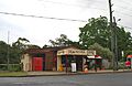
General store
|
|||||||||||||||

Peachester
Location in Queensland
|
|||||||||||||||
| Population | 1,460 (2021 census) | ||||||||||||||
| • Density | 26.21/km2 (67.9/sq mi) | ||||||||||||||
| Postcode(s) | 4519 | ||||||||||||||
| Area | 55.7 km2 (21.5 sq mi) | ||||||||||||||
| Time zone | AEST (UTC+10:00) | ||||||||||||||
| Location | |||||||||||||||
| LGA(s) | Sunshine Coast Region | ||||||||||||||
| County | Canning | ||||||||||||||
| Parish | Durundur | ||||||||||||||
| State electorate(s) | Glass House | ||||||||||||||
| Federal Division(s) | Fisher | ||||||||||||||
|
|||||||||||||||
Peachester is a small rural town. It is also a locality in the Sunshine Coast Region of Queensland, Australia. In 2021, about 1,460 people lived in Peachester.
Contents
Where is Peachester Located?
Peachester is found in the beautiful Sunshine Coast hinterland. This means it is inland, away from the coast. The D'Aguliar mountain range starts in the north-west part of the area. The Kilcoy–Beerwah Road runs right through Peachester from west to east.
Peachester's Past: A Look Back in Time
How Peachester Got Its Name
Peachester got its name in 1888. A man named William Embury Hill was surveying the town. He named it after a peach tree. This tree was growing right at a crossing of the Stanley River.
Early Buildings and Schools
A public hall was built in Peachester in 1889. This hall was important for the community.
Peachester Provisional School opened on 19 April 1892. It started in the public hall. The school closed for a short time in 1893 because not many students attended. But it reopened in 1894. On 2 May 1910, it became Peachester State School.
Industries and Community Life
In the early days, people in Peachester worked in dairying. They also cut down timber for Grigor's sawmill.
In 1906, a special ceremony happened for a new Anglican church. It was called St Andrew's Anglican church. The church was officially opened in 1908. Sadly, a big storm called Tropical Cyclone Annie destroyed the church in 1963. It was never rebuilt.
Peachester also had a Post Office. It opened by 1918 and closed in 1974. From the 1930s to the 1950s, Peachester was home to Inigo Jones. He was famous for forecasting the weather a long time in advance. A factory that made fruit cases also operated here in the 1920s and after World War II.
Who Lives in Peachester?
In 2021, the population of Peachester was 1,460 people. The number of people living here has grown over the years. In 2006, there were 452 people. By 2011, it grew to 1,259 people. In 2016, the population was 1,357.
Education in Peachester
Peachester State School is a primary school for students from Prep to Year 6. It is located at 966 Peachester Road. In 2018, the school had 85 students. There were 11 teachers and 9 other staff members.
There is no high school in Peachester itself. Students usually go to nearby high schools. These include Beerwah State High School in Beerwah or Maleny State High School in Maleny.
Community Services and Places
Local Amenities
The Sunshine Coast Regional Council offers a mobile library service. This library on wheels visits near the Community Hall.
The Peachester branch of the Queensland Country Women's Association meets at Peachester Hall. This hall is located at 963 Peachester Road.
Other Facilities
The Peachester Cemetery is not actually in Peachester. It is located on Cemetery Road in Crohamhurst.
Images for kids
-
General store
