Bald Knob, Queensland facts for kids
Quick facts for kids Bald KnobQueensland |
|||||||||||||||
|---|---|---|---|---|---|---|---|---|---|---|---|---|---|---|---|
| Population | 280 (2021 census) | ||||||||||||||
| • Density | 13.93/km2 (36.1/sq mi) | ||||||||||||||
| Postcode(s) | 4552 | ||||||||||||||
| Area | 20.1 km2 (7.8 sq mi) | ||||||||||||||
| Time zone | AEST (UTC+10:00) | ||||||||||||||
| Location | |||||||||||||||
| LGA(s) | Sunshine Coast Region | ||||||||||||||
| State electorate(s) | Glass House | ||||||||||||||
| Federal Division(s) | Fisher | ||||||||||||||
|
|||||||||||||||
Bald Knob is a small rural area in Queensland, Australia. It is part of the Sunshine Coast Region. In 2021, about 280 people lived there.
Contents
Where is Bald Knob?
Bald Knob is about 78 kilometers north of Brisbane. It sits on the Blackall Range. This area is in the hinterland (the land behind the coast) of the Sunshine Coast.
Bald Knob has two main mountains:
- Bald Knob, which is 462 meters (1,516 feet) above sea level.
- Wilkes Knob, which is 477 meters (1,565 feet) above sea level.
The Landsborough–Maleny Road passes through Bald Knob. It goes from the south-east to the west.
History of Bald Knob
The name "Bald Knob" comes from the mountain itself. A person named Samuel Burgess named it around 1895. He called it "Bald Knob" because the mountain had fewer trees than the thick vine forests around it. It looked a bit "bald."
A school, Bald Knob Provisional School, opened on January 20, 1902. It later became Bald Knob State School in 1909. However, the school closed in August 1945.
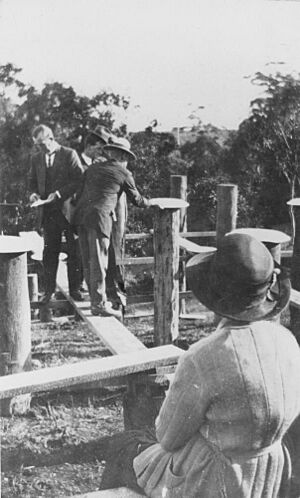
On July 26, 1924, a special event happened. It was a "stump capping ceremony" to celebrate the start of building the Bald Knob public hall. This hall was officially opened on October 18, 1924. A politician named Richard Warren opened it.
People in Bald Knob
The number of people living in Bald Knob has changed over time.
- In 2011, there were 254 people.
- In 2016, the population was 253 people.
- By 2021, the population grew to 280 people.
Most people (77%) living in Bald Knob were born in Australia. Other people came from countries like England, Portugal, Germany, and Canada. Most people (95.3%) spoke only English at home.
Schools near Bald Knob
There are no schools directly in Bald Knob. Students go to schools in nearby areas.
The closest primary schools are:
- Mooloolah State School in Mooloolah Valley (to the north-east).
- Landsborough State School in Landsborough (to the east).
- Peachester State School in Peachester (to the south).
- Maleny State School in Maleny (to the west).
For high school, students can go to:
- Maleny State High School in Maleny.
- Beerwah State High School in Beerwah (to the south-east).
Places to Visit
Bald Knob has several parks and interesting spots:
- Bald Knob Lookout: A great place to see views.
- Landsborough-Maleny Road Park.
- MacDonalds Road Environmental Reserve.
- Upper Mooloolah Nature Refuge: A natural area for wildlife.
There is also the Skipper Musk Teahouse Lookout. It is on the Landsborough Maleny Road. This lookout is between the Bald Knob and Wilkes Knob mountains. It is named after a teahouse that Amelia Elizabeth Skipper and Daisy Georgina Musk ran in the 1920s.
 | William Lucy |
 | Charles Hayes |
 | Cleveland Robinson |


