
Peravia Province facts for kids
Quick facts for kids
Peravia
|
||
|---|---|---|

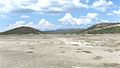
Bani, Dominican Republic landscape
|
||
|
||

Location of the Peravia Province
|
||
| Country | ||
| Province since | 1944 | |
| Capital | Baní | |
| Government | ||
| • Type | Subdivisions | |
| • Body | 3 municipalities 10 municipal districts |
|
| Area | ||
| • Total | 792.33 km2 (305.92 sq mi) | |
| Population
(2014)
|
||
| • Total | 217,241 | |
| • Density | 274.1800/km2 (710.123/sq mi) | |
| Time zone | UTC-4 (AST) | |
| Area code | 1-809 1-829 1-849 | |
| ISO 3166-2 | DO-17 | |
| Postal Code | 94000 | |

Peravia is a province located along the southern coast of the Dominican Republic. Its capital city is Baní.
Contents
History of Peravia Province
The Peravia Province was created in 1944. It was first called Baní Province. Later that same year, its name changed to José Trujillo Valdez Province. This was in honor of the father of a powerful leader at the time, Rafael Trujillo.
In 1961, the province's name was changed again to its current name, Peravia. Over the years, smaller areas within the province became official districts. For example, Nizao became a municipality in 1988. Other areas like Matanzas and Villa Fundación became municipal districts in the 1990s and early 2000s.
In 2000, the northern part of Peravia Province became a new province called San José de Ocoa.
Where is Peravia Province?
Peravia Province is located in the southern part of the Dominican Republic.
- To the north, it borders the San José de Ocoa province.
- To the east, it is next to the San Cristóbal province.
- To the west, it shares a border with the Azua province.
- To the south, it meets the Caribbean Sea.
 |
San José de Ocoa | |
||
| Azua | San Cristóbal | |||
| Caribbean Sea |
Population of Peravia Province
According to the last national census in 2014, about 217,241 people lived in Peravia Province. A large number of these people, 125,534, live in towns and cities.
The province has a population density of about 276.7 people per square kilometer. This means it is the 16th most populated province in the Dominican Republic.
As of 2016, the estimated total population for the province is 192,660 people. The biggest city in Peravia Province is Baní. It is the capital and had about 72,466 people living in its urban area during the last census.
Geography and Landscape
Peravia Province covers a total area of about 785.2 km2 (303.2 sq mi). This makes it the 29th largest province in the Dominican Republic.
The province is located along the Caribbean coast. It is part of the "Caribbean Coastal Plain," which is a flat area. In the southern part, there are small valleys. To the north and west, you can find mountains that are part of the Cordillera Central (Central mountain range).
The capital city, Baní, is about 67 m (220 ft) above sea level. The most important rivers in the province are the Nizao River and the Ocoa River.
Climate in Peravia
The climate in Peravia Province is generally tropical and dry. It is hot for most of the year. However, it gets cooler in the mountains. The flat areas and savannas are very dry and often experience long periods without rain, known as droughts.
Cities and Towns
Peravia Province has two main municipalities and 11 smaller areas called municipal districts.

The table below shows the different parts of Peravia Province, including their population, area, and how high they are above sea level.
| Municipality (code) |
Municipal Districts (code) | Population (2010) |
Area (km2) |
Density | Altitude (m) |
|---|---|---|---|---|---|
| Baní (170101) | 92,153 | 363.3 | 253.7 | 51 | |
| Matanzas (170102) | 16,622 | 118.8 | 139.9 | 76 | |
| Villa Fundación (170103) | 8,811 | 84.8 | 103.9 | 121 | |
| Sabana Buey (170104) | 2,194 | 36.1 | 60.8 | 71 | |
| Paya (170105) | 14,133 | 34.1 | 414.5 | 48 | |
| Villa Sombrero (170106) | 7,954 | 13.3 | 598.0 | 32 | |
| El Carretón (170107) | 4,594 | 14.7 | 312.5 | 165 | |
| Catalina (170108) | 3,436 | 15.0 | 229.1 | 41 | |
| El Limonal (170109) | 4,997 | 45.6 | 109.6 | 233 | |
| Las Barías (170110) | 2,422 | 15.1 | 160.4 | 97 | |
| Baní (170100) | 157,316 | 740.9 | 212.3 | ||
| Nizao (170201) | 13,240 | 17.9 | 739.7 | 29 | |
| Pizarrete (170202) | 6,369 | 12.2 | 522.0 | 57 | |
| Santana (170203) | 7,419 | 14.3 | 518.8 | 50 | |
| Nizao (170200)) | 27,028 | 44.3 | 610.1 | ||
| Peravia (170000) | 217,241 | 785.2 | 276.7 | ||
Economy of Peravia
The main way people make a living in Peravia Province is through farming. Farmers grow many different fruits, like delicious mangos, and vegetables, such as tomatoes and onions.
Along the Caribbean Sea, Fishing is also an important activity. People also produce salt from the sea. In the city of Baní, there are some factories that contribute to the local economy.
Images for kids
-
Salinas
-
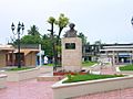
Nizao


See also
 In Spanish: Provincia de Peravia para niños
