Perryville, Kentucky facts for kids
Quick facts for kids
Perryville, Kentucky
|
|||
|---|---|---|---|

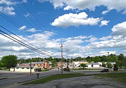
View of Perryville along US-150 (2nd Street)
|
|||
|
|||

Location of Perryville in Boyle County, Kentucky.
|
|||
| Country | United States | ||
| State | Kentucky | ||
| County | Boyle | ||
| Settled | January 17, 1817 | ||
| Incorporated | February 6, 1867 | ||
| Named for | the hero of the 1813 Battle of Lake Erie | ||
| Area | |||
| • Total | 0.80 sq mi (2.06 km2) | ||
| • Land | 0.78 sq mi (2.02 km2) | ||
| • Water | 0.01 sq mi (0.04 km2) | ||
| Elevation | 840 ft (260 m) | ||
| Population
(2020)
|
|||
| • Total | 782 | ||
| • Density | 1,001.28/sq mi (386.61/km2) | ||
| Time zone | UTC-5 (Eastern (EST)) | ||
| • Summer (DST) | UTC-4 (EDT) | ||
| ZIP code |
40468
|
||
| Area code(s) | 859 | ||
| FIPS code | 21-60258 | ||
| GNIS feature ID | 2404507 | ||
Perryville is a small city in Boyle County, Kentucky, United States. It is located along the Chaplin River. In 2020, about 782 people lived there. Perryville is part of the Danville Micropolitan Statistical Area. This means it's a smaller city connected to a larger nearby city.
Contents
History of Perryville
Early Settlement and Naming
The area where Perryville now stands was first settled around 1781. A group of people from Virginia, led by James Harbeson, built a place called Harbeson's Fort. This fort was near a cave and a spring, which helped protect them from attacks by Native American groups.
Because of its location by the river and on important roads, the settlement was later called Harbeson's Crossing. These roads led to other early towns like Harrod's Fort, Louisville, and Danville.
In 1815, two men, Edward Bullock and William Hall, planned a new town here. They named it after Commodore Oliver Hazard Perry. He was a hero from the 1813 Battle of Lake Erie during the War of 1812. The town got its own post office in 1816. The state government officially made it a city in 1817.
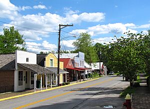
In the late 1830s, a row of buildings was built next to the Chaplin River. These buildings, now known as "Merchants' Row," are still standing today. They were important for trade and business in the early village.
Education and Social Change
In the early 1800s, Perryville became a center for education. Many schools, especially colleges for women, were started here. Some of these included the Ewing Institute, the Elmwood Academy, and Harmonia College.
A famous person who studied at Harmonia College was Carrie Nation. She was a national leader in the temperance movement. This movement worked to stop people from drinking alcohol. Carrie Nation was known for "cleaning out" places that sold alcohol. It's believed that Perryville was one of the first places in the U.S. to use "Local Option" laws. These laws let local communities decide if they wanted to allow alcohol sales.
The Civil War Battle
In October 1862, a very important battle of the American Civil War took place just west of Perryville. This was the Battle of Perryville. It was a major fight that ended the Kentucky Campaign for the Confederate generals Braxton Bragg and Edmund Kirby Smith.
Today, the Perryville Battlefield is a preserved state park. Every year, people hold a reenactment of the battle there. This helps visitors understand what happened during that historic event.
Historic Recognition
Because of its important role in American history, Perryville has received special recognition. In 1961, Perryville and the area around it became a National Historic Landmark. Later, in 1973, the entire town of Perryville was added to the National Register of Historic Places. This means the whole town is recognized for its historical value.
Geography of Perryville
Perryville is located where two main roads meet: US Route 68 and US Route 150.
The United States Census Bureau says that the city covers a total area of about 2.1 square kilometers (0.80 square miles). Most of this area, about 2.0 square kilometers (0.78 square miles), is land. A small part, about 0.04 square kilometers (0.01 square miles), is water.
Population Data
| Historical population | |||
|---|---|---|---|
| Census | Pop. | %± | |
| 1830 | 283 | — | |
| 1870 | 479 | — | |
| 1880 | 498 | 4.0% | |
| 1890 | 436 | −12.4% | |
| 1900 | 481 | 10.3% | |
| 1910 | 407 | −15.4% | |
| 1920 | 631 | 55.0% | |
| 1930 | 349 | −44.7% | |
| 1940 | 462 | 32.4% | |
| 1950 | 660 | 42.9% | |
| 1960 | 715 | 8.3% | |
| 1970 | 730 | 2.1% | |
| 1980 | 841 | 15.2% | |
| 1990 | 815 | −3.1% | |
| 2000 | 763 | −6.4% | |
| 2010 | 751 | −1.6% | |
| 2020 | 782 | 4.1% | |
| U.S. Decennial Census | |||
As of the census in 2000, there were 763 people living in Perryville. The population density was about 948.9 people per square mile (386.61 people per square kilometer).
The population was spread out in terms of age. About 24.1% of the people were under 18 years old. About 21.2% were 65 years or older. The average age in the city was 39 years.
Notable People from Perryville
- E. Belle Mitchell (1848–1942): She was the first African-American educator at Camp Nelson. She also helped start the Colored Orphans Industrial Home in Lexington, Kentucky.
See also
 In Spanish: Perryville (Kentucky) para niños
 | Delilah Pierce |
 | Gordon Parks |
 | Augusta Savage |
 | Charles Ethan Porter |


