
Placerville, California facts for kids
Quick facts for kids
Placerville, California
|
||
|---|---|---|

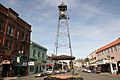
Bell Tower on Main Street
|
||
|
||
| Nickname(s):
Hangtown
|
||

Location of Placerville in California
|
||

Placerville, California
Location in Northern California

Placerville, California
Location in California

Placerville, California
Location in the United States
|
||
| Country | ||
| State | ||
| County | El Dorado | |
| Incorporated | May 13, 1854 | |
| Area | ||
| • Total | 5.84 sq mi (15.13 km2) | |
| • Land | 5.84 sq mi (15.13 km2) | |
| • Water | 0.00 sq mi (0.00 km2) 0.01% | |
| Elevation | 1,867 ft (569 m) | |
| Population
(2020)
|
||
| • Total | 10,747 | |
| • Density | 1,840.2/sq mi (710.31/km2) | |
| Time zone | UTC-8 (PST) | |
| • Summer (DST) | UTC-7 (PDT) | |
| ZIP Code |
95667
|
|
| Area code | 530 | |
| FIPS code | 06-57540 | |
| GNIS feature IDs | 277577, 2411433 | |
| Official name: Placerville - Overland Pony Express Route | ||
| Reference #: | 701 | |
| Official name: Old Dry Higgins-Old Hangtown | ||
| Reference #: | 475 | |

Placerville is a city in California, United States. It is the main city of El Dorado County. The name Placerville comes from "placer," a Spanish word for "sand deposit." This refers to the placer mining that was very important when the town was growing. The city's population was about 10,747 people in 2020. It is part of the larger Sacramento metropolitan area.
Contents
History of Placerville
How Placerville Got Its Name
Placerville has an interesting history, especially during the California Gold Rush. Gold was found nearby in 1848, and many miners came to the area. At first, the town was called Dry Diggin's. This was because miners would dig up dry soil and carry it to water to find gold.
Later, around 1849, the town got a new nickname: "Hangtown." This name came from some hangings that happened there. By 1850, people wanted a friendlier name for the town. So, in 1854, the city was officially named Placerville and became an incorporated city. At that time, Placerville was the third-largest town in California! In 1857, it became the county seat, which means it's where the main government offices for the county are located.
Mining and Transportation
Placerville was a very important center for mining in the Mother Lode region. It offered many services for miners, like transportation, places to stay, banks, and general stores. You can still learn about the history of mining at the Gold Bug Park & Mine, which is now a museum.
The Southern Pacific Railroad used to have a train line that went from Sacramento to Placerville. This track was closed in the 1980s. Another short train line, the Camino, Placerville and Lake Tahoe Railroad, also operated until 1986. Today, parts of the old train tracks are being turned into a path for hiking and biking.
Placerville is also recognized as California Historical Landmark #701 because of its important history.
Historic Buildings in Placerville
Many buildings in Placerville are listed on the National Register of Historic Places. These buildings show the city's rich past.
-

Fountain-Tallman Soda Works (now the Fountain & Tallman Museum)
-
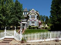
Combellack-Blair House


Geography and Climate
Where is Placerville?
Placerville is located where two major roads meet: U.S. Route 50 and State Route 49. Most of U.S. Route 50 is a fast highway, but in Placerville, it has traffic lights.
The city covers about 5.8 square miles (15.13 square kilometers) of land. Downtown Placerville is about 1,867 feet (569 meters) above sea level. Some areas nearby in the Sierra Nevada foothills can be much higher, up to almost 4,000 feet (1,219 meters).
Placerville's Climate
Placerville has a Mediterranean climate. This means it has cool, often wet winters and hot, dry summers.
- Winter: In January, the average high temperature is around 53.4°F (11.9°C), and the average low is about 32.5°F (0.3°C).
- Summer: In July, the average high temperature is around 92.7°F (33.7°C), and the average low is about 57.2°F (14.0°C).
Placerville gets about 38.11 inches (968 mm) of rain each year, mostly in winter. It rains about 66 days a year. The highest temperature ever recorded was 114°F (46°C) in 1911, and the lowest was 8°F (-13°C) in 1972.
| Climate data for Placerville, California (1915-2005) | |||||||||||||
|---|---|---|---|---|---|---|---|---|---|---|---|---|---|
| Month | Jan | Feb | Mar | Apr | May | Jun | Jul | Aug | Sep | Oct | Nov | Dec | Year |
| Record high °F (°C) | 75 (24) |
78 (26) |
87 (31) |
92 (33) |
104 (40) |
109 (43) |
110 (43) |
109 (43) |
108 (42) |
100 (38) |
83 (28) |
76 (24) |
110 (43) |
| Mean daily maximum °F (°C) | 53.3 (11.8) |
56.9 (13.8) |
60.2 (15.7) |
66.3 (19.1) |
74.5 (23.6) |
83.7 (28.7) |
92.4 (33.6) |
91.3 (32.9) |
85.5 (29.7) |
74.8 (23.8) |
61.1 (16.2) |
53.9 (12.2) |
71.2 (21.8) |
| Daily mean °F (°C) | 42.8 (6.0) |
45.8 (7.7) |
48.8 (9.3) |
53.3 (11.8) |
60.3 (15.7) |
67.7 (19.8) |
74.8 (23.8) |
73.6 (23.1) |
68.5 (20.3) |
59.8 (15.4) |
49.0 (9.4) |
43.4 (6.3) |
57.3 (14.1) |
| Mean daily minimum °F (°C) | 32.4 (0.2) |
34.7 (1.5) |
37.4 (3.0) |
40.3 (4.6) |
46.0 (7.8) |
51.6 (10.9) |
56.8 (13.8) |
55.9 (13.3) |
51.5 (10.8) |
44.7 (7.1) |
37.1 (2.8) |
32.9 (0.5) |
43.4 (6.4) |
| Record low °F (°C) | 9 (−13) |
15 (−9) |
19 (−7) |
24 (−4) |
29 (−2) |
31 (−1) |
38 (3) |
37 (3) |
33 (1) |
23 (−5) |
21 (−6) |
8 (−13) |
8 (−13) |
| Average rainfall inches (mm) | 7.05 (179) |
6.70 (170) |
5.85 (149) |
3.09 (78) |
1.52 (39) |
0.46 (12) |
0.08 (2.0) |
0.09 (2.3) |
0.56 (14) |
2.12 (54) |
4.52 (115) |
6.52 (166) |
38.56 (980.3) |
| Average snowfall inches (cm) | 1.2 (3.0) |
0.4 (1.0) |
0.4 (1.0) |
0.3 (0.76) |
0 (0) |
0 (0) |
0 (0) |
0 (0) |
0 (0) |
0 (0) |
0 (0) |
0.4 (1.0) |
2.7 (6.76) |
| Average rainy days | 10 | 10 | 10 | 7 | 4 | 2 | 0 | 1 | 1 | 4 | 7 | 10 | 66 |
| Source: http://www.wrcc.dri.edu/cgi-bin/cliMAIN.pl?caplac+nca | |||||||||||||
People of Placerville
Population Facts
| Historical population | |||
|---|---|---|---|
| Census | Pop. | %± | |
| 1860 | 2,466 | — | |
| 1870 | 1,562 | −36.7% | |
| 1880 | 1,951 | 24.9% | |
| 1890 | 1,690 | −13.4% | |
| 1900 | 1,748 | 3.4% | |
| 1910 | 1,914 | 9.5% | |
| 1920 | 1,650 | −13.8% | |
| 1930 | 2,322 | 40.7% | |
| 1940 | 3,064 | 32.0% | |
| 1950 | 3,749 | 22.4% | |
| 1960 | 4,439 | 18.4% | |
| 1970 | 5,416 | 22.0% | |
| 1980 | 6,739 | 24.4% | |
| 1990 | 8,355 | 24.0% | |
| 2000 | 9,610 | 15.0% | |
| 2010 | 10,389 | 8.1% | |
| 2019 (est.) | 11,175 | 7.6% | |
| U.S. Decennial Census | |||
In 2010, Placerville had a population of 10,389 people. Most residents (about 83.9%) were White. About 17.9% of the population identified as Hispanic or Latino.
Most people in Placerville live in households. About 30.4% of households had children under 18. The average household size was 2.37 people. The median age in Placerville was 40.4 years old.
Economy and Business
Wine and Local Industries
The area east of Placerville is known for its wine production. This region is called the El Dorado AVA. There are many wineries, from large ones like Boeger to smaller family-owned places. They are known for making tasty wines, especially Rhone style wines, grown in the high elevations of the Sierra Nevada mountains.
Placerville is also home to the Mountain Democrat, which is the oldest newspaper in California that has been printed continuously. The city also has Marshall Medical Center, a local hospital.
Placerville Speedway
The Placerville Speedway is a famous place for auto racing. It was built in 1956 by the El Dorado County Fair. The track is made of dark red clay and is known for its high banking, which makes races exciting. Since 1965, many different types of races have been held there.
Getting Around Placerville

Roads and Public Transport
Placerville is connected by two main highways. California State Route 49 runs north and south, linking Placerville to other towns in the Sierra Nevada foothills. U.S. Route 50 goes west to Sacramento and east to South Lake Tahoe. This part of U.S. Route 50 is also part of the historic Lincoln Highway.
El Dorado Transit provides public bus service in Placerville. You can take local buses around the city or commuter buses to Sacramento. Amtrak Thruway also offers daily bus connections to Sacramento and South Lake Tahoe.
Placerville Airport
Placerville has its own airport, called Placerville Airport. It has a 4,200-foot (1,280-meter) long runway. It's known as a "Good Neighbor" airport because it tries to reduce noise for nearby residents. However, no commercial airlines fly from this airport.
Culture and Traditions
Gold Rush History on Main Street
Placerville's Main Street is full of old buildings from the Gold Rush era. As you walk around, you'll see many historical markers. These markers tell stories about important events or people from that time. Placerville was also a stop on the Pony Express, a mail service that quickly delivered letters across the country.
The "Hangtown" Nickname and Traditions
Placerville was historically called "Hangtown." This nickname came from a few hangings that happened there in the early days. Today, you can still see a display of a mannequin named "George" hanging from a noose above where the Old Hangman's Tree used to be. This is a historical display, and the dummy was even stolen once but later replaced. In 2021, the city council decided to remove the noose from the city's official logo to update its image.
Placerville is also famous for a special dish called "Hangtown fry." It's a unique meal made with eggs, bacon, and oysters. There are many stories about how it started, but everyone agrees it came from Placerville!
Community and Recreation
The old Southern Pacific Transportation Company rail line has been bought by local governments. It is being turned into a hiking and biking trail, with over 12 miles (19 km) already paved for biking.
Placerville is also home to the first United Ancient Order of Druids hall in California, established in 1860. There's a large stone monument on Main Street called "The Druid Monument" that celebrates this history. The city is currently discussing plans to repave the area around the monument, which has led to some community debate.
Notable People from Placerville
Many interesting and influential people have lived or worked in Placerville over the years, especially along its historic Main Street.
- Horace Bell (1830–1918), lawyer, journalist, historian
- Amy Bruni, Ghost Hunters television series, investigator.
- T. J. Caystile (1848–1884), newspaperman, printer
- Dan Crary (born 1939), bluegrass flat-picking guitarist, retired PhD professor of communications at Cal State Fullerton.
- John Thomas Dunlop (1914–2003), politician, born in Placerville
- Oliver Gagliani (1917–2002), photographer, born in Placerville
- Toby Hall (born 1975), baseball player
- Henry Hooker (1829–1907), cattle baron
- Mark Hopkins Jr. (1813–1878), railroad financier and businessman, lived in Placerville in the 1850s.
- Thomas Kinkade (1958–2012), painter
- Larry LaLonde (born 1968), Primus band guitarist
- Bevo LeBourveau (1896–1947), baseball player, later a policeman in Placerville
- Edwin Markham (1852–1940), poet, member of the Placerville Masonic Lodge.
- Alexander Howison Murray Jr. (1907–1993), also known as "Sandy Murray," mayor
- Nello Olivo (1879–?), winemaker
- Ziba Peterson (?–1849)— early American Latter Day Saint, sheriff during the 1849 hanging.
- John Augustus Raffetto (1864–1954), hotelier and banker, founded the First National Bank of Placerville.
- Michael Raffetto (1899–1990), radio star, born in Placerville.
- Spider Sabich (1945–1976), ski racer from Kyburz - buried in Placerville
- Levi Strauss (1829–1902), businessman and clothing maker.
- John Studebaker (1833–1917), auto maker.
- Daniel Trudeau (born 1986), musician, artist
- Ralph Taeger (1936–2015), actor; operated Taeger's Firewood Company in Placerville
- Jerome R. Waldie (1925–2009), U.S. Representative from California
- Jesse Yarnell (1837–1906), newspaperman, established the Daily News in Placerville.
Gallery
-
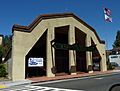
Town Hall
-
Placerville bell


See also
 In Spanish: Placerville (California) para niños
