Plymouth, Minnesota facts for kids
Quick facts for kids
Plymouth
|
||
|---|---|---|

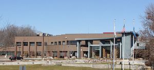
Plymouth City Hall
|
||
|
||

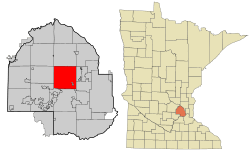
Location of Plymouth
within Hennepin County, Minnesota |
||
| Country | United States | |
| State | Minnesota | |
| County | Hennepin | |
| Incorporated as a township | 1858 | |
| Incorporated as a village | 1955 | |
| Incorporated as a city | 1974 | |
| Area | ||
| • City | 35.28 sq mi (91.38 km2) | |
| • Land | 32.71 sq mi (84.72 km2) | |
| • Water | 2.57 sq mi (6.66 km2) | |
| Elevation | 971 ft (296 m) | |
| Population
(2020)
|
||
| • City | 81,026 | |
| • Estimate
(2022)
|
78,683 | |
| • Rank | US: 462nd MN: 7th |
|
| • Density | 2,477.03/sq mi (956.38/km2) | |
| • Metro | 3,693,729 (US: 16th) | |
| Time zone | UTC-6 (Central (CST)) | |
| • Summer (DST) | UTC-5 (CDT) | |
| ZIP codes |
55441, 55442, 55446, 55447
|
|
| Area code | 763 | |
| FIPS code | 27-51730 | |
| GNIS feature ID | 0649598 | |
Plymouth is a city in Hennepin County, Minnesota. It is a suburb in the Minneapolis–Saint Paul area. The city is about 10 miles (16 km) west of downtown Minneapolis. In 2020, 81,026 people lived there. This makes Plymouth the 7th-largest city in Minnesota.
Contents
History of Plymouth
Early Inhabitants and First Settlers
Plymouth's history goes back a long time. The first people to live here were the Dakota people. They had a camp at the north end of Medicine Lake. The name Medicine Lake comes from the Dakota word Mdewakanton. This means "Lake of the Spirit." The Dakota named the lake after a warrior. He overturned his canoe there and was never found.
Antoine LeCounte was the first settler in this area. He was a guide and explorer. He arrived in 1848 but settled in 1852. LeCounte delivered mail from the Red River to places south. He also traded goods with Native Americans for horses. He built the first cabin where East Medicine Lake Boulevard is today.
Town Beginnings and Name Changes
Plymouth started as a town in 1855. It was on the northwest shores of what is now Parkers Lake. A gristmill and other buildings were put up there. In 1857, Parkers Lake flooded. The mill was then moved to Wayzata.
As more settlers came, they organized the area. The Hennepin County Board of Commissioners named the new settlement Plymouth. On April 19, 1858, people met to elect town officials. On May 11, 1858, they voted to change the town's name to Medicine Lake. This name was used only once and then never again.
Plymouth During the Civil War
During the Dakota War of 1862, settlers in Plymouth formed a local protection group. This was to keep themselves safe. When the American Civil War began, Plymouth paid its volunteers $25 to join the army. Around this time, schools and churches were built. A post office also opened in Plymouth. By 1863, hotels were being built. Medicine Lake became a popular spot for tourists.
Growth and Modern Government
By 1880, Plymouth had 1,074 people. Farming was the main job for many years. Roads were built, connecting Plymouth to other towns.
The community changed from a farming area to a suburb. So did its local government. Plymouth became a village on May 18, 1955. On August 1, 1968, the city started using a Council–Manager government. Plymouth became a statutory city on February 7, 1974. Voters made it a home rule charter city on November 3, 1992. This meant it adopted its own city rules.
Geography of Plymouth
The city of Plymouth covers about 35.33 square miles (91.50 km²). About 32.68 square miles (84.64 km²) is land. The remaining 2.65 square miles (6.86 km²) is water.
Major roads in Plymouth include Interstate 494, U.S. Highway 169, and Minnesota State Highway 55. Plymouth has many streets, including 863 cul-de-sacs. The city's public works teams take care of 300 miles (480 km) of city streets.
Plymouth's Climate
Plymouth has a humid continental climate. This means it has very cold winters. Summers are usually hot and often humid. In summer, daytime temperatures average 83 °F (28 °C). Nighttime lows are around 60 °F (15 °C). In winter, temperatures average 23 °F (-5 °C). Nighttime lows are about 3 °F (-16 °C).
The highest temperature ever recorded in Plymouth was 99 °F (37 °C) in 1964. The lowest was -39 °F (-39.4 °C) in 1977. Rain falls throughout the year. Most of the rain happens in the summer months. June is the rainiest month, with 120.3 mm of rain.
| Climate data for Plymouth, Minnesota | |||||||||||||
|---|---|---|---|---|---|---|---|---|---|---|---|---|---|
| Month | Jan | Feb | Mar | Apr | May | Jun | Jul | Aug | Sep | Oct | Nov | Dec | Year |
| Record high °F (°C) | 55 (13) |
59 (15) |
83 (28) |
92 (33) |
95 (35) |
102 (39) |
99 (37) |
96 (36) |
96 (36) |
87 (31) |
73 (23) |
61 (16) |
102 (39) |
| Mean daily maximum °F (°C) | 23 (−5) |
29 (−2) |
41 (5) |
57 (14) |
71 (22) |
78 (26) |
83 (28) |
80 (27) |
72 (22) |
59 (15) |
41 (5) |
27 (−3) |
55 (13) |
| Mean daily minimum °F (°C) | 3 (−16) |
10 (−12) |
27 (−3) |
34 (1) |
47 (8) |
56 (13) |
60 (16) |
58 (14) |
49 (9) |
37 (3) |
24 (−4) |
10 (−12) |
35 (1) |
| Record low °F (°C) | −39 (−39) |
−58 (−50) |
−27 (−33) |
−5 (−21) |
18 (−8) |
33 (1) |
42 (6) |
36 (2) |
22 (−6) |
9 (−13) |
−19 (−28) |
−33 (−36) |
−58 (−50) |
| Average precipitation inches (mm) | 0.90 (22.8) |
0.66 (16.7) |
1.68 (42.6) |
2.41 (61.2) |
3.54 (89.9) |
4.74 (120.3) |
4.16 (105.6) |
4.02 (102.1) |
3.3 (85) |
2.50 (63.5) |
1.64 (41.6) |
0.90 (22.8) |
30.45 (774.1) |
| Source: http://www.weather.com/weather/wxclimatology/monthly/graph/55447?from=tenDay_bottomnav_undeclared | |||||||||||||
People of Plymouth
| Historical population | |||
|---|---|---|---|
| Census | Pop. | %± | |
| 1860 | 393 | — | |
| 1870 | 872 | 121.9% | |
| 1880 | 1,072 | 22.9% | |
| 1890 | 1,053 | −1.8% | |
| 1900 | 1,164 | 10.5% | |
| 1910 | 1,221 | 4.9% | |
| 1920 | 1,275 | 4.4% | |
| 1930 | 1,683 | 32.0% | |
| 1940 | 2,989 | 77.6% | |
| 1950 | 5,813 | 94.5% | |
| 1960 | 9,576 | 64.7% | |
| 1970 | 18,077 | 88.8% | |
| 1980 | 31,615 | 74.9% | |
| 1990 | 50,889 | 61.0% | |
| 2000 | 65,894 | 29.5% | |
| 2010 | 70,576 | 7.1% | |
| 2020 | 81,026 | 14.8% | |
| 2022 (est.) | 78,683 | 11.5% | |
| U.S. Decennial Census 2020 Census |
|||
2010 Census Information
In 2010, there were 70,576 people living in Plymouth. There were 28,663 households and 19,230 families. The city had about 2,160 people per square mile (834 per km²). There were 29,982 housing units.
Most of the people were White (84.2%). Other groups included African American (5.2%), Native American (0.3%), and Asian (6.9%). About 3.0% of the population was Hispanic or Latino.
About 32.4% of households had children under 18. Most households (55.6%) were married couples. The average household had 2.42 people. The average family had 2.96 people.
The average age in the city was 39.5 years. About 23.9% of residents were under 18. And 12.1% were 65 or older. The population was 48.4% male and 51.6% female.
Education in Plymouth
Public Schools in Plymouth
Five different school districts serve Plymouth. These are Wayzata Public Schools (ISD 284), Robbinsdale Area Schools (ISD 281), Osseo School District (279), West Metro Education Program (ISD 6069), and Hopkins School District (ISD 270).
Most of Plymouth, especially the western and southern parts, is served by Wayzata Public Schools. Robbinsdale Area Schools serves the east-central area. The Osseo District covers the northeast. Hopkins District covers the southeast corner. Some students can choose to attend public schools in other districts. This is allowed under Minnesota's open enrollment law.
Here are the Wayzata Public Schools located in Plymouth:
- Birchview Elementary School
- Gleason Lake Elementary School
- Greenwood Elementary School
- Kimberly Lane Elementary School
- Meadow Ridge Elementary School
- North Woods Elementary School
- Oakwood Elementary School
- Plymouth Creek Elementary School
- Sunset Hill Elementary School
- Wayzata East Middle School
- Wayzata Central Middle School
- Wayzata H.S.
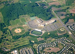
Wayzata High School is run by the Wayzata School District. It has about 3,500 students in grades 9 to 12. This makes it Minnesota's largest high school by student numbers. The school is part of the Lake Conference. In 2008, Newsweek magazine ranked it among the top high schools in America.
Here are some Robbinsdale School District schools:
- Robbinsdale Armstrong High School
- Robbinsdale Plymouth Middle School
- Fair School Pilgrim Lane
- Zachary Lane Elementary School
Here are some West Metro Education Program (WMEP) District 6069 schools:
- The InterDistrict Downtown School (IDDS)
- FAIR (Fine Arts Interdisciplinary Resource) School
Private Schools and Colleges in Plymouth
- Free Lutheran Bible College and Seminary
- Fourth Baptist Christian School
- Central Baptist Theological Seminary
- Providence Academy
- West Lutheran High School
Economy in Plymouth
Several company headquarters are located in Plymouth. These include OneBeacon, Select Comfort, Christopher & Banks, and Tonka Water.
Major Employers in Plymouth
Here are some of the biggest employers in Plymouth:
| # | Employer | # of Employees |
|---|---|---|
| 1 | Zayo Group | 3,500 |
| 2 | I.S.D. No. 284 (Wayzata) | 2,529 |
| 3 | Medtronic | 1,168 |
| 4 | City of Plymouth | 830 |
| 5 | US Foods | 700 |
| 6 | Meritain Health | 600 |
| 7 | Life Time Fitness | 325 |
| 8 | Target | 301 |
| 9 | TURCK Inc. | 300 |
| Polaris | 300 |
Source: 2023 Annual Comprehensive Financial Report
Notable People from Plymouth
Many interesting people have connections to Plymouth:
- Marion Barber III – a former professional football player (running back)
- Rudy Boschwitz – a U.S. senator who lived in Plymouth
- Dani Cameranesi – an Olympic Gold Medalist
- Ariya Daivari – a professional wrestler
- Jonas H. Howe – an abolitionist, artist, and state legislator
- Jeff Johnson – a Hennepin County Commissioner
- Evan Kaufmann (born 1984) – a professional ice hockey player
- Amy Klobuchar – a U.S. senator and former presidential candidate
- James Laurinaitis – a professional football player (linebacker)
- Adrianne Lenker - a singer/songwriter and lead singer of Big Thief
- Mark Parrish – a former professional hockey All-Star player
- Rem Pitlick – a professional hockey player
- Andrew Tang – a chess grandmaster
- A.J. Tarpley – a professional football player (linebacker)
- Blake Wheeler – a professional hockey player
See also
 In Spanish: Plymouth (Minnesota) para niños


