Point Lobos facts for kids
Quick facts for kids Point Lobos State Natural Reserve |
|
|---|---|
|
IUCN Category V (Protected Landscape/Seascape)
|
|
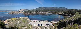
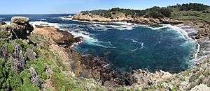
Looking north over Whaler's Cove, the largest of a number of coves in Point Lobos, and the location of Whalers Cabin.
|
|
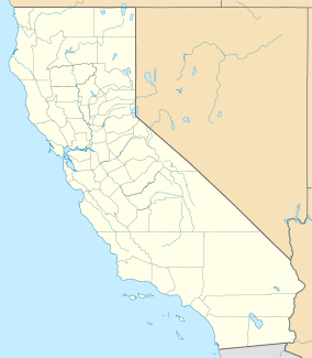
| Location | Monterey County, California, United States |
| Nearest city | Carmel-by-the-Sea |
| Governing body | California Department of Parks and Recreation |
| Designated: | 1967 |
Point Lobos, also known as the Point Lobos State Natural Reserve, is often called the "crown jewel" of California's state parks. An artist named Francis McComas once said it was the "greatest meeting of land and water in the world." The ocean area next to Point Lobos is one of California's richest places for marine life. This ocean area is protected by two special zones: the Point Lobos State Marine Reserve and the Point Lobos State Marine Conservation Area. Many people think the sea near Point Lobos is one of the best spots for scuba diving along the California coast.
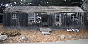
Point Lobos is located just south of Carmel-by-the-Sea, California, at the start of the Big Sur coast. It offers many hiking trails, often right next to the ocean, and a few smaller beaches. The old Whalers Cabin, first built by Chinese fishermen, is now a museum.
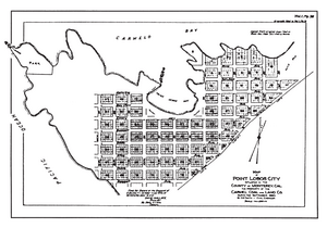
Long ago, in 1896, there were plans to build a town called "Carmelito" at Point Lobos. But a man named Alexander Allan bought the land and stopped the town from being built. Today, over a million people visit Point Lobos each year. However, there are only 150 parking spots inside the reserve. Most visitors have to park along Highway 1 and walk in. Because so many people visit, the park might start requiring reservations during busy times.
Contents
Exploring Point Lobos: Land and Sea
Point Lobos is a very special place with unique rocks and a wide variety of plants and animals, both on land and in the water. It's known for its amazing natural beauty. The way the land and water meet here is truly spectacular.
Just north of Point Lobos is the Carmel submarine canyon. This deep canyon brings cold, nutrient-rich water from the ocean depths to the surface. These nutrients help a lot of tiny ocean plants grow, which then feed many different kinds of sea creatures. This is why there's so much life in the waters around Point Lobos.
Point Lobos is one of only two places in the world where the Monterey Cypress trees grow naturally. The waters here also have huge kelp forests, which are like underwater forests for many marine animals.
During certain times of the year, visitors can watch whales from the shore as they travel along the coast. Gray, humpback, and blue whales are often seen swimming past Point Lobos.
Fun Activities and Protecting the Park
Point Lobos has many miles of trails for visitors to explore. You can enjoy beautiful views of the coast, discover hidden coves, and have a picnic. The protected ocean areas nearby are great for learning about the sea and having fun.
Many people come to Point Lobos for scuba diving because the underwater environment is so healthy. Whaler's Cove is a popular spot for divers to start their underwater adventures. Other activities include kayaking and snorkeling.
Because so many people visit, some areas of the park are starting to wear away. The Point Lobos Foundation works with volunteers to plant hundreds of native plants to help fix these worn-out spots. To manage the crowds, the park is planning to ask visitors to make reservations during busy hours.
Special Ocean Protection Zones
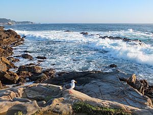
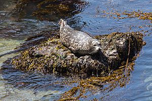
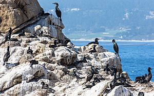
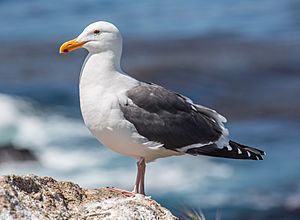
The original Point Lobos Ecological Reserve was created in 1973. It has become one of the richest places for marine life in California. Divers are not allowed to take any fish or shellfish from this reserve. These protected ocean areas provide a safe home for many fish, invertebrates (like crabs and sea stars), birds, and marine mammals. This includes animals that live in the shallow kelp forests and those that live in the deep waters of the Carmel Submarine Canyon.
In 2007, the California Department of Fish and Game made the protected area bigger. They renamed it the Point Lobos State Marine Reserve and Point Lobos State Marine Conservation Area. A "no-take" zone was made larger, meaning no fishing or collecting is allowed in that area. These were some of the first protected ocean areas created as part of a plan to protect California's coastline.
What is a State Marine Reserve?
The Point Lobos State Marine Reserve (SMR) covers about 5.36 square miles. In an SMR, all marine life is protected. This means that fishing and taking any living marine resources are completely forbidden.
What is a State Marine Conservation Area?
The Point Lobos State Marine Conservation Area (SMCA) covers about 8.83 square miles. In this area, most marine life is protected. However, people are allowed to fish for salmon and albacore for fun or for business. They can also catch spot prawn for business.
How Scientists Help
Scientists regularly study these protected ocean areas along California's coast. They want to see how well these areas are working and learn more about the health of the ocean. Similar studies in other protected areas have already shown that fish are getting bigger and there are more of them.
The Whaling Station Museum
The historic Whalers Cabin at Whaler's Cove was built in the 1850s. It was first used by Chinese fishermen, and later by Japanese and Portuguese fishermen. The cabin was made from local pine and redwood. Its floor was originally dirt, and the floor supports were made from six whale bones resting on granite blocks. There used to be about 10 cabins around the cove.
Portuguese whalers from the Azores might have used this cabin. They would hunt whales off the coast and bring them back to the cove to remove the blubber (fat). The Carmel Whaling Company operated here from 1862 to 1879. Whaling stopped around 1900 because kerosene oil became cheaper than whale oil. Japanese whalers briefly returned from 1898 to 1900.
In 1983, after the last person moved out, someone suggested turning the cabin into a museum. They removed newer additions like fiberboard walls and wires. Park staff talked to the families who used to live and work there to get old items for the museum. Today, the Whaling Station Museum tells the story of the point's history, including its role in movies and the old plans to build a town there. It's the only building from that time that has been saved.
A Look Back in Time: Point Lobos History
Long ago, the Ohlone people lived around Point Lobos. They gathered shellfish like abalone from the waters. Evidence shows that a village called Ichxenta existed near Point Lobos for about 2,500 years. This village meadow is now known as the Polo Field. There are 19 ancient shell mounds and five sites with grinding holes used by the natives for preparing food.
Spanish explorers likely visited the area in the early 1600s. In 1769, Gaspar de Portolà and his group camped nearby. Around 1770, Spanish cowboys from the Carmel Mission raised large herds of cattle near Point Lobos. The Ohlone village was probably lived in until the time of the Carmel Mission. Sadly, many native people died from diseases and harsh conditions during that period.
Spanish and Mexican Control
In 1839, Governor Juan Bautista Alvarado gave a large piece of land, including Point Lobos, to Marcelino Escobar. This land stretched south for about 11 miles. Escobar's sons later sold the land to Doňa Maria Josefa de Abrego for $250. This was about three cents per acre.
However, the sale was complicated because the sons didn't get permission from all their brothers and sisters. Later, Maria Abrego gave the land to a group of soldiers, supposedly for free. A story says a gambler lost the land in a card game. The soldiers then gave the land to their officer, Colonel José Castro.
After the Mexican-American War, California became part of the United States. The new government said it would honor old land grants. But owners had to prove their ownership. Castro tried to claim the land but sold it to Joseph S. Emery and Abner Bassett in 1854 for $700. They had to continue the legal fight for ownership. After many years and lawsuits, the land ownership was finally settled in 1888.
The Industrial Era at Point Lobos
In 1851, a Chinese sailor named Quock Junk was shipwrecked at Point Lobos. He was saved by the Ohlone people. Later, other Chinese families joined him and built cottages at Whaler's Cove, becoming the first commercial fishermen there. From 1854 to 1858, a granite quarry operated at Whaler's Cove. The granite was used to build famous structures like the San Francisco Mint.
In 1862, Portuguese whalers arrived at Point Lobos. About 50 to 70 family members lived at Whaler's Cove. They would spot whales from a hill, then row out to harpoon them. They brought the whales back to the cove to get the blubber.
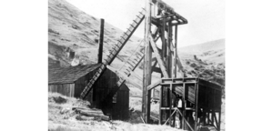
In 1874, a type of coal was found south of Point Lobos. In 1888, many landowners formed the Carmelo Land and Coal Company. They dug a mine and used a tramway to carry the coal to Coal Chute Point. From there, the coal was loaded directly onto ships.
In 1890, the owners of Point Lobos divided it into 1,000 small plots. They started selling these plots for a new town called "Carmelito". But sales were slow because there was no bridge over the Carmel River and the economy was bad.
In 1897, Alexander MacMillan Allan, an engineer, was hired to improve the coal mine. When he realized the mine wasn't profitable, he bought 640 acres of Point Lobos in 1898. He partnered with marine biologist Gennosuke Kodani to build the Point Lobos Canning Company, which canned abalone. Allan also started a sand and gravel mining operation and a dairy farm.
Protecting the Beauty: Tollgate and State Interest
In 1899, Alexander Allan and his wife Satie loved the natural beauty of Point Lobos. They were worried about the growing number of visitors. To control access, they put up toll gates and charged cars 50 cents to enter. They also bought back many of the subdivided lots and removed the town plan from county records.
Scientists told the government that the Carmel area, including Point Lobos, was the "most picturesque spot on the Pacific Coast." In 1925, there were talks about making Point Lobos part of the new state park system. Experts like Frederick Law Olmsted described Point Lobos as a unique place with beautiful rocks, waves, and rare Monterey cypress trees. The state considered buying the land, but the Allan family asked them to wait until Alexander Allan passed away.
Point Lobos Becomes a State Park
On February 8, 1933, three years after Alexander Allan's death, his family sold 348 acres to the State of California for $631,000. The state quickly removed most of the man-made structures, like the abalone cannery and the railroad, leaving only the Whalers Cabin. The Allan family also donated an extra 15 acres of cypress-covered land as a memorial to Alexander and Satie Allan. The state later added another 50 acres, making the reserve almost 400 acres.
World War II Use
During World War II, the U.S. Army used the Whalers Cabin as its headquarters. From 1942 to 1944, Whaler's Cove was a radar site. In 1943, the U.S. Army also used the cove to train soldiers for boat and shore operations. These soldiers later took part in many landings in the Pacific.
Modern Changes and Expansion
The Allan family kept the land east of Highway 1. In the 1950s, one of Alexander's daughters bought back the last subdivided lots. In 1960, 750 acres of underwater land were added, creating the first marine reserve in the United States. This marine reserve became an ecological reserve in 1973. In 1992, it was added to the Monterey Bay National Marine Sanctuary, which is one of the largest in the nation.


