Power County, Idaho facts for kids
Quick facts for kids
Power County
|
||
|---|---|---|

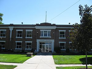
Power County Courthouse, American Falls
|
||
|
||

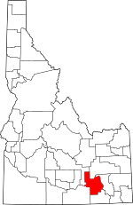
Location within the U.S. state of Idaho
|
||
 Idaho's location within the U.S. |
||
| Country | ||
| State | ||
| Founded | January 30, 1913 | |
| Named for | power plant at the American Falls Dam | |
| Seat | American Falls | |
| Largest city | American Falls | |
| Area | ||
| • Total | 1,443 sq mi (3,740 km2) | |
| • Land | 1,404 sq mi (3,640 km2) | |
| • Water | 38 sq mi (100 km2) 2.7% | |
| Population
(2020)
|
||
| • Total | 7,878 | |
| • Density | 5.4595/sq mi (2.1079/km2) | |
| Time zone | UTC−7 (Mountain) | |
| • Summer (DST) | UTC−6 (MDT) | |
| Congressional district | 2nd | |
Power County is a county in the state of Idaho, USA. It's home to about 7,878 people, according to the 2020 census. The main city and county seat is American Falls.
This county was created on January 30, 1913. It was formed from parts of Cassia County. Power County got its name from an early hydroelectric power plant built in 1902. This plant was located at the American Falls Dam.
Contents
Exploring Power County's Land
Power County covers a total area of about 1,443 square miles. Most of this area, about 1,404 square miles, is land. The remaining 38 square miles are covered by water.
Neighboring Counties
Power County shares its borders with several other counties:
- Bannock County to the east
- Oneida County to the south
- Bingham County to the north
- Blaine County to the northwest
- Cassia County to the southwest
Main Roads and Highways
Important roads that run through Power County include:
 Interstate 86
 US 30
US 30 State Highway 37
 State Highway 39
Protected Natural Areas
Parts of several national protected areas are found within Power County. These are special places where nature is preserved:
- Caribou National Forest
- Craters of the Moon National Monument and Preserve
- Curlew National Grassland
- Minidoka National Wildlife Refuge
- Sawtooth National Forest
People of Power County
| Historical population | |||
|---|---|---|---|
| Census | Pop. | %± | |
| 1920 | 5,105 | — | |
| 1930 | 4,457 | −12.7% | |
| 1940 | 3,965 | −11.0% | |
| 1950 | 3,988 | 0.6% | |
| 1960 | 4,111 | 3.1% | |
| 1970 | 4,864 | 18.3% | |
| 1980 | 6,844 | 40.7% | |
| 1990 | 7,086 | 3.5% | |
| 2000 | 7,538 | 6.4% | |
| 2010 | 7,817 | 3.7% | |
| 2020 | 7,878 | 0.8% | |
| 2023 (est.) | 8,253 | 5.6% | |
| U.S. Decennial Census 1790–1960, 1900–1990, 1990–2000, 2010, 2020 |
|||
In 2010, there were 7,817 people living in Power County. These people lived in 2,641 households. About 75% of the population was white. Many people also had Hispanic or Latino backgrounds, making up almost 30% of the population.
The average age of people in the county was about 33 years old. Many households, about 40%, had children under 18 living with them.
Towns and Communities
Power County has several towns and communities where people live.
Cities
- American Falls
- Pocatello (partly)
- Rockland
Census-Designated Place
Other Communities
These are smaller communities that are not officially cities:
Schools in Power County
Children in Power County attend schools in these districts:
- American Falls Joint School District 381
- Arbon Elementary School District 383
- Rockland School District 382
See also
 In Spanish: Condado de Power para niños
 | Lonnie Johnson |
 | Granville Woods |
 | Lewis Howard Latimer |
 | James West |


