Radford, Coventry facts for kids
Quick facts for kids Radford |
|
|---|---|
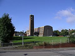
 St. Nicholas Church, Radford |
|
| Population | 18,879 (2011.Ward) |
| • Density | 64.7 per ha |
| Metropolitan borough | |
| Metropolitan county | |
| Region | |
| Country | England |
| Sovereign state | United Kingdom |
| Post town | COVENTRY |
| Postcode district | CV6 |
| Dialling code | 024 or 025 |
| Police | West Midlands |
| Fire | West Midlands |
| Ambulance | West Midlands |
| EU Parliament | West Midlands |
| UK Parliament |
|
Radford is a part of Coventry, a city in England. It's like a neighborhood or a suburb, located about 1.5 miles north of the city centre. Radford is also an electoral ward, which means it's an area used for local elections. It's part of the Coventry North West area for national elections.
Contents
Exploring Radford's Location
Radford is surrounded by other areas of Coventry. These include Holbrooks, Foleshill, St Michael's, Sherbourne, and Bablake. The whole Radford area covers about 303.9 hectares.
Radford's Different Areas
Radford is made up of four smaller neighborhoods:
- Radford Diamond: This area is about one mile northwest of Coventry city centre. It's bordered by certain roads and a railway line.
- East Radford: This is a small area with many houses on six streets. It's located between the Coventry-Nuneaton railway and the Coventry Canal.
- West Radford: This is a larger neighborhood with many people living there. It's about two miles north of the city centre. Key parts of West Radford include Jubilee Crescent and the areas around St. Augustine's School and Beake Avenue.
- Canal Basin: This neighborhood includes Leicester Row, St Nicholas Street, and the Draper's Field development.
A Look Back: Radford's History
At the end of the 1800s, Radford started to change. It went from being mostly countryside to a busy area with many factories. The southern part of Radford was great for factories because it was near the Coventry Canal and a railway. There was even a train station called Daimler Halt railway station on Sandy Lane. This was also where the Sandy Lane power station was, which is now a modern living and business area called Electric Wharf.
The Birth of British Cars
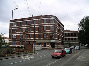
Radford is famous for its role in starting the British car industry. In 1896, a company called The Great Horseless Carriage Company opened in old cotton mill buildings. They renamed their factory "Motor Mills." This factory was located near St. Nicholas Street, Sandy Lane, and the Coventry Canal. It had a red-brick office building and a power house.
Soon after, the company changed its name to Daimler. Before the First World War, they moved to a new, larger factory. This factory grew even more during and after the First World War. In 1960, Daimler joined with another company, and the factory also became home to Jaguar cars. Jaguar continued to make cars there until the mid-1990s.
Radford During the Wars
Between the world wars, Radford even had an aerodrome (a small airport) for a short time. It was near the Daimler factory. Today, a primary school and a rugby club are on that spot.
During the "Coventry Blitz" in the Second World War, Radford was a major target for German planes (the Luftwaffe). This was because the Daimler and Alvis factories in the area were making important vehicles and weapons for Britain's war effort. Most of the Motor Mills factory was destroyed in the bombing, except for the office building and power house. On November 19, 1940, a special bomb dropped by parachute exploded above ground. It destroyed St Nicholas' Church, leaving only a few stones standing. Some people hiding in the church's basement were hurt or killed.
Places to See in Radford
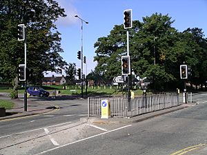
Radford Road runs along the western side of Radford. It's a main road that goes into Coventry city centre and out to other areas like Keresley. You can find several small shops along Radford Road.
Another main shopping area in Radford is Jubilee Crescent. This area has a library, a community centre, a doctor's office, and many local shops. You can also find bigger stores like Tesco and Asda there. Jubilee Crescent was named in 1935 to celebrate the upcoming 25th anniversary of King George V becoming king.
Homes and Buildings
Most of the northern part of Radford is residential, meaning people live there. Many homes were built in the 20th century. You can find different types of homes, from apartment buildings to semi-detached and terraced houses. Some are privately owned, and some used to be council housing (homes owned by the local government).
New Developments and Parks
Even though many factories in Radford have closed, the area is being renewed.
- The old Radford railway station site is now a block of apartments.
- Sandy Lane Power Station, which later became offices, is now Electric Wharf. This is a mixed-use area with homes and public art.
- The former Daimler factory is now a residential area called Daimler Green.
Radford also has many parks.
- Nauls' Mill Park runs behind the Radford "Council" Estate. A hidden fact is that the Radford Brook river flows underground here. It used to fill the Nauls' Mill Park pool.
- Other parks include Daimler Park and Radford Rec.
- There's a pink-brown sandstone war memorial in Radford. It was put up in 1919 and lists the names of 152 local people who fought in the Great War (World War I). A cross next to 17 names shows that those men died.
Learning in Radford: Schools
Barr's Hill School is the main secondary school in Radford. It teaches both boys and girls. Before 1975, it was an all-girls grammar school.
Primary schools in the area include:
- Radford Primary Academy
- Hill Farm School
- St Augustine's RC Primary School
- Joseph Cash Primary School
Military Presence
Westfield House Army Reserve Centre is on Radford Road. It's a base for different parts of the Army Reserve, including the Royal Electrical & Mechanical Engineers, Royal Signals, and the Royal Army Medical Corps. Young people can also join the Army Cadet Force or an Air Training Corps squadron here.
Famous People from Radford
- Philip Larkin: He was a very famous English poet in the second half of the 1900s. He was born in Radford at 2, Poultney Road.
- Errol Christie: He was an English boxer who became a European champion in the 1980s. He used to live in Radford.
 | Kyle Baker |
 | Joseph Yoakum |
 | Laura Wheeler Waring |
 | Henry Ossawa Tanner |


