Randolph, New Hampshire facts for kids
Quick facts for kids
Randolph, New Hampshire
|
|
|---|---|
|
Town
|
|

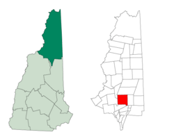
Location in Coös County, New Hampshire
|
|
| Country | United States |
| State | New Hampshire |
| County | Coös |
| Incorporated | 1824 |
| Villages | Randolph Randolph Hill Bowman |
| Area | |
| • Total | 47.1 sq mi (122.0 km2) |
| • Land | 47.0 sq mi (121.8 km2) |
| • Water | 0.08 sq mi (0.2 km2) 0.13% |
| Elevation | 1,280 ft (390 m) |
| Population
(2020)
|
|
| • Total | 328 |
| • Density | 7/sq mi (2.7/km2) |
| Time zone | UTC-5 (Eastern) |
| • Summer (DST) | UTC-4 (Eastern) |
| ZIP code |
03593
|
| Area code(s) | 603 |
| FIPS code | 33-63860 |
| GNIS feature ID | 0873704 |
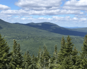
Randolph is a town in Coös County, New Hampshire, United States. It's mostly covered in forests and sits on the northern slopes of the White Mountains. The town stretches from the Presidential Range in the south to the Crescent Range and Berlin in the north. U.S. Route 2 runs right through the middle of Randolph.
Parts of Randolph are within the White Mountain National Forest and the Ice Gulch Town Forest. The central part of the town is where most people live. In 2020, about 328 people lived there. Randolph is also part of the larger Berlin, NH-VT Micropolitan Statistical Area. This means it's connected to Berlin and other nearby towns for jobs and services.
Contents
History of Randolph
Randolph became an official town in 1824. Before that, it was known as "Durand" in 1772. The town was named after John Randolph, a famous politician from Virginia. He was a congressman and senator, and he was also a descendant of Pocahontas.
Geography and Mountains

Randolph is a very mountainous area. The town covers about 122 square kilometers (47 square miles). Most of this area is land, with only a small amount of water.
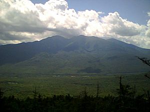
The southern part of Randolph includes the northern slopes of the Presidential Range, which are very tall mountains. To the north, there are four main mountains: Mount Crescent, Black Crescent Mountain, Mount Randolph, and Pond Hill. U.S. Route 2 divides these northern slopes from the southern ones. The highest point in Randolph is on its southern border, on a knob of Howker Ridge, which is part of Mount Madison. This spot is about 1,204 meters (3,950 feet) high.
The main areas where people live in Randolph are:
- Randolph "valley": This is where the town hall is located.
- Randolph Hill: This area has several roads connected to Randolph Hill Road. A hotel called the Mt. Crescent House used to be here. It opened in 1883 and was taken down in 1971.
Other parts of town include the area west of Durand Road, which has Valley Road and houses along Route 2, heading towards Jefferson. The main train station for Randolph was at Appalachia. There were also smaller stations called "Randolph East" and Bowman.
Neighboring Towns
Randolph shares its borders with several other towns:
- Berlin (to the north)
- Gorham (to the east)
- Thompson and Meserve's Purchase (to the southeast)
- Low and Burbank's Grant (to the south)
- Jefferson (to the west)
- Kilkenny (to the northwest)
Weather and Climate
The weather in Randolph can change a lot. In summer, temperatures are usually comfortable, often in the 20s Celsius (70s or 80s Fahrenheit). Summer nights can be cool, sometimes dropping to 10 degrees Celsius (40s or 50s Fahrenheit). It's very rare for summer temperatures to reach 38 degrees Celsius (100 degrees Fahrenheit).
Winters in Randolph can be very cold, with temperatures sometimes falling below -40 degrees Celsius (-40 degrees Fahrenheit). There's a special place called Ice Gulch in the northern part of Randolph. It has a unique microclimate that is much colder than the rest of the town. Ice blocks there can sometimes last all summer without melting!
Population and People
| Historical population | |||
|---|---|---|---|
| Census | Pop. | %± | |
| 1830 | 143 | — | |
| 1840 | 115 | −19.6% | |
| 1850 | 113 | −1.7% | |
| 1860 | 118 | 4.4% | |
| 1870 | 138 | 16.9% | |
| 1880 | 203 | 47.1% | |
| 1890 | 137 | −32.5% | |
| 1900 | 137 | 0.0% | |
| 1910 | 137 | 0.0% | |
| 1920 | 67 | −51.1% | |
| 1930 | 82 | 22.4% | |
| 1940 | 114 | 39.0% | |
| 1950 | 158 | 38.6% | |
| 1960 | 140 | −11.4% | |
| 1970 | 169 | 20.7% | |
| 1980 | 274 | 62.1% | |
| 1990 | 371 | 35.4% | |
| 2000 | 339 | −8.6% | |
| 2010 | 310 | −8.6% | |
| 2020 | 328 | 5.8% | |
| U.S. Decennial Census | |||
In 2000, there were 339 people living in Randolph. The town had 146 households and 104 families. The population density was about 2.8 people per square kilometer (7.2 people per square mile). Most of the people living in Randolph were White (96.46%).
About 26% of households had children under 18 living with them. Most households (69.2%) were married couples. The average household had 2.31 people, and the average family had 2.74 people.
The median age in Randolph was 46 years old. This means half the people were younger than 46 and half were older. About 19.2% of the population was under 18, and 18.6% was 65 or older.
Many houses in Randolph are used as summer or vacation homes. In the past, people would stay in hotels, which they reached by horse-drawn carriage from the train station. As cars became more popular, people started buying private vacation homes instead of staying in hotels. Randolph was a great place for vacations before air conditioners were common because its summers are usually cool, especially in the higher mountain areas.
Parks and Recreation
The Randolph Mountain Club was started in 1910. Its main goal was to fix hiking trails that had been damaged by logging. Today, the club works to help people enjoy the Randolph area. They do this by:
- Promoting hiking.
- Building and taking care of trails.
- Maintaining camps and shelters.
- Sharing knowledge about the area.
The club runs four camps in the White Mountain National Forest. Two are enclosed cabins, and two are semi-enclosed shelters. A caretaker lives at these camps all year.
Randolph also has two artificial lakes or ponds. Durand Lake is there all year. Ravine House Pool is created in the summer by damming a mountain stream. There are also tennis courts near the Ravine House Pool. The town of Randolph owns these facilities, and they are maintained with help from the Randolph Foundation.
Notable Person
- Bob Savage (1921–2013) was a baseball pitcher who played in the 1940s. He was a notable person from Randolph.
See also
 In Spanish: Randolph (Nuevo Hampshire) para niños


