Jefferson, New Hampshire facts for kids
Quick facts for kids
Jefferson, New Hampshire
|
|
|---|---|
|
Town
|
|
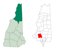
Location in Coos County, New Hampshire
|
|
| Country | United States |
| State | New Hampshire |
| County | Coos |
| Incorporated | 1796 |
| Places |
|
| Area | |
| • Total | 50.32 sq mi (130.34 km2) |
| • Land | 50.00 sq mi (129.49 km2) |
| • Water | 0.33 sq mi (0.85 km2) 0.66% |
| Elevation | 1,381 ft (421 m) |
| Population
(2020)
|
|
| • Total | 1,043 |
| • Density | 21/sq mi (8.1/km2) |
| Time zone | UTC-5 (Eastern) |
| • Summer (DST) | UTC-4 (Eastern) |
| ZIP code |
03583
|
| Area code(s) | 603 |
| FIPS code | 33-38820 |
| GNIS feature ID | 0873634 |
Jefferson is a small town in Coos County, New Hampshire, United States. In 2020, about 1,043 people lived there.
Jefferson is special because it's home to parts of the beautiful White Mountain National Forest. It also has Santa's Village, a fun Christmas-themed amusement park. You can find many private campgrounds, motels, and inns here too.
Jefferson is part of the larger Berlin, New Hampshire-Vermont Micropolitan Statistical Area.
Contents
History of Jefferson
The first land grants in this area were made in 1765. This was by Colonial Governor Benning Wentworth. However, very few people settled here at first. It was deep in unexplored lands. Also, it was soon after the French and Indian War. English colonists didn't want to be exposed on the frontier.
Colonel Joseph Whipple (1738–1816) received a land grant. He cut trails through the forests and built a large house. He first named the town "Dartmouth." This was after William Legge, 2nd Earl of Dartmouth, who supported Dartmouth College.
Colonel Whipple was the brother of William Whipple. William Whipple signed the Declaration of Independence. Four years before Thomas Jefferson became president, Colonel Whipple renamed the town "Jefferson." The state officially gave the town a new charter as "Jefferson" on December 8, 1796.
In the mid-1800s, the border with the nearby town of Kilkenny was changed. This made Kilkenny's few residents part of Jefferson.
Famous Inventor from Jefferson
Thaddeus S. C. Lowe was born on a farm in Jefferson in 1832. He grew up to be a world-famous inventor. He created dirigibles (airships) and other cool devices.
During the Civil War, he talked with President Abraham Lincoln. Lowe then organized a balloon corps for the Union Army. After the war, he invented the ice-making machine. He also invented the water-gas process. This process was used for many years to light gas lamps in hundreds of cities.
Lowe's father, Clovis Lowe, partly owned nearby Low and Burbank's Grant in 1832. This area includes much of Mount Adams and Mount Madison. You can find a New Hampshire historical marker (number 19) in Jefferson that honors Thaddeus S. C. Lowe.
Natural Events and Local Legends
In 1885, a landslide happened on the north side of Cherry Mountain. It destroyed the Stanley farm and badly hurt a worker. Hotels in the area quickly started daily trips for people to see the landslide site. Today, a New Hampshire historical marker (number 152) called "Cherry Mountain Slide" marks the spot.
Jefferson's third historical marker (number 229) honors Deborah Vicker. She was known as "Granny Stalbird." People say she brought the very first bible to the "north country" region.
Jefferson as a Resort Town
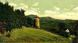
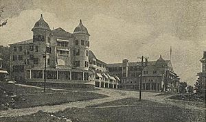
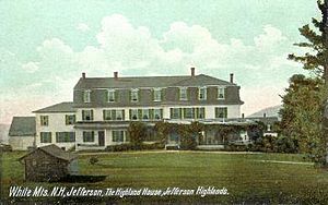
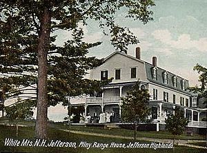
In the early 1900s, Jefferson was a very popular summer resort. It had one of the biggest "grand hotels" in the White Mountains. This was the Waumbek Hotel. It could host almost 300 guests.
The hotel even had its own train line. This allowed guests to travel directly from Boston and New York to the hotel without changing trains. Sadly, the Waumbek Hotel was destroyed by a fire on May 9, 1928.
When tourism was at its peak, Jefferson had over 30 inns and boarding houses. You could reach them by several train stations like Riverton, Baileys, Meadows, and Highlands. Some of the original station buildings are still around. However, most have been moved to new spots. The train tracks were removed in the 1920s.
More people started owning cars, which gave them more choices for vacation spots. Also, the Great Depression meant fewer people could afford vacations for many years. Because of these changes, many people looked for different places to stay than grand hotels.
Some old, interesting buildings from the resort era are still standing. The Waumbek Cottages were used for the White Mountains Festival of the Arts until 1979. In March 2006, the Waumbek Cottages Historic District was added to the National Register of Historic Places. This means it's recognized as an important historical place.
Geography of Jefferson
Jefferson is located on U.S. Route 2. This road connects Lancaster and Randolph. It's about halfway between the borders of Vermont and Maine.
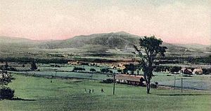
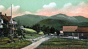
The town sits in the wide valley of the Israel River. From here, you can see amazing views of the Presidential Range and other peaks in the White Mountains. Mount Starr King is the highest point in town. It is 3,907 feet (1,191 meters) tall and is named after Thomas Starr King. Hikers often cross it to reach nearby Mount Waumbek. Mount Waumbek is 4,006 feet (1,221 meters) tall. It is one of the "four-thousand footers"—the 48 peaks in New Hampshire that are over 4,000 feet (1,219 meters) high.
All of Jefferson is within the Connecticut River watershed. This means all the water flows towards the Connecticut River.
In recent years, thousands of acres in Jefferson have been sold or given by private owners to the White Mountain National Forest. This includes parts of the Randolph Town Forest, the Silvio O. Conte National Fish and Wildlife Refuge, and Mount Starr King.
The United States Census Bureau says that Jefferson covers a total area of 50.3 square miles (130.3 square kilometers). About 49.9 square miles (129.5 square kilometers) is land. The remaining 0.3 square miles (0.9 square kilometers) is water, which is about 0.66% of the town's total area.
Neighboring Towns
Jefferson shares its borders with these towns:
- Lancaster (north)
- Kilkenny (northeast)
- Randolph (east)
- Low and Burbank's Grant (southeast)
- Carroll (south)
- Whitefield (west)
Climate in Jefferson
Jefferson has a warm-summer humid continental climate. This means it has warm summers and cold, snowy winters.
| Climate data for Jefferson, New Hampshire, 1991–2020 normals, extremes 2000–present | |||||||||||||
|---|---|---|---|---|---|---|---|---|---|---|---|---|---|
| Month | Jan | Feb | Mar | Apr | May | Jun | Jul | Aug | Sep | Oct | Nov | Dec | Year |
| Record high °F (°C) | 62 (17) |
65 (18) |
78 (26) |
86 (30) |
93 (34) |
94 (34) |
94 (34) |
92 (33) |
92 (33) |
80 (27) |
71 (22) |
62 (17) |
94 (34) |
| Mean maximum °F (°C) | 50.5 (10.3) |
50.1 (10.1) |
58.4 (14.7) |
75.3 (24.1) |
84.1 (28.9) |
87.6 (30.9) |
88.8 (31.6) |
85.9 (29.9) |
84.3 (29.1) |
72.4 (22.4) |
64.1 (17.8) |
51.5 (10.8) |
90.6 (32.6) |
| Mean daily maximum °F (°C) | 26.2 (−3.2) |
28.8 (−1.8) |
37.5 (3.1) |
50.9 (10.5) |
64.4 (18.0) |
72.6 (22.6) |
77.6 (25.3) |
75.9 (24.4) |
67.4 (19.7) |
55.3 (12.9) |
41.5 (5.3) |
30.9 (−0.6) |
52.4 (11.4) |
| Daily mean °F (°C) | 16.8 (−8.4) |
19.0 (−7.2) |
27.6 (−2.4) |
40.6 (4.8) |
53.1 (11.7) |
61.6 (16.4) |
66.7 (19.3) |
64.8 (18.2) |
56.4 (13.6) |
46.0 (7.8) |
34.0 (1.1) |
23.3 (−4.8) |
42.5 (5.8) |
| Mean daily minimum °F (°C) | 7.4 (−13.7) |
9.1 (−12.7) |
17.8 (−7.9) |
30.3 (−0.9) |
41.7 (5.4) |
50.5 (10.3) |
55.8 (13.2) |
53.6 (12.0) |
45.4 (7.4) |
36.7 (2.6) |
26.5 (−3.1) |
15.7 (−9.1) |
32.5 (0.3) |
| Mean minimum °F (°C) | −14.0 (−25.6) |
−9.7 (−23.2) |
−4.3 (−20.2) |
18.8 (−7.3) |
30.4 (−0.9) |
39.2 (4.0) |
45.9 (7.7) |
42.7 (5.9) |
31.8 (−0.1) |
24.9 (−3.9) |
10.8 (−11.8) |
−4.2 (−20.1) |
−16.6 (−27.0) |
| Record low °F (°C) | −31 (−35) |
−22 (−30) |
−17 (−27) |
8 (−13) |
25 (−4) |
32 (0) |
40 (4) |
36 (2) |
21 (−6) |
16 (−9) |
−2 (−19) |
−16 (−27) |
−31 (−35) |
| Average precipitation inches (mm) | 2.51 (64) |
2.28 (58) |
2.61 (66) |
3.36 (85) |
3.80 (97) |
4.40 (112) |
4.26 (108) |
3.98 (101) |
3.34 (85) |
4.29 (109) |
2.95 (75) |
3.26 (83) |
41.04 (1,043) |
| Average snowfall inches (cm) | 20.1 (51) |
19.8 (50) |
16.7 (42) |
6.5 (17) |
0.5 (1.3) |
0.0 (0.0) |
0.0 (0.0) |
0.0 (0.0) |
0.0 (0.0) |
1.8 (4.6) |
7.7 (20) |
21.7 (55) |
94.8 (240.9) |
| Average precipitation days (≥ 0.01 in) | 16.3 | 13.5 | 14.1 | 13.6 | 14.5 | 14.5 | 12.9 | 12.2 | 10.6 | 14.4 | 14.5 | 16.9 | 168 |
| Average snowy days (≥ 0.1 in) | 15.3 | 13.2 | 10.5 | 4.9 | 0.5 | 0.0 | 0.0 | 0.0 | 0.0 | 1.4 | 7.7 | 13.7 | 67.2 |
| Source 1: NOAA | |||||||||||||
| Source 2: National Weather Service (mean maxima and minima 2006–2020) | |||||||||||||
Population and People of Jefferson
| Historical population | |||
|---|---|---|---|
| Census | Pop. | %± | |
| 1800 | 112 | — | |
| 1810 | 197 | 75.9% | |
| 1820 | 252 | 27.9% | |
| 1830 | 492 | 95.2% | |
| 1840 | 575 | 16.9% | |
| 1850 | 629 | 9.4% | |
| 1860 | 700 | 11.3% | |
| 1870 | 826 | 18.0% | |
| 1880 | 951 | 15.1% | |
| 1890 | 1,062 | 11.7% | |
| 1900 | 1,080 | 1.7% | |
| 1910 | 1,061 | −1.8% | |
| 1920 | 960 | −9.5% | |
| 1930 | 771 | −19.7% | |
| 1940 | 763 | −1.0% | |
| 1950 | 728 | −4.6% | |
| 1960 | 600 | −17.6% | |
| 1970 | 714 | 19.0% | |
| 1980 | 803 | 12.5% | |
| 1990 | 965 | 20.2% | |
| 2000 | 1,006 | 4.2% | |
| 2010 | 1,107 | 10.0% | |
| 2020 | 1,043 | −5.8% | |
| U.S. Decennial Census | |||
In 2000, there were 1,006 people living in Jefferson. These people made up 407 households and 295 families. The town had about 20 people per square mile (8.1 people per square kilometer). There were 582 housing units, with about 12 units per square mile (4.5 units per square kilometer).
Most of the people in town (98.31%) were White. A small number were Native American, Asian, or Pacific Islander. About 1.39% of people were from two or more races. A very small number (0.10%) were Hispanic or Latino.
Out of the 407 households:
- 28.0% had children under 18 living with them.
- 62.4% were married couples living together.
- 5.2% had a female head of household with no husband present.
- 27.5% were not families.
About 20.4% of all households were single individuals. And 6.9% had someone living alone who was 65 years old or older. The average household had 2.47 people. The average family had 2.84 people.
The population of Jefferson was spread out by age:
- 22.0% were under 18 years old.
- 4.5% were from 18 to 24 years old.
- 27.2% were from 25 to 44 years old.
- 32.4% were from 45 to 64 years old.
- 13.9% were 65 years old or older.
The average age in town was 43 years. For every 100 females, there were about 103.6 males. For every 100 females aged 18 and over, there were about 105.0 males.
The average income for a household in town was $41,089. For a family, the average income was $42,067. Males earned an average of $27,130, while females earned an average of $21,382. The per capita income for the town was $19,556. About 4.7% of families and 8.2% of the total population lived below the poverty line. This included 12.0% of those under 18 and 9.9% of those 65 or older.
Places to Visit in Jefferson
- Jefferson Historical Museum: This museum is located in the old St. John's Methodist church. You can find it on US Route 2, just east of the village center. It's open for free to the public on Thursday and Sunday afternoons from June to October.
- Pondicherry Wildlife Refuge: A great place for nature lovers and bird watchers.
Notable Person from Jefferson
- Thaddeus S. C. Lowe (1832–1913), a famous scientist and inventor.
See also
 In Spanish: Jefferson (Nuevo Hampshire) para niños
 | Anna J. Cooper |
 | Mary McLeod Bethune |
 | Lillie Mae Bradford |


