Rawreth facts for kids
Quick facts for kids Rawreth |
|
|---|---|
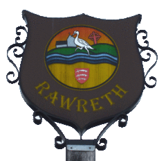
 Rawreth Village Sign, showing a heron and a stream |
|
| Population | 1,126 (2011) |
| OS grid reference | TQ781934 |
| District |
|
| Shire county | |
| Region | |
| Country | England |
| Sovereign state | United Kingdom |
| Post town | Wickford |
| Postcode district | SS11 |
| Dialling code | 01268 |
| Police | Essex |
| Fire | Essex |
| Ambulance | East of England |
| EU Parliament | East of England |
| UK Parliament |
|
Rawreth is a small village and civil parish located in Essex, England. It's part of the Rochford District and sits between the towns of Wickford and Rayleigh.
The name 'Rawreth' has an interesting history! It was first written down in 1177 as Raggerea. Later, in 1240, it appeared as Ragherethe, and by 1267, it was Raureth. The name actually means 'herons' stream', which you can even see on the village sign.
This area is mostly farmland with not many people living there. You'll also find a few small businesses. Many of the old farmhouses in Rawreth used to be large, important homes with moats around them, and some of these still exist today!
The local council for Rawreth was first set up a long time ago. It was then joined with Rayleigh in the 1930s. But in 1994, after some changes to local government, Rawreth got its own council back again.
Contents
How is Rawreth Governed?
Rawreth is part of an area called Downhall and Rawreth. This area is used for elections. It also includes a big part of the nearby town of Rayleigh. In 2011, about 4,843 people lived in this electoral area.
What is Rawreth's Geography Like?
A small stream flows through Rawreth. It goes under Church Road, close to the Rawreth Equestrian Centre. This stream eventually joins the River Crouch near the A1245 road.
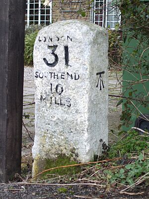
You might spot a milestone in Rawreth. It's marked on maps at grid reference TQ773930. This stone is at the south end of Church Road, very near the new A130 road.
Maps of the Rawreth area also show a blue horseshoe symbol. This symbol means the area is good for horse riding.
What About Rawreth's Church?
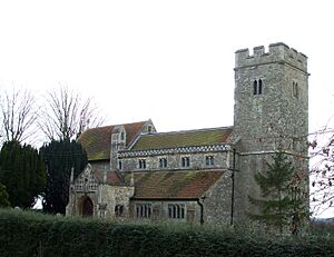
The village has a church called St Nicholas, located on Church Road. It was originally built in the Middle Ages. However, only the tower is from that very old time. Most of the church building was rebuilt much later, in the late Victorian era.
Where is Rawreth's School?
St Nicholas Church of England Primary School used to be in Rawreth. It has now moved to a new building. This new school is just a short distance away, slightly over the village boundary into Rayleigh.
The Chichester Hotel
The Chichester Hotel is a well-known place in Rawreth. It's thought to be named after Sir John de Chichester, a knight from the Norman times. He was supposedly the first person to live in Chichester Hall. This hall was a large farmhouse with a moat, built in the 1200s, and it's still standing today!
However, another idea is that the hall was named by Lancelot Andrewes. He lived there in the 1500s and later became the Bishop of Chichester. So, he might have named it after the city of Chichester.
Later, in the early 1700s, Thomas Holt White lived at the hall. He was a scientist and the brother of the famous nature writer, Gilbert White. Thomas Holt White grew a special type of elm tree called the Chichester Elm from a tree that was in the hall's grounds.
 | John T. Biggers |
 | Thomas Blackshear |
 | Mark Bradford |
 | Beverly Buchanan |


