Reardan, Washington facts for kids
Quick facts for kids
Reardan
|
|
|---|---|
| Reardan, Washington | |

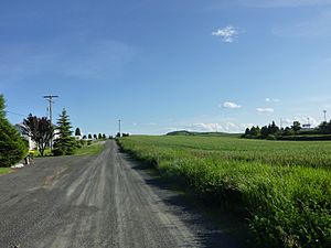
Spring in Reardan
|
|

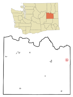
Location of Reardan, Washington
|
|
| Country | United States |
| State | Washington |
| County | Lincoln |
| Area | |
| • Total | 0.50 sq mi (1.30 km2) |
| • Land | 0.50 sq mi (1.29 km2) |
| • Water | 0.00 sq mi (0.01 km2) |
| Elevation | 2,513 ft (766 m) |
| Population
(2020)
|
|
| • Total | 637 |
| • Density | 1,229.84/sq mi (474.56/km2) |
| Time zone | UTC-8 (Pacific (PST)) |
| • Summer (DST) | UTC-7 (PDT) |
| ZIP code |
99029
|
| Area code(s) | 509 |
| FIPS code | 53-57465 |
| GNIS feature ID | 1507746 |
Reardan is a small town in Lincoln County, Washington, United States. In 2020, the town had a population of 637 people. It is known for its community events and its natural surroundings.
Contents
History of Reardan
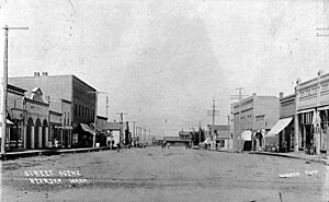
Reardan was started in 1882 and officially mapped out in 1889. It was named after C.F. Reardan, an engineer for the Central Washington Railroad. The town officially became a city on April 14, 1903.
The town is home to the schools for the Reardan-Edwall School District. This district covers a large area of over 360 square miles (930 km2) in Lincoln and Spokane counties. North of town, there is a wetland area called Audubon Lake. This lake is a popular spot for bird watchers because many birds stop there during their long migrations along the Pacific Flyway. A group of people called Hutterites also settled in the area in 1961.
Reardan celebrates "Mule Days" every year on the first Saturday in June. This festival has been happening for over 50 years! It includes a Kiddie Parade, a Main Parade, fun games for kids at the park, and a three-on-three basketball tournament. There's also a food and craft fair, a community BBQ lunch with pork, and a dance.
Geography and Location
According to the United States Census Bureau, Reardan covers a total area of 0.50 square miles (1.30 km2). Most of this area, about 0.49 square miles (1.27 km2), is land, and a very small part, 0.01 square miles (0.03 km2), is water.
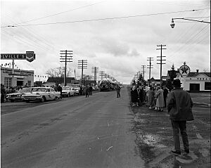
U.S. Route 2 goes through Reardan. In town, it's also known as Broadway Avenue and is the main street. This highway connects Reardan to Spokane, a bigger city 22 miles (35 km) to the east. It also connects to Davenport, the county seat, which is 13 miles (21 km) to the west. Washington State Route 231, which runs north and south, also passes through Reardan. The Washington Eastern Railroad also has tracks running through the town.
Reardan is located on a natural dividing line between the areas that drain into the Columbia River and the Spokane River. Audubon Lake, which is north of town, is where Crab Creek begins. Crab Creek flows southwest for 163 miles (262 km) before it reaches the Columbia River. The lake and the wet areas around it also drain into Deep Creek, which flows into the Spokane River. Spring Creek also starts from the Audubon Lake wetlands and flows north into the Spokane River.
Population and People
| Historical population | |||
|---|---|---|---|
| Census | Pop. | %± | |
| 1910 | 527 | — | |
| 1920 | 420 | −20.3% | |
| 1930 | 422 | 0.5% | |
| 1940 | 422 | 0.0% | |
| 1950 | 410 | −2.8% | |
| 1960 | 474 | 15.6% | |
| 1970 | 389 | −17.9% | |
| 1980 | 498 | 28.0% | |
| 1990 | 482 | −3.2% | |
| 2000 | 608 | 26.1% | |
| 2010 | 571 | −6.1% | |
| 2020 | 637 | 11.6% | |
| U.S. Decennial Census | |||
2010 Census Information
In 2010, there were 571 people living in Reardan. These people lived in 240 households, and 160 of these were families. The town had about 1165 people per square mile (450 per km2).
Most of the people in Reardan were White (92.5%). There were also Native American (4.7%), African American (0.5%), and Asian (0.4%) residents. About 1.9% of the population identified as being from two or more races. People of Hispanic or Latino background made up 2.5% of the population.
Out of the 240 households, 30% had children under 18 living there. Nearly half (49.6%) were married couples living together. About 13.8% of households had a female head of household with no husband present. The average household had 2.38 people, and the average family had 2.88 people.
The average age of people in Reardan was 43.2 years old. About 24.7% of residents were under 18. About 15.8% were 65 years old or older. The town's population was 47.3% male and 52.7% female.
Famous People Connected to Reardan
Reardan has connections to a few well-known people:
- The famous Indigenous American writer Sherman Alexie went to Reardan High School. He wrote about the school in some of his stories, including his 2007 novel for young adults, The Absolutely True Diary of a Part-Time Indian.
- PFC Joe E. Mann was born in Reardan on July 8, 1922. He was a soldier in World War II and received the Medal of Honor, a very brave award. He was killed in action on September 19, 1944, in Best, Netherlands.
Education and Museums
Reardan is part of the Reardan-Edwall School District.
The Inland Northwest Rail Museum opened in Reardan in 2016. It's a place where you can learn about trains and railroad history in the region.
See also
 In Spanish: Reardan (Washington) para niños
 | Bayard Rustin |
 | Jeannette Carter |
 | Jeremiah A. Brown |


