Crab Creek facts for kids
Quick facts for kids Crab Creek |
|
|---|---|
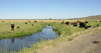
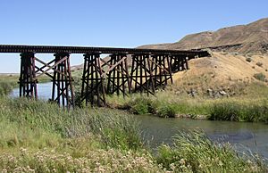
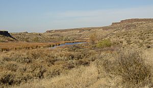
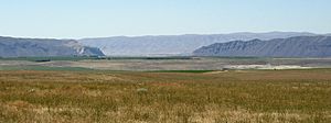
Lower Crab Creek above confluence with Red Rock Coulee.
|
|
|
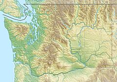
Mouth of Crab Creek in Washington
|
|
| Country | United States |
| State | Washington |
| County | Grant County, Adams County, Lincoln County |
| City | Moses Lake |
| Physical characteristics | |
| Main source | Near Gettys Butte Lincoln County 2,730 ft (830 m) 47°42′42″N 117°54′24″W / 47.71167°N 117.90667°W |
| River mouth | Columbia River Grant County 489 ft (149 m) 46°48′55″N 119°55′19″W / 46.81528°N 119.92194°W |
| Length | 163 mi (262 km) |
| Basin features | |
| Basin size | 5,097 sq mi (13,200 km2) |
| Tributaries |
|
Crab Creek is a stream in the U.S. state of Washington. It got its name because of the many crayfish living there. It's special because it's one of the few streams in central Washington that flows all year round.
Crab Creek starts in the northeastern Columbia Plateau and flows west-southwest. It eventually empties into the Columbia River near the town of Beverly. The creek's path shows amazing signs of how powerful huge floods were long ago. These floods, called the Missoula Floods, carved out the land.
Today, Crab Creek and the area around it have changed a lot. This is due to a big irrigation project called the Columbia Basin Project. This project has raised the water levels underground, making Crab Creek much longer. It has also created new lakes and streams.
Crab Creek is about 163 miles (262 km) long. Its watershed (the area of land that drains into it) covers about 5,097 square miles (13,200 km2) in eastern Washington. Some people call it the "longest ephemeral stream in North America." An ephemeral stream only flows sometimes, usually after rain or snowmelt.
The Course of Crab Creek
Crab Creek is often thought of in different parts. Sometimes it's split into two:
- Upper Crab Creek: This part runs from where the creek starts all the way to Potholes Reservoir.
- Lower Crab Creek: This part flows from Potholes Reservoir to the Columbia River.
Sometimes, people divide the stream into three sections:
- Upper Crab Creek: From its source to Brook Lake.
- Middle Crab Creek: From Brook Lake to and including Potholes Reservoir.
- Lower Crab Creek: From below Potholes Reservoir to the Columbia River.
Upper Crab Creek's Journey
Before the big irrigation project, Upper Crab Creek was often dry. Even today, it only flows sometimes. It starts near Reardan and flows southwest, then west. Along the way, it collects water from smaller streams like Rock Creek and Wilson Creek. It then flows into Brook Lake. This lake is near Billy Clapp Lake, which is part of the irrigation project.
Middle and Lower Sections
After Brook Lake, Crab Creek turns south. A main irrigation canal, the East Low Canal, crosses over Crab Creek but doesn't mix its water with it. At the city of Moses Lake, Crab Creek flows into an arm of Moses Lake. Before it reaches the lake, it gets water from Rocky Coulee Wasteway. This is a mix of a stream that flows sometimes and extra water from the irrigation project. Before the irrigation project, Crab Creek didn't flow all the time between Brook Lake and Moses Lake.
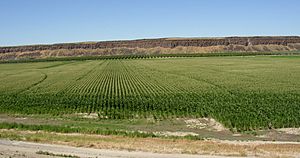
Moses Lake then empties into Potholes Reservoir. This reservoir sends water to irrigation canals further south. Below the O'Sullivan Dam, several natural springs restart Crab Creek. It then flows southwest, then west. Near the town of Smyrna, Crab Creek winds through a wide canyon. This canyon is bordered by the Saddle Mountains to the south. It also includes parts of the Columbia National Wildlife Refuge. Finally, Crab Creek empties into the Columbia River.
Lakes Along Crab Creek
Before 1904, shifting sand dunes blocked Crab Creek below Moses Lake. This meant the creek's water didn't always reach the Columbia River. Moses Lake was the biggest natural lake on the creek. In 1904, a large flood broke through the dunes, lowering Moses Lake by eight feet. Fish found in Moses Lake suggest that it was connected to the Columbia River at times before 1904. It's possible that the sand dunes actually helped create Moses Lake by blocking the creek.
Changes from the Columbia Basin Project
The Columbia Basin Project (CBP) in central Washington greatly changed Crab Creek. A large earthfill dam called the O'Sullivan Dam (also known as the Potholes Dam) was built between 1947 and 1949. This dam created Potholes Reservoir.
Potholes Reservoir is a key part of the CBP. It stores water for irrigation, natural runoff, and water that returns from irrigation. This allows the irrigation water to be used again in the southern part of the project. Potholes Reservoir releases water through canals. It doesn't have a natural, year-round outlet to Lower Crab Creek.
Today, the water in Lower Crab Creek comes from several sources:
- Water seeping out from Potholes Reservoir and irrigation areas.
- Water from the Goose Lake Wasteway.
- Water from other streams that flow into Crab Creek downstream of the O'Sullivan Dam.
The underground water level in this area is generally high. This is because of the low elevation and the irrigation runoff. Many lakes, like Merry, Lenice, and Nunally Lakes, also drain into Crab Creek.
History of the Crab Creek Area
Crab Creek was an important place because it was one of the few reliable water sources in the region. Native American tribes, like the Spokane and Palouse people, used the area along Crab Creek to gather roots and other foods. A main Native American trail through the region followed the creek.
Later, in 1879, Lt. Symons passed through the mid-Crab Creek area while planning a military road. In 1888, the "Old Wagon Road" was built along the creek, connecting Waterville, Washington to Ritzville, Washington.
Early Settlers and Ranching
Before irrigation began, most of Upper Crab Creek was covered in bunchgrass. This was perfect for raising cattle and sheep. Crab Creek and its smaller streams provided water for the herds. Even though a few ranchers lived there, the area was very empty. One early settler was George Lucas, who started a way-station and raised cattle and horses in 1869.
Lower Crab Creek was the only place with water in that dry, shrubby area. So, it became the center of early settlement. The first recorded cabin was built by Ben and Sam Hutchinson in 1884. The town of Othello was established in 1904.
When the Bureau of Reclamation set up offices in Othello in 1947 and built the Columbia Irrigation Project, the quiet countryside changed a lot. Many more people moved to the area.
How Geology Shaped Crab Creek
Long ago, a huge sheet of ice called the Okanogan lobe moved down the Okanogan River valley. It blocked the old path of the Columbia River, causing water to back up and form Lake Spokane. As the ice grew, the Columbia River was forced to flow through a new path, the Grand Coulee.
The ice-age Columbia River then entered the Quincy Basin and joined Crab Creek at Moses Lake. It followed Crab Creek's path southward past the Frenchman Hills and then turned west. It flowed along the north side of the Saddle Mountains, rejoining the modern Columbia River path near Sentinel Gap.
The Missoula Floods' Impact
During this time, massive floods called the Missoula Floods happened many times. These floods released huge amounts of water. Some of this water reached Upper Crab Creek by flowing over the land that separated the Columbia River's drainage from Crab Creek's. Other floodwaters entered the Columbia River and then flowed into Crab Creek at Moses Lake.
Because of these floods, large canyons (called coulees) and rocky, eroded areas (called scablands) were created in the Upper Crab Creek area. The part of Crab Creek below Potholes Reservoir is also "overlarge." This means its channel is big enough to hold a much larger river than what flows there today. This shows the incredible power of those ancient floods.
Fun Things to Do at Crab Creek
Potholes State Park is a 640-acre (260 ha) park located on the shore of Potholes Reservoir. It's a great place to visit the Drumheller Channels National Natural Landmark. This landmark is just downstream from the O'Sullivan Dam.
The Drumheller Channels are a landscape that has been heavily eroded. It has hundreds of isolated, steep-sided hills (called buttes) surrounded by many channels that look like braids. All of these channels are dry now, except for the one where Crab Creek flows. This area is a perfect example of how powerful the huge Missoula Floods were. These floods reshaped the volcanic land of the Columbia Plateau during the last ice age.
There are also five wildlife areas found along Crab Creek where you can explore nature:
- Crab Creek Wildlife Area: This area runs from the Columbia River east along the north side of the Saddle Mountains to Othello, Washington.
- Seep Lakes Wildlife Area: This is in the same place as the Drumheller Channels National Natural Landmark.
- Potholes Wildlife Area: This area is next to Potholes Reservoir.
- Gloyd Seeps Wildlife Area: This is north of Moses Lake.
- North Columbia Basin Wildlife Area - Gloyd Seeps: This is north of the Gloyd Seeps Wildlife Area.
 | Mary Eliza Mahoney |
 | Susie King Taylor |
 | Ida Gray |
 | Eliza Ann Grier |


