Red Bay, Newfoundland and Labrador facts for kids
Quick facts for kids
Red Bay
|
|
|---|---|
|
Town
|
|

Red Bay seen from above
|
|
| Country | |
| Province | |
| Region | NunatuKavut (unofficial) |
| Government | |
| • Type | Municipal incorporation |
| Area | |
| • Total | 1.58 km2 (0.61 sq mi) |
| Elevation | 10 m (30 ft) |
| Population
(2021)
|
|
| • Total | 142 |
| • Density | 89.9/km2 (232.8/sq mi) |
| Time zone | UTC-3:30 (Newfoundland Time) |
| • Summer (DST) | UTC-2:30 (Newfoundland Daylight) |
| Area code(s) | 709 |
| Highways | |
| Official name: Red Bay Basque Whaling Station | |
| Type: | Cultural |
| Criteria: | iii, vi |
| Designated: | 2013 (37th session) |
| Reference #: | 1412 |
| Region: | Europe and North America |
| Official name: Red Bay National Historic Site of Canada | |
| Designated: | 1979 |
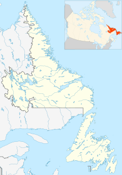
Red Bay is a small fishing village located in Labrador, Canada. It is famous for being one of the most important underwater archaeological sites in North and South America.
From the 1530s to the early 1600s, Red Bay was a major area for Basque whaling. Many whaling ships, including large galleons and smaller chalupas, sank here. When these shipwrecks were discovered, Red Bay was named a UNESCO World Heritage Site in 2013. This means it's a very special place recognized globally for its history.
Contents
Exploring Red Bay's Location
Red Bay is a natural harbour, meaning it's a safe place for ships to dock. It gets its name from the red granite cliffs found in the area. During World War II, this sheltered harbour was used as a safe spot for naval vessels.
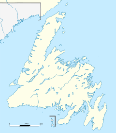
Inside the bay, you'll find Penney Island and Saddle Island. The Basques used these islands for their whaling activities long ago. The famous sunken ship, the San Juan, is located near Saddle Island.
A Glimpse into Red Bay's Past
The Basque Whaling Era
Between 1550 and the early 1600s, Red Bay was known as Balea Baya, which means Whale Bay. It was a busy centre for Basque whaling. Sailors from southern France and northern Spain would send about 15 whaling ships and 600 men each season to this distant outpost. Their goal was to catch right whales and bowhead whales in the waters of the Strait of Belle Isle.
Discovering Sunken Ships
In 1565, a ship believed to be the San Juan sank in Red Bay during a storm. Archaeologists studying this wreck call it 24M. Other smaller boats, like chalupas, have also been found in the bay's waters.
In 2004, another large galleon was discovered about 25 to 35 feet underwater. This was the fourth large ship found in the area that had traveled across the ocean.
The Whalers' Cemetery
On nearby Saddle Island, there is a cemetery where 140 whalers are buried. Many of these whalers likely died from drowning or from being exposed to the harsh weather.
Historians believe that the number of whales eventually decreased. This led to the Basque whalers leaving their stations in Red Bay. Today, you can visit an interpretive centre in Red Bay to learn all about this fascinating history.
Local Legends and Recognition
Local stories in Red Bay talk about a hidden treasure. It is said to be buried in a small body of water called Pond on the Hill 51°43′43″N 56°26′56″W / 51.72861°N 56.44889°W at the bottom of Tracey Hill. The legend says the treasure was hidden by the famous pirate Captain William Kidd. Some people from Carrol Cove even tried to find it by draining the pond, but they were not successful.
Red Bay has been recognized as a National Historic Site of Canada since 1979. In 2013, it also became one of Canada's UNESCO World Heritage Sites, highlighting its global importance.
In 2016, you could even explore Red Bay using Google Street View. It is one of the few communities in Labrador with images available on the service.
In 2021, the local school, Basque Memorial School, sadly closed because there were no students enrolled.
Red Bay's Population
According to the 2021 Census, Red Bay had a population of 142 people. They lived in 65 homes out of a total of 69 private dwellings. This was a decrease from its 2016 population of 169 people. The land area of Red Bay is about 2.31 square kilometers.
Fun Things to Do in Red Bay
Red Bay offers several exciting activities for visitors:
- Explore Basque Whaling Stations: Learn about the historical whaling operations.
- Go Iceberg and Whale Watching: See massive icebergs and majestic whales.
- Enjoy Hiking: Discover the beautiful natural landscapes on foot.
- Experience Local Culture: Enjoy local entertainment and taste delicious cuisine.
- Try Fishing: Cast a line and enjoy the peaceful waters.
- Dine at The Whaler's Restaurant: Enjoy classic fish & chips and other local dishes.
Images for kids
See also
 In Spanish: Red Bay (Canadá) para niños
 | Audre Lorde |
 | John Berry Meachum |
 | Ferdinand Lee Barnett |


