NunatuKavut facts for kids
Quick facts for kids
NunatuKavut
|
|
|---|---|
|
Proposed Autonomous area
|
|
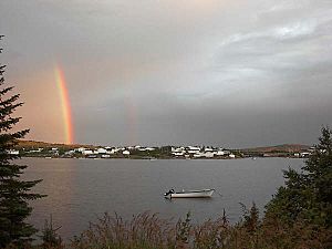
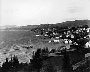
The village of Mary's Harbour, in NunatuKavut
|
|
| Country | Canada |
| Province | Newfoundland and Labrador |
| Capital | Vâli, Labrador |
| Government | |
| • Type | Proposed parliamentary democracy within the parliamentary system of Canada |
| Population
(2007)
|
|
| • Total | 6,000 |
| Time zone | UTC-04 (AST) |
| Postal code prefix |
A0P
|
| ISO 3166 code | NL |
| Federal riding | Labrador (electoral district) |
| Provincial riding | Cartwright-L'Anse au Clair and Lake Melville |
| Website | NunatuKavut.ca |
NunatuKavut (Inuktitut: ᓄᓇᑐᑲᕗᑦ) is a territory in Labrador, Canada. It is not yet officially recognized by the Canadian government. The NunatuKavut people are the direct descendants of the Inuit who lived south of the Churchill River before Europeans arrived. Over time, some European settlers, mostly English, joined their communities.
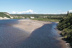
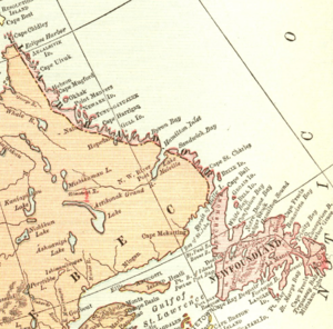
Today, many people in NunatuKavut communities identify as Inuit-Métis. This means they have both Inuit and European heritage. The name NunatuKavut IPA: [ˈnuːnətuːhəvuːt] means "Our ancient land" in the old Inuttitut language of the Inuit in central and southern Labrador. The area claimed by NunatuKavut covers Southern Labrador, from the Grand River south to Lodge Bay and west to the border with Quebec.
Contents
History of NunatuKavut
Early European Visits
Long ago, the area was known as Markland by the Greenlandic Norse people. They called the people living there the Skræling.
In the 1600s, European explorers and missionaries started writing about Inuit communities in this region. For example, in 1659, Jacques Fremin described an Inuit community at Cape St. Charles. Later, in 1743, Louis Fornel called the coast from Alexis Bay to Hamilton Inlet the "Coste des Eskimaux." He said Inuit lived in many bays along this coast.
Labrador and European Contact (After 1763)
In 1763, the area known as Labrador became part of the Colony of Newfoundland. This was done to give Newfoundland fishermen more places to fish. Labrador was formed from parts of the French colony of New France and the British colony of Rupert's Land. For a long time, the exact inland border of Labrador was not clear. Canada claimed the interior as part of Quebec and the Northwest Territories, while Newfoundland said Labrador went far inland.
In 1764, a missionary named Jens Haven arrived. He was from the Moravian Church. Haven learned the Inuit language and helped the Colony of Newfoundland make peace with the Inuit. He had learned a similar language in Greenland.
A year later, in 1765, Governor Sir Hugh Palliser signed the "Labrador Treaty" with Inuit leaders at Chateau Bay. This treaty meant that the British would protect Labrador from French and American influence. In return, the Inuit would keep their right to govern themselves and to hunt and use natural resources. This treaty helped create a peaceful relationship between the Inuit and the fishermen from England and Newfoundland.
Mixing of Cultures (1800s)
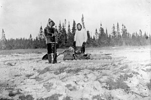
In the 1800s, some English fishermen started marrying Inuit women. Later, many fishermen from Conception Bay and Trinity Bay (who were mostly English and Irish) also came to the area. Because of these marriages, most Inuit in southern Labrador got European last names. However, some Inuit last names, like "Kippenhuck" and "Toomashie," are still used today.
By 1824, records show that the population around Lake Melville was a mix of Inuit, European settlers, and people of both European and Inuit descent. The culture of southern Labrador became a special blend of Newfoundland's traditions and the native Inuit culture. This mix continues to this day.
Labrador Joins Canada
In 1949, Newfoundland became Canada's 10th province. Before this, most Inuit lived in small groups in isolated areas. In the 1950s and 1960s, many communities in the province moved to larger towns as part of a government program. The decline of the cod fishing industry also greatly affected NunatuKavut, causing many people to leave to find work.
In 1996, the Labrador Metis Association (now the NunatuKavut Community Council) strongly protested a proposed fishing camp on the Eagle River. They said this river was a traditional salmon fishing area for their people. Many residents protested, stopping supplies from reaching the construction site. This led to some arrests, but the charges were later dropped.
In 2002, a gravel road opened, connecting many communities in NunatuKavut. This road was later extended to Happy Valley-Goose Bay. If NunatuKavut becomes an officially recognized Inuit region in Canada, it would be the only one with a highway system reaching most of its communities.
Around the mid-2010s, the Labrador Inuit-Metis began calling themselves the Southern Inuit of NunatuKavut. Today, NunatuKavut represents about 6,000 Inuit people. This area is more populated than other Inuit regions like Nunatsiavut.
Lower Churchill Project
The NunatuKavut people have spoken out against the Muskrat Falls hydroelectric project. They believe this project affects their traditional lands.
NunatuKavut Flag
In 2016, the NunatuKavut Community Council showed a design for its flag. The flag was created by Barry Pardy, who is from Cartwright.
NunatuKavut Communities
- Black Tickle-Domino
- Cartwright
- Charlottetown
- Lodge Bay
- Mary's Harbour
- Norman's Bay
- Paradise River
- Pinsent's Arm
- Port Hope Simpson
- St. Lewis
- William's Harbour
Land Claim for Recognition
In the mid-1980s, the Labrador Metis Association was formed. People living on Labrador's southern coast created it to be recognized as a distinct group. At that time, people thought the "Inuit-Metis" were just Inuit who had joined Western society. Not much was known about their history.
In 2006, the Labrador Metis Association started a project with Memorial University of Newfoundland. They wanted to learn more about their past. This research showed that the "Labrador Metis" were actually a continuation of the Inuit people of southern Labrador.
In 2010, the Labrador Metis Association changed its name to the NunatuKavut Community Council to show their newly understood heritage. To make sure the 1765 treaty is followed, NunatuKavut has started a land claim with the Canadian government. They are currently working to negotiate this claim. As part of this claim, the NunatuKavut Community Council says that the Muskrat Falls and Lower Churchill hydroelectric projects are on their traditional territory.
See also
- Nunatsiavut
- Nunavik
- Nunavut
 | Aaron Henry |
 | T. R. M. Howard |
 | Jesse Jackson |


