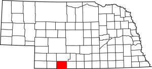
Red Willow County, Nebraska facts for kids
Quick facts for kids
Red Willow County
|
|
|---|---|

Red Willow County Courthouse in McCook
|
|

Location within the U.S. state of Nebraska
|
|
 Nebraska's location within the U.S. |
|
| Country | |
| State | |
| Founded | 1873 |
| Named for | Red Willow Creek |
| Seat | McCook |
| Largest city | McCook |
| Area | |
| • Total | 718 sq mi (1,860 km2) |
| • Land | 717 sq mi (1,860 km2) |
| • Water | 1.0 sq mi (3 km2) 0.1%% |
| Population
(2020)
|
|
| • Total | 10,702 |
| • Estimate
(2021)
|
10,623 |
| • Density | 14.905/sq mi (5.755/km2) |
| Time zone | UTC−6 (Central) |
| • Summer (DST) | UTC−5 (CDT) |
| Congressional district | 3rd |
Red Willow County is a county located in the state of Nebraska, USA. As of 2020, about 10,700 people live here. The main town and county seat is McCook. When Nebraska started its license plate system in 1922, Red Willow County was given the number 48. This was because it had the 48th largest number of registered vehicles in the state at that time.
Contents
History of Red Willow County
Red Willow County was officially created in 1873. It was named after a nearby waterway called Red Willow Creek. The name "Red Willow" might be a slight mistake in translation from the Dakota Indian name. The Dakota people called the creek Chanshasha Wakpala. This name literally means "Red Dogwood Creek." They named it this because of the red dogwood shrubs that grew along its banks. These shrubs have deep red stems and branches. They are also often used by people to make baskets.
Geography and Location
Red Willow County is located in the southern part of Nebraska. Its southern border touches the northern border of the state of Kansas. The Republican River flows through the north-central part of the county, moving towards the east. The land in the county has rolling hills. These hills gently slope towards the east. The areas of land that are part of river systems are used for farming. The county covers a total area of about 718 square miles. Most of this (717 square miles) is land, and only 1.0 square mile (0.1%) is water.
Main Roads in Red Willow County
 U.S. Highway 6
 U.S. Highway 34
 U.S. Highway 83
 Nebraska Highway 89
Public Transportation
- Amtrak California Zephyr train (stops at the McCook station)
Neighboring Counties
- Furnas County – to the east
- Decatur County, Kansas – to the south
- Rawlins County, Kansas – to the southwest
- Hitchcock County – to the west
- Frontier County – to the north
Protected Natural Areas
- Red Willow Reservoir State Wildlife Management Area (part of it is in the county)
Population and People
| Historical population | |||
|---|---|---|---|
| Census | Pop. | %± | |
| 1880 | 3,044 | — | |
| 1890 | 8,837 | 190.3% | |
| 1900 | 9,604 | 8.7% | |
| 1910 | 11,056 | 15.1% | |
| 1920 | 11,434 | 3.4% | |
| 1930 | 13,859 | 21.2% | |
| 1940 | 11,951 | −13.8% | |
| 1950 | 12,977 | 8.6% | |
| 1960 | 12,940 | −0.3% | |
| 1970 | 12,191 | −5.8% | |
| 1980 | 12,615 | 3.5% | |
| 1990 | 11,705 | −7.2% | |
| 2000 | 11,448 | −2.2% | |
| 2010 | 11,055 | −3.4% | |
| 2020 | 10,702 | −3.2% | |
| 2021 (est.) | 10,623 | −3.9% | |
| US Decennial Census 1790-1960 1900-1990 1990-2000 2010-2013 |
|||
As of the 2000 United States Census, there were 11,448 people living in Red Willow County. The population density was about 16 people per square mile. The average age of people in the county was 40 years old. About 24.9% of the population was under 18 years old. About 19% of the population was 65 years or older.
Towns and Villages
Cities
Villages
Unincorporated Communities
See also
 In Spanish: Condado de Red Willow para niños

