Riegelsville, Pennsylvania facts for kids
Quick facts for kids
Riegelsville, Pennsylvania
|
|
|---|---|
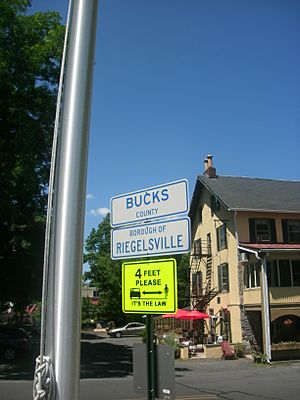
Signs on the approach for the Riegelsville Bridge denoting entrance into Riegelsville. The Riegelsville Inn can be seen in the background.
|
|
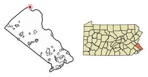
Location in Bucks County, Pennsylvania
|
|
| Country | United States |
| State | Pennsylvania |
| County | Bucks |
| Area | |
| • Total | 1.08 sq mi (2.79 km2) |
| • Land | 1.01 sq mi (2.61 km2) |
| • Water | 0.07 sq mi (0.19 km2) |
| Elevation | 151 ft (46 m) |
| Population
(2020)
|
|
| • Total | 847 |
| • Density | 841.11/sq mi (324.82/km2) |
| Time zone | UTC-5 (Eastern (EST)) |
| • Summer (DST) | UTC-4 (EDT) |
| ZIP Code |
18077
|
| Area code(s) | 610 |
| FIPS code | 42-64856 |
Riegelsville is a small town, called a borough, located in Bucks County, Pennsylvania, in the United States. In 2020, about 847 people lived there. Even though it's close to the Lehigh Valley, it's considered part of the larger Delaware Valley area, which includes cities like Philadelphia.
Contents
History of Riegelsville
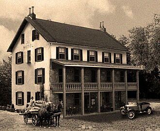
Riegelsville was founded by Benjamin Riegel. He built the historic Riegelsville Inn in 1838, which still stands today. This old stone inn has provided food and places to stay for travelers in Bucks County for over 160 years.
The town was named after the Riegel family because they owned a lot of land early on. They also built paper mills across the Delaware River in Warren County, New Jersey.
When the Delaware Canal was finished in 1832, the land along the Delaware River became very popular for new industries. Moving coal, an important product, brought money and new businesses to Easton. Boats carried coal, stone, iron, crops, and other goods for 60 miles from Easton to Bristol.
Along Canal Street, one of America's biggest industrial areas grew in the 1830s and 1840s. Easton continued to grow as a center for industry, manufacturing, business, and culture. This happened at the Forks of Delaware and along the major train lines.
From 1904 to 1926, Riegelsville had electric trolleys for both people and goods. These trolleys were part of the Doylestown & Easton Street Railway Company. Riegelsville did very well when the Delaware Canal opened in 1832, with many warehouses and factories along its banks.
The canal closed in 1931 after 99 years of use. Railroads then took its place. Today, Riegelsville is a peaceful and quiet town. Woods and fields are next to the Delaware Canal. Old, crumbling stone foundations along its banks remind us of a busy past.
In the late 1800s and early 1900s, Riegelsville was a town known for its mills. The borough looks over the Delaware River. The Riegelsville Bridge crosses the river, connecting Riegelsville with Riegelsville, New Jersey.
The bridge was built in 1904 by John A. Roebling's Sons, Co. It is one of about three dozen bridges that cross the Delaware River between Pennsylvania and New Jersey.
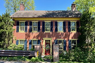
Homes near the river, built by Riegel Paper Company leaders in the late 1880s, have been fixed up. These homes were part of an area known as "Mansions Row." The Benjamin Riegel House was added to the National Register of Historic Places in 1987.
Geography of Riegelsville
Riegelsville covers about 1.0 square mile (2.79 square kilometers). Most of this area is land, with a small part being water.
Neighboring Towns
Riegelsville is surrounded by these other towns:
- Durham Township (to the west and south)
- Holland Township, New Jersey (to the southeast)
- Pohatcong Township, New Jersey (to the northeast)
- Williams Township, Northampton County (to the north)
Population and People
| Historical population | |||
|---|---|---|---|
| Census | Pop. | %± | |
| 1880 | 308 | — | |
| 1920 | 610 | — | |
| 1930 | 725 | 18.9% | |
| 1940 | 824 | 13.7% | |
| 1950 | 871 | 5.7% | |
| 1960 | 953 | 9.4% | |
| 1970 | 1,050 | 10.2% | |
| 1980 | 993 | −5.4% | |
| 1990 | 912 | −8.2% | |
| 2000 | 863 | −5.4% | |
| 2010 | 868 | 0.6% | |
| 2020 | 847 | −2.4% | |
| Sources: | |||
In 2010, most of the people living in Riegelsville were White (96.8%). A small number were Black or African American (0.2%), Native American (0.3%), or Asian (0.2%). About 2.0% of the people were of Hispanic or Latino background.
In 2000, there were 863 people living in Riegelsville. There were 378 households, and 250 of these were families. The average number of people in a household was 2.28.
Education
Riegelsville used to be part of the Easton Area School District. Now, it is part of the Palisades School District.
Weather and Climate
Riegelsville has a climate with hot summers and cold winters. This type of climate is called a Humid continental climate. It means there's at least one month with an average temperature below freezing (32°F or 0°C). Also, at least four months have an average temperature above 50°F (10°C), and at least one month has an average temperature above 71.6°F (22°C).
Summers in Riegelsville can be humid. Sometimes, it can feel very hot, with the "feels like" temperature going above 105°F (41°C). The hottest air temperature recorded since 1981 was 102.2°F (39°C) on July 22, 2011.
July is usually the wettest month, which is when thunderstorms happen most often. The most rain in one day since 1981 was 6.56 inches (16.7 cm) on August 27, 2011, during Hurricane Irene.
In winter, the average coldest temperature is about -1.4°F (-18.6°C). The coldest air temperature recorded since 1981 was -13.4°F (-25.2°C) on January 21, 1994. Sometimes, it can get very cold and windy, making it feel like -12°F (-24°C) or colder.
Riegelsville usually gets between 30 and 36 inches (76 to 91 cm) of snow each year, from November to April. Big snowstorms, with 12 inches (30 cm) or more of snow, happen every few years. These often occur during "nor'easters" from December to February.
| Climate data for Riegelsville, Elevation 171 ft (52 m), 1981–2010 normals, extremes 1981–2018 | |||||||||||||
|---|---|---|---|---|---|---|---|---|---|---|---|---|---|
| Month | Jan | Feb | Mar | Apr | May | Jun | Jul | Aug | Sep | Oct | Nov | Dec | Year |
| Record high °F (°C) | 70.2 (21.2) |
78.4 (25.8) |
87.7 (30.9) |
94.2 (34.6) |
94.5 (34.7) |
95.5 (35.3) |
102.2 (39.0) |
99.7 (37.6) |
96.9 (36.1) |
89.8 (32.1) |
80.6 (27.0) |
73.9 (23.3) |
102.2 (39.0) |
| Mean daily maximum °F (°C) | 37.9 (3.3) |
41.6 (5.3) |
50.4 (10.2) |
62.8 (17.1) |
72.7 (22.6) |
81.3 (27.4) |
85.3 (29.6) |
83.3 (28.5) |
76.7 (24.8) |
65.0 (18.3) |
54.3 (12.4) |
42.5 (5.8) |
62.9 (17.2) |
| Daily mean °F (°C) | 29.4 (−1.4) |
32.2 (0.1) |
40.0 (4.4) |
51.1 (10.6) |
60.9 (16.1) |
70.0 (21.1) |
74.6 (23.7) |
72.7 (22.6) |
65.4 (18.6) |
53.8 (12.1) |
44.3 (6.8) |
34.2 (1.2) |
52.5 (11.4) |
| Mean daily minimum °F (°C) | 20.8 (−6.2) |
22.8 (−5.1) |
29.6 (−1.3) |
39.4 (4.1) |
49.1 (9.5) |
58.8 (14.9) |
63.9 (17.7) |
62.0 (16.7) |
54.2 (12.3) |
42.5 (5.8) |
34.3 (1.3) |
25.9 (−3.4) |
42.0 (5.6) |
| Record low °F (°C) | −13.4 (−25.2) |
−5.8 (−21.0) |
1.2 (−17.1) |
16.5 (−8.6) |
31.8 (−0.1) |
39.9 (4.4) |
45.6 (7.6) |
40.4 (4.7) |
34.1 (1.2) |
22.7 (−5.2) |
9.1 (−12.7) |
−2.7 (−19.3) |
−13.4 (−25.2) |
| Average precipitation inches (mm) | 3.32 (84) |
2.79 (71) |
3.56 (90) |
4.02 (102) |
4.30 (109) |
4.33 (110) |
5.03 (128) |
4.09 (104) |
4.56 (116) |
4.40 (112) |
3.64 (92) |
3.98 (101) |
48.02 (1,220) |
| Average relative humidity (%) | 67.9 | 63.5 | 58.9 | 57.5 | 62.2 | 67.4 | 67.7 | 70.6 | 71.6 | 70.4 | 68.3 | 68.7 | 66.3 |
| Average dew point °F (°C) | 20.1 (−6.6) |
21.2 (−6.0) |
26.8 (−2.9) |
36.6 (2.6) |
47.9 (8.8) |
58.7 (14.8) |
63.2 (17.3) |
62.6 (17.0) |
56.0 (13.3) |
44.4 (6.9) |
34.5 (1.4) |
25.0 (−3.9) |
41.5 (5.3) |
| Source: PRISM | |||||||||||||
Transportation
As of 2005, Riegelsville had about 6.96 miles (11.20 km) of public roads. The Pennsylvania Department of Transportation (PennDOT) took care of 1.74 miles (2.80 km) of these roads. The borough itself maintained the other 5.22 miles (8.40 km).
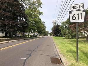
Pennsylvania Route 611 is the main highway that goes through Riegelsville. It runs north and south through the middle of the town, and it's also known as Easton Road.
Ecology and Nature
Riegelsville's natural plant life is mostly made up of Appalachian Oak trees. This means the area is covered by Eastern Hardwood Forests. The climate allows for a variety of plants to grow.
The earliest spring flowers usually start blooming around April 12. The beautiful fall colors, when leaves change, typically reach their peak around October 28.
See also
 In Spanish: Riegelsville para niños
 | Lonnie Johnson |
 | Granville Woods |
 | Lewis Howard Latimer |
 | James West |


